Enable Location

We need your location to show you interesting places around you

Discover nearby places

Find interesting locations and hidden gems around you

Precise directions

Get accurate directions and distances to places

Your location is never shared with other users. It's only used when you tap the location button.

Spicers Gap Road

Log in to your account

Start exploring — it's free

Trusted by 62,287 travelers worldwide

Continue with Google
Continue with Apple
or

We will send you a code to connect

By continuing, you accept our Terms and Conditions and our Privacy Policy

Check your inbox

We've sent a pincode in your inbox. Please enter the code below.

Spicers Gap Road

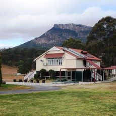
Spicers Gap Road, Heritage road in Main Range National Park, Australia

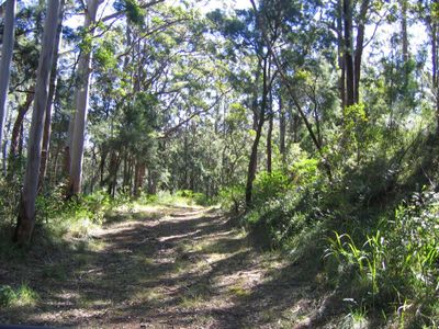
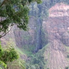
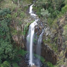
Spicers Gap Road is a mountain route through Main Range National Park with stone-pitched surfaces and sections reinforced by logs, linking the Darling Downs region to Brisbane. The road displays different construction methods and preserves visible evidence of its nineteenth-century engineering work.

Built between 1859 and 1865, the project required major government investment and convict labor to create a working transport link. This construction marked a turning point in connecting the highland areas with the coastal region.

The road traces paths that Indigenous Australians used for generations to move between inland areas and the coast before Europeans arrived. Walking here, you can sense the long history of connection this route represented for distant communities.

Access is limited to specific road sections, though visitors can walk through the preserved parts of this historic route. The best time to explore is during dry weather, when the old construction methods and stone work are most clearly visible.

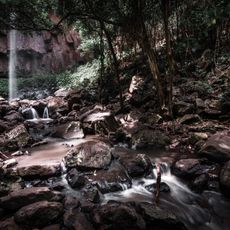
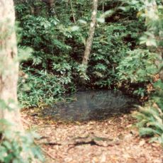
Along the eastern passage of the route stands Moss's Well, a natural spring named after road contractor Edward Moss that remains intact today. This small water source was a crucial rest stop for early workers and travelers making the grueling mountain crossing.

The community of curious travelers

AroundUs brings together thousands of curated places, local tips, and hidden gems, enriched daily by 60,000 contributors worldwide.

Start exploring
Location
GPS coordinates
-28.08190,152.41170
Latest update
December 14, 2025 13:03
« Spicers Gap Road - Heritage road in Main Range National Park, Australia » is provided by Around Us (aroundus.com). Images and texts are derived from Wikimedia project under a Creative Commons license. You are allowed to copy, distribute, and modify copies of this page, under the conditions set by the license, as long as this note is clearly visible.

Discover hidden gems everywhere you go!

From secret cafés to breathtaking viewpoints, skip the crowded tourist spots and find places that match your style. Our app makes it easy with voice search, smart filtering, route optimization, and insider tips from travelers worldwide. Download now for the complete mobile experience.

Around Us App Screenshot

A unique approach to discovering new places

Le Figaro

All the places worth exploring

France Info

A tailor-made excursion in just a few clicks

20 Minutes

Around Us
Travel Guide & Maps
Download

Send to your phone

QR Code
1

Open the camera app on your mobile.

2

Point at the QR code with your camera. A notification will appear.

3

Tap the notification to open the link.