Enable Location

We need your location to show you interesting places around you

Discover nearby places

Find interesting locations and hidden gems around you

Precise directions

Get accurate directions and distances to places

Your location is never shared with other users. It's only used when you tap the location button.

Grafton

Log in to your account

Start exploring — it's free

Trusted by 61,905 travelers worldwide

Continue with Google
Continue with Apple
or

We will send you a code to connect

By continuing, you accept our Terms and Conditions and our Privacy Policy

Check your inbox

We've sent a pincode in your inbox. Please enter the code below.

Grafton, Administrative division in Clarence Valley Council, Australia

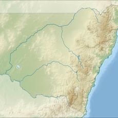
Grafton is a town on the Clarence River, located roughly 608 kilometers north-northeast of Sydney in New South Wales. It spreads across the riverbank areas and serves as a regional center for surrounding communities along the coastal plain.

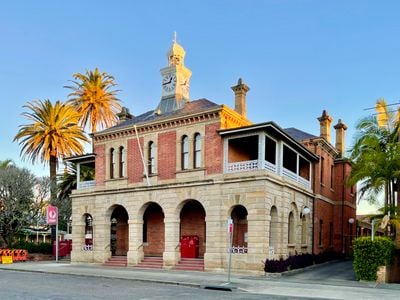
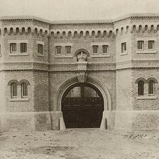
Governor FitzRoy founded the town in 1851 and chose the name in honor of the Duke of Grafton. The council officially received city status in 1885 and established itself as an administrative seat for the region.

The town nurtures a tree-planting tradition dating from 1862 with jacaranda specimens that transform entire streets into a purple blossom carpet every spring. This annual display has become a fixed part of the local calendar and shapes the townscape during the flowering period in October and November.

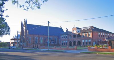
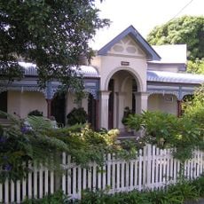
The town lies at the junction of major routes between Sydney and Brisbane and offers access to both riverbanks. Visitors find amenities and services in the center, while surrounding areas show a rural character.

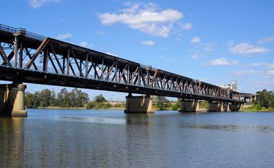
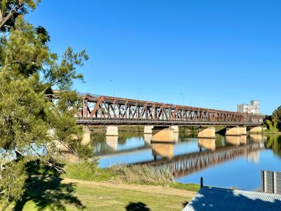
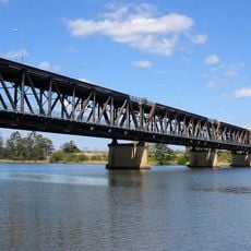
The bridge from 1932 was the longest of its kind in Australia at the time of its opening and spanned the river with a double-deck construction. Its completion ended decades of ferry operations and connected the two parts of town permanently for the first time.

The community of curious travelers

AroundUs brings together thousands of curated places, local tips, and hidden gems, enriched daily by 60,000 contributors worldwide.

Start exploring
Location
Location
Elevation above the sea
5 m
Shares border with
Alumy Creek, Great Marlow, Carrs Peninsula, Carrs Creek, Carrs Island, Clarenza, Waterview, South Grafton
GPS coordinates
-29.68167,152.93444
Latest update
December 14, 2025 17:27
« Grafton - Administrative division in Clarence Valley Council, Australia » is provided by Around Us (aroundus.com). Images and texts are derived from Wikimedia project under a Creative Commons license. You are allowed to copy, distribute, and modify copies of this page, under the conditions set by the license, as long as this note is clearly visible.

Discover hidden gems everywhere you go!

From secret cafés to breathtaking viewpoints, skip the crowded tourist spots and find places that match your style. Our app makes it easy with voice search, smart filtering, route optimization, and insider tips from travelers worldwide. Download now for the complete mobile experience.

Around Us App Screenshot

A unique approach to discovering new places

Le Figaro

All the places worth exploring

France Info

A tailor-made excursion in just a few clicks

20 Minutes

Around Us
Travel Guide & Maps
Download

Send to your phone

QR Code
1

Open the camera app on your mobile.

2

Point at the QR code with your camera. A notification will appear.

3

Tap the notification to open the link.