Mount Walsh National Park, Nature reserve in Fraser Coast Regional, Australia.
Mount Walsh National Park lies 230 km northwest of Brisbane and 84 km west of Maryborough, reached via the Isis Highway turnoff 2 km north of Biggenden. Its northern Bluff rises to 703 m with three peaks of exposed granite, cliffs and tors above sheltered gullies and steep forested slopes. A 300 m trail from the picnic area crosses open eucalypt forest to a rainforest-fringed creek gully and lookouts.
Mount Walsh's granite began forming in the late Triassic, about 215 million years ago, when two large bodies of magma rose close to the surface from the volcanic Mungore Centre. Erosion later carved the cliffs, gorges, rocky pavements and tors visible today. The park lies 230 km northwest of Brisbane and 84 km west of Maryborough, reached via the Isis Highway turnoff 2 km north of Biggenden.
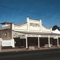
The name Biggenden comes from the pastoral run taken up in the 1840s, and the granite bluff of Mount Walsh has long served as the landmark by which the district is oriented. The park lies 2 km north of Biggenden off the Isis Highway, and its picnic ground is the usual gathering point for local visitors.
Access is via the Isis Highway, turning off 2 km north of Biggenden and following the national park road 5.3 km to the picnic area. A 300 m trail from the picnic area leads through open eucalypt forest to a rainforest-fringed creek gully and lookouts. The unmarked summit hike takes about 2.5 hours and suits experienced walkers. Bush camping is allowed but no facilities are provided, so visitors must be self-sufficient.
The bare granite summit has three peaks and rises to 703 metres. The climb is an unmarked, strenuous hike of about two and a half hours for experienced walkers, and the reward is a wide view over the Biggenden district.
The community of curious travelers
AroundUs brings together thousands of curated places, local tips, and hidden gems, enriched daily by 93,628 contributors worldwide.