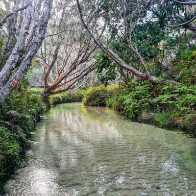
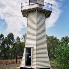
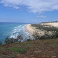
Eli Creek, river in Australia
Description
Eli Creek is a gentle stream on Fraser Island in Queensland that flows from underground springs and reaches the ocean. The clear water moves steadily across soft sand, bordered by tall melaleuca trees and native plants that frame this natural waterway.
History
Eli Creek formed from rainwater and runoff flowing down Fraser Island's sand dunes, gradually creating this gentle stream over time. The Butchulla people used this water source for thousands of years before the area became a popular destination for visitors.
Culture
Eli Creek holds significance for the Butchulla people, the traditional inhabitants of Fraser Island, who used the water and land for thousands of years. Visitors today can learn through guides and information about how this waterway remains an important part of the island's cultural identity.
Practical
Eli Creek is easily reached by a short walk from Fraser Island's main road, with simple parking nearby. The best time to visit is early morning or late afternoon when weather conditions are milder and the area feels quieter.
Did you know?
Eli Creek's water comes from underground springs that keep it cool and fresh throughout the year, creating a natural oasis on hot days. This steady water supply means the stream flows continuously regardless of seasonal changes.
AroundUs brings together thousands of curated places, local tips, and hidden gems, enriched daily by 60,000 contributors worldwide. Discover all places nearby (Queensland).
Urangan Pier
32 km
Great Sandy National Park
9.6 km
Poona National Park
51.9 km
Queen's Park, Maryborough
58.4 km
Woody Island Lighthouses
25.2 kmGreat Sandy
40.9 km
Maryborough Post Office
58.6 km
Gataker's Warehouse Complex
58.6 km
Customs House, Maryborough
58.5 km
Customs House Hotel, Maryborough
58.6 km
Second World War RAAF Buildings, Maryborough Airport
57 km
Hotel Francis
58.7 km
Criterion Hotel, Maryborough
58.5 km
Ilfracombe, Maryborough
57.5 km
Engineers' Arms Hotel
58.6 km
Maryborough Heritage Centre
58.6 km
Australian Joint Stock Bank Building, Maryborough
58.7 km
Queensland National Bank, Maryborough
58.6 km
Maryborough Military and Colonial Museum
58.6 km
Government Bond Store, Maryborough
58.5 km
Maryborough Waterside Workers' Hall
58.5 km
Royal Bank of Queensland, Maryborough
58.6 km
Pialba Memorial Cenotaph
38.7 km
75 Mile Beach
944 m
Colonsay Farm
37.8 km
Urangan Point State School, Block D
32.3 km
Wharf Street Shop, Maryborough
58.6 km
Maryborough Government Office Building
58.5 kmDiscover hidden gems everywhere you go!
From secret cafés to breathtaking viewpoints, skip the crowded tourist spots and find places that match your style. Our app makes it easy with voice search, smart filtering, route optimization, and insider tips from travelers worldwide. Download now for the complete mobile experience.
A unique approach to discovering new places❞
— Le Figaro
All the places worth exploring❞
— France Info
A tailor-made excursion in just a few clicks❞
— 20 Minutes