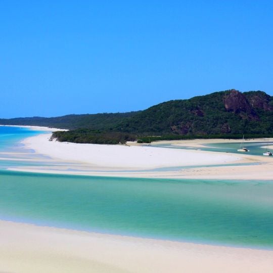
Whitehaven Beach, Beach in Whitsunday Island, Australia
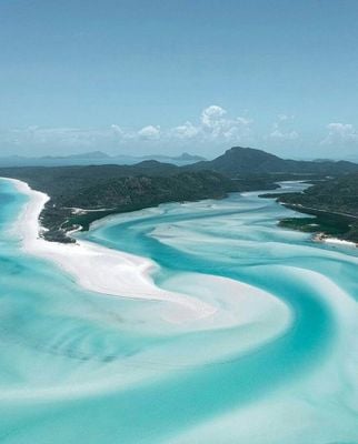
Whitehaven Beach is a seven-kilometre stretch of near-white sand on the east coast of Whitsunday Island, Queensland. It faces a band of deeper turquoise water that cuts between white sandbars, with shallow aquamarine water over the flats and a strip of grey-green vegetation at the sand's far edge. The beach runs opposite Stockyard Beach, also called Chalkie's Beach, on Haslewood Island.
James Cook sailed through the Whitsunday Islands in 1770 and charted these waters for European navigation. The area later became part of a national park to protect the natural features of the coastal landscape from alteration.
The name was given in 1879 by Staff Commander E.P. Bedwell, Admiralty surveyor for Queensland, after the English town of Whitehaven in Cumberland. It was one of several Cumberland place names he assigned in the area, following James Cook's 1770 naming of the Cumberland Islands. The beach hosts the Whitehaven Beach Ocean Swim, a two-kilometre open-water race held each November since 2009 as part of the Hamilton Island Triathlon.
Access is by boat, seaplane or helicopter from Hamilton Island or Airlie Beach, as no road connects to the island. Visitors should bring all necessary items, as there are no facilities or shops at the beach.
The sand is 98 percent silica, yet silica does not occur in the island's own rocks; it is thought that ocean currents carried the grains here over millions of years. The fine grains can scratch camera and phone screens, but they also polish tarnished jewellery.
The community of curious travelers
AroundUs brings together thousands of curated places, local tips, and hidden gems, enriched daily by 92,646 contributors worldwide.