Mowbray National Park, National park in Queensland, Australia
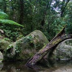
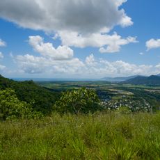
Mowbray National Park is an 86 km² national park in Far North Queensland, about 50 km north of Cairns and 5 km west of Port Douglas, bordering Kuranda National Park to the south. Its vegetation is open eucalyptus woodland and tropical rainforest, and its landmark is the pyramid-shaped Black Mountain.
The Bump Track, reached about 5 km along Mowbray River Road from the Captain Cook Highway near Craiglie, was cut in 1877 to link the coast with the goldfields inland. Coaches on its steep climbs often required passengers to get out and walk part of the way.
The Bump Track, reached about 5 km along Mowbray River Road, was cut in 1877 to link the coast with the Hodgkinson goldfields; coach passengers often had to walk the steepest sections. The track crosses the park's western edge and is still walked today.
The area is open for walking, mountain biking, and horse riding, with different sections designated for each activity. Routes vary in difficulty, so it helps to check ahead which trails match your ability level.
The park's landmark is Black Mountain, a pyramid-shaped peak. Mowbray also forms a wildlife corridor linking the Daintree and Carbine Tablelands in the north with the parks of the Atherton Tablelands to the south.
The community of curious travelers
AroundUs brings together thousands of curated places, local tips, and hidden gems, enriched daily by 94,420 contributors worldwide.