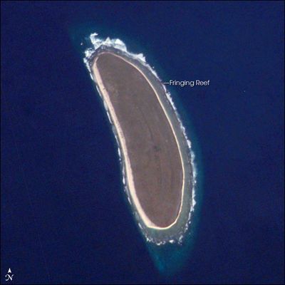
Howland Island, Coral atoll in Central Pacific Ocean, United States.
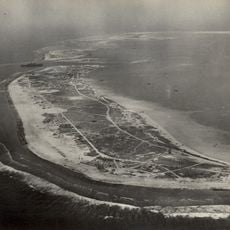
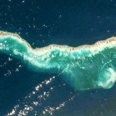
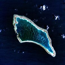
Howland Island is a flat coral atoll in the central Pacific Ocean within the United States Minor Outlying Islands. The landmass stretches roughly 2.4 kilometers (1.5 miles) in length and rises about 6 meters (20 feet) above sea level, with a central basin covered in low vegetation and nesting seabirds.
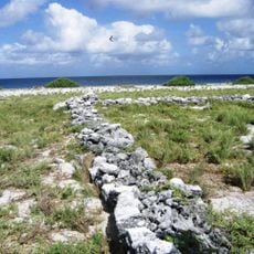
The United States claimed the territory in 1857 under the Guano Act and began mining operations for bird droppings that lasted until the late nineteenth century. A settlement attempt launched in 1935 through the American Equatorial Islands Colonization Project ended when the Second World War began.
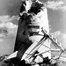
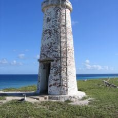
The name honors William Howland, a board member of the American Guano Company that operated here in the 1800s. Structures from the colonization project and the white concrete tower built as a memorial to Amelia Earhart still stand across the flat terrain.
Access requires special permission from the U.S. Fish and Wildlife Service and is granted mainly for scientific research purposes. The atoll has no facilities, no freshwater supply, and no docking point, making any visit extremely difficult.
The atoll sits in the UTC-12:00 time zone, making it one of the last places on Earth where the date changes each day. Amelia Earhart planned to land here in 1937 during her round-the-world flight but disappeared before arrival and was never found.
The community of curious travelers
AroundUs brings together thousands of curated places, local tips, and hidden gems, enriched daily by 60,000 contributors worldwide.