Enable Location

We need your location to show you interesting places around you

Discover nearby places

Find interesting locations and hidden gems around you

Precise directions

Get accurate directions and distances to places

Your location is never shared with other users. It's only used when you tap the location button.

Wheeler Army Airfield

Log in to your account

Start exploring — it's free

Trusted by 62,863 travelers worldwide

Continue with Google
Continue with Apple
or

We will send you a code to connect

By continuing, you accept our Terms and Conditions and our Privacy Policy

Check your inbox

We've sent a pincode in your inbox. Please enter the code below.

Wheeler Army Airfield, National Historic Landmark military airbase in Wahiawa, Hawaii.

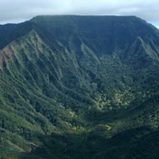
Wheeler Army Airfield is a military installation in central Oahu featuring multiple hangars and administrative buildings spread across extensive grounds. The facility sits at approximately 255 meters elevation and connects different areas of central Oahu.

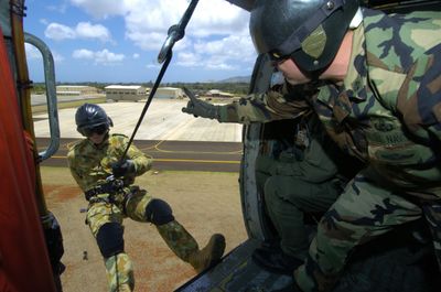
The airfield was founded in 1922 and named to honor Major Sheldon H. Wheeler. During the Pearl Harbor attack on December 7, 1941, it became a critical target with 33 casualties on the grounds.

The base holds deep ties to the local community through military families, schools, and shared defense operations across the island. These connections shape daily life and relationships between the installation and surrounding areas.

Access is restricted to authorized personnel and approved visitors with valid identification, as this is an active military installation. The facility is conveniently positioned with connections to major roads linking various parts of Oahu.

The grounds served as the departure point in 1935 for Amelia Earhart's solo flight journey from Hawaii to California. This flight marked a notable milestone in early aviation history.

The community of curious travelers

AroundUs brings together thousands of curated places, local tips, and hidden gems, enriched daily by 60,000 contributors worldwide.

Start exploring
Location
Inception
1941
Official opening
1941
Elevation above the sea
255 m
GPS coordinates
21.48000,-158.04000
Latest update
December 20, 2025 02:22
Around this place
The Dole Plantation
United States of America

The Dole Plantation

5.1 km
Kaʻala
United States of America

Kaʻala

11 km
Kukaniloko Birth Site
United States of America

Kukaniloko Birth Site

3.1 km
United States of America

Pearl Harbor National Wildlife Refuge

11.5 km
Wahiawa Botanical Garden
United States of America

Wahiawa Botanical Garden

3.4 km
United States of America

Patsy T. Mink Central Oahu Regional Park

8.2 km
United States of America

Oahu Forest National Wildlife Refuge

12.2 km
Wakamiya Inari Shrine
United States of America

Wakamiya Inari Shrine

10.9 km
United States of America

Our Lady of Good Counsel Catholic Church

11.4 km
United States of America

Lake Wilson

3.1 km
Tropic Lightning Museum
United States of America

Tropic Lightning Museum

1.7 km
United States of America

Redlander Field

2.7 km
United States of America

Blaisdell Park

13.3 km
United States of America

Melemanu Park

2.1 km
Pineapple Garden Maze
United States of America

Pineapple Garden Maze

5 km
United States of America

Schofield Barracks Forest Reserve

9.2 km
United States of America

Honouliuli Forest Reserve

6.9 km
The Arrival of Filipino Plantation Workers in Hawaii historical marker
United States of America

The Arrival of Filipino Plantation Workers in Hawaii historical marker

10.9 km
United States of America

Kal'kaua Golf Course

2.5 km
United States of America

West Loch Golf Course

12.8 km
United States of America

Waikele Golf Club

9.4 km
United States of America

Makalena Golf Course

12 km
United States of America

Mililani Golf Course

3.5 km
United States of America

Royal Kunia Country Club

8.4 km
United States of America

Wahiwa General Hospital Thrift Shop

2.5 km
United States of America

Goodwill

2.4 km
United States of America

Installation artwork, Work of art

11.7 km
United States of America

Scenic viewpoint

11.5 km
Show the full map
« Wheeler Army Airfield - National Historic Landmark military airbase in Wahiawa, Hawaii » is provided by Around Us (aroundus.com). Images and texts are derived from Wikimedia project under a Creative Commons license. You are allowed to copy, distribute, and modify copies of this page, under the conditions set by the license, as long as this note is clearly visible.

Discover hidden gems everywhere you go!

From secret cafés to breathtaking viewpoints, skip the crowded tourist spots and find places that match your style. Our app makes it easy with voice search, smart filtering, route optimization, and insider tips from travelers worldwide. Download now for the complete mobile experience.

Around Us App Screenshot

A unique approach to discovering new places

Le Figaro

All the places worth exploring

France Info

A tailor-made excursion in just a few clicks

20 Minutes

Around Us
Travel Guide & Maps
Download

Send to your phone

QR Code
1

Open the camera app on your mobile.

2

Point at the QR code with your camera. A notification will appear.

3

Tap the notification to open the link.