Kaʻala, Mountain summit in Oahu, Hawaii, US
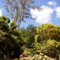
Kaʻala is the highest peak on Oahu, rising over 1,200 meters above sea level as part of the Waianae Range. The mountain displays the gentle slopes typical of shield volcanoes, with vegetation that shifts noticeably as elevation increases.
This peak formed millions of years ago through volcanic activity as part of the Hawaiian-Emperor seamount chain. Over time, cooling and erosion shaped the gentle slopes of this shield volcano into the highest point on the island.
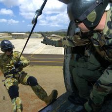
The name Kaʻala means "fragrant" in Hawaiian, and the mountain marks the boundary between the Waiʻanae and Haleʻiwa districts. The summit plateau and its FAA facility are closed to the public and guarded by the US Army, so the mountain is experienced today through the marked trail from Waianae Valley Road rather than at the top.
The hike takes several hours and requires sturdy footwear plus layers for changing weather at higher elevations. Wet conditions are common, especially after rain, so checking the forecast and starting early in the day helps ensure a safer outing.
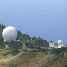
The white dome on the summit is a tracking station run by the FAA, not a navigation aid for shipping; it is closed to the public and guarded by the US Army, stationed below at Schofield Barracks. A paved road from Waialua on the northwest coast, built in the 1940s and repaired at length in 2020, serves the site.
The community of curious travelers
AroundUs brings together thousands of curated places, local tips, and hidden gems, enriched daily by 92,652 contributors worldwide.