Enable Location

We need your location to show you interesting places around you

Discover nearby places

Find interesting locations and hidden gems around you

Precise directions

Get accurate directions and distances to places

Your location is never shared with other users. It's only used when you tap the location button.

Kaena Point Satellite Tracking Station

Log in to your account

Start exploring — it's free

Trusted by 62,892 travelers worldwide

Continue with Google
Continue with Apple
or

We will send you a code to connect

By continuing, you accept our Terms and Conditions and our Privacy Policy

Check your inbox

We've sent a pincode in your inbox. Please enter the code below.

Kaena Point Satellite Tracking Station
Discussion Reviews 1 Photos
14.2k Popularity

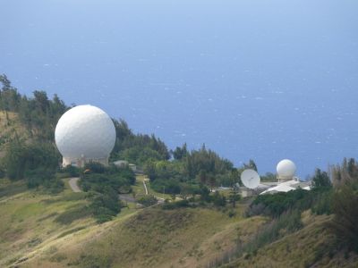
Kaena Point Satellite Tracking Station, Military satellite tracking facility at Kaena Point, Hawaii.

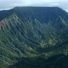
Kaena Point Satellite Tracking Station is a military facility located on a ridge in Hawaii, spanning 153 acres with two large dome structures visible from the surrounding area. Its elevated position enables communication with satellites across vast distances.

The facility was established in 1959 and supported reconnaissance programs and surveillance missions during the Cold War era. It evolved into an important center for space operations in the Pacific region.

The station plays a key role in satellite operations across the Pacific and works closely with government agencies to monitor space activities. This work shapes how the facility connects with the region and its communities.

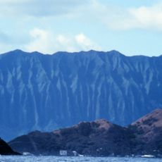
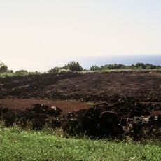
The area is within a protected zone, so visitors should check which trails are open to the public before heading out. Sturdy shoes and water are essential since the terrain is rocky and offers little shade.

The station transmits and receives signals to spacecraft in orbit, playing a role in military communications that most travelers never see directly. Its remote hilltop location makes it a notable geographic landmark for hikers exploring the area.

The community of curious travelers

AroundUs brings together thousands of curated places, local tips, and hidden gems, enriched daily by 60,000 contributors worldwide.

Start exploring
Location
Operator
United States Air Force
GPS coordinates
21.56160,-158.24000
Latest update
December 7, 2025 20:22
Around this place
USS Missouri
United States of America

USS Missouri

37.1 km
Banzai Pipeline
United States of America

Banzai Pipeline

22.4 km
Polynesian Cultural Center
United States of America

Polynesian Cultural Center

34.2 km
Laie Hawaii Temple
United States of America

Laie Hawaii Temple

33.4 km
Wheeler Army Airfield
United States of America

Wheeler Army Airfield

22.6 km
Koʻolau Range
United States of America

Koʻolau Range

37.3 km
Sunset Beach
United States of America

Sunset Beach

22.6 km
Waimea Valley
United States of America

Waimea Valley

21.1 km
USS Bowfin
United States of America

USS Bowfin

37.8 km
Sacred Falls State Park
United States of America

Sacred Falls State Park

33.8 km
Kaʻala
United States of America

Kaʻala

11.8 km
Admiral Clarey Bridge
United States of America

Admiral Clarey Bridge

37.4 km
Pacific Aviation Museum Pearl Harbor
United States of America

Pacific Aviation Museum Pearl Harbor

36.5 km
Kukaniloko Birth Site
United States of America

Kukaniloko Birth Site

21.6 km
Wet'n'Wild Hawaii
United States of America

Wet'n'Wild Hawaii

29.7 km
Hawaiian Railway Society
United States of America

Hawaiian Railway Society

32.5 km
James Campbell National Wildlife Refuge
United States of America

James Campbell National Wildlife Refuge

32.7 km
Wahiawa Botanical Garden
United States of America

Wahiawa Botanical Garden

23.9 km
Barbers Point Light
United States of America

Barbers Point Light

32.6 km
Ahupua'a O Kahana State Park
United States of America

Ahupua'a O Kahana State Park

38.2 km
Pu'u o Mahuka Heiau State Monument
United States of America

Pu'u o Mahuka Heiau State Monument

20.6 km
Waimalu Shopping Center
United States of America

Waimalu Shopping Center

35.9 km
Tropic Lightning Museum
United States of America

Tropic Lightning Museum

21 km
Waipahu Theater
United States of America

Waipahu Theater

31.1 km
Honolulu Magnetic Observatory
United States of America

Honolulu Magnetic Observatory

36.9 km
Waialua Public Library
United States of America

Waialua Public Library

12.3 km
Pineapple Garden Maze
United States of America

Pineapple Garden Maze

21.3 km
The Arrival of Filipino Plantation Workers in Hawaii historical marker
United States of America

The Arrival of Filipino Plantation Workers in Hawaii historical marker

31 km
Show the full map
« Kaena Point Satellite Tracking Station - Military satellite tracking facility at Kaena Point, Hawaii » is provided by Around Us (aroundus.com). Images and texts are derived from Wikimedia project under a Creative Commons license. You are allowed to copy, distribute, and modify copies of this page, under the conditions set by the license, as long as this note is clearly visible.

Discover hidden gems everywhere you go!

From secret cafés to breathtaking viewpoints, skip the crowded tourist spots and find places that match your style. Our app makes it easy with voice search, smart filtering, route optimization, and insider tips from travelers worldwide. Download now for the complete mobile experience.

Around Us App Screenshot

A unique approach to discovering new places

Le Figaro

All the places worth exploring

France Info

A tailor-made excursion in just a few clicks

20 Minutes

Around Us
Travel Guide & Maps
Download

Send to your phone

QR Code
1

Open the camera app on your mobile.

2

Point at the QR code with your camera. A notification will appear.

3

Tap the notification to open the link.