Banzai Pipeline

Log in to your account

AroundUs is a community-driven map of interesting places, built by curious explorers like you. It grows with every review, story, and photo you share.
Connect to save your favorite spots, contribute locations, and create personalized routes.
By continuing, you accept our Terms and Conditions and our Privacy Policy
Add to collection
Map
Suggest a change
Share

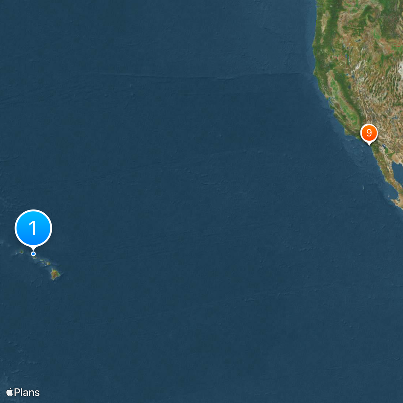
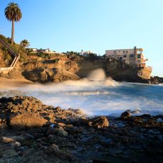
Banzai Pipeline, Surf reef break in Pūpūkea, North Shore of Oahu, US
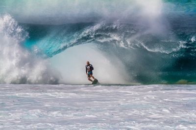
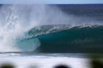
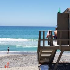
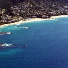
The waves at Banzai Pipeline crash over a sharp coral reef, forming hollow water tubes in depths as shallow as four feet.

The name originated in 1961 when filmmaker Bruce Brown recorded Phil Edwards surfing near a construction site with an underground pipeline.

Professional surf competitions like the Pipe Masters bring international athletes to test their skills against the powerful waves.

Winter months from November through February deliver the largest swells, with wave heights reaching up to twenty feet.

Three distinct reef sections create different wave patterns, with First Reef producing the most frequent and surfable waves.

Location: Pūpūkea

GPS coordinates: 21.66400,-158.05400

Latest update: May 28, 2025 17:57

Surf spots: Banzai Pipeline in Hawaii, Teahupo'o in Polynesia, Jeffreys Bay in South Africa

This collection includes renowned surf spots around the world, located across multiple continents and oceans. From the north coast of Oahu in Hawaii to Australian beaches like Bells Beach and Snapper Rocks, these locations attract surfers from around the world for their consistent waves and favorable conditions. The sites feature diverse characteristics suitable for different skill levels. Banzai Pipeline produces tube-shaped waves over coral reefs, while Supertubes at Jeffreys Bay offers rapid rights over 300 meters. Mavericks in California and Teahupo'o in Tahiti are known for their large waves requiring advanced experience, whereas Rincon Point and Hossegor provide accessible waves with quality sessions. Each destination has its own seasons and geological formations determining surf conditions. Rocky reefs, sandbanks, and coral bottoms create waves with distinct profiles, helping surfers choose their playground based on their skills and preferences.

Around this place
Show the full map
Mission San Juan Capistrano
United States of America

Mission San Juan Capistrano

4167.6 km
Doheny State Beach
United States of America

Doheny State Beach

4165.6 km
Mission Basilica San Juan Capistrano
United States of America

Mission Basilica San Juan Capistrano

4167.5 km
Chet Holifield Federal Building
United States of America

Chet Holifield Federal Building

4163.9 km
The Pier Beach
United States of America

The Pier Beach

4170.2 km
Hangover House
United States of America

Hangover House

4159.9 km
Casa Romantica
United States of America

Casa Romantica

4170.3 km
El Adobe de Capistrano
United States of America

El Adobe de Capistrano

4167.5 km
Aliso and Wood Canyons Regional Park
United States of America

Aliso and Wood Canyons Regional Park

4161.4 km
Aliso Canyon
United States of America

Aliso Canyon

4159.4 km
Los Rios Street Historic District
United States of America

Los Rios Street Historic District

4167.5 km
Laguna Niguel Lake
United States of America

Laguna Niguel Lake

4164.3 km
Laguna Niguel Regional Park
United States of America

Laguna Niguel Regional Park

4164.2 km
Salt Creek Beach
United States of America

Salt Creek Beach

4161.5 km
Strand Beach Funicular
United States of America

Strand Beach Funicular

4162.2 km
Goldschmidt House
United States of America

Goldschmidt House

4171.4 km
North Beach
United States of America

North Beach

4169.4 km
Richard Egan House
United States of America

Richard Egan House

4167.6 km
Esslinger Building
United States of America

Esslinger Building

4167.7 km
Frank A. Forster House
United States of America

Frank A. Forster House

4168.3 km
Aliso Beach
United States of America

Aliso Beach

4159.5 km
Roger Y. Williams House
United States of America

Roger Y. Williams House

4167.1 km
Table Rock Beach
United States of America

Table Rock Beach

4159.9 km
Dana Point
United States of America

Dana Point

4162.2 km
Coast Royale Beach
United States of America

Coast Royale Beach

4159.8 km
San Clemente City Beach
United States of America

San Clemente City Beach

4169.6 km
Dana Point Cave
United States of America

Dana Point Cave

4162.4 km
Poche Beach
United States of America

Poche Beach

4168.2 km
Show the full map

Reviews

Visited this place? Tap the stars to rate it and share your experience / photos with the community! Try now! You can cancel it anytime.

« Banzai Pipeline: Surf reef break in Pūpūkea, North Shore of Oahu, US » is provided by Around Us (aroundus.com). Images and texts are derived from Wikimedia project under a Creative Commons license. You are allowed to copy, distribute, and modify copies of this page, under the conditions set by the license, as long as this note is clearly visible.

Discover hidden gems everywhere you go!

From secret cafés to breathtaking viewpoints, skip the crowded tourist spots and find places that match your style. Our app makes it easy with voice search, smart filtering, route optimization, and insider tips from travelers worldwide. Download now for the complete mobile experience.

Around Us App Screenshot

A unique approach to discovering new places

Le Figaro

All the places worth exploring

France Info

A tailor-made excursion in just a few clicks

20 Minutes