Enable Location

We need your location to show you interesting places around you

Discover nearby places

Find interesting locations and hidden gems around you

Precise directions

Get accurate directions and distances to places

Your location is never shared with other users. It's only used when you tap the location button.

Doheny State Beach

Log in to your account

Start exploring — it's free

Trusted by 61,426 travelers worldwide

Continue with Google
Continue with Apple
or

We will send you a code to connect

By continuing, you accept our Terms and Conditions and our Privacy Policy

Check your inbox

We've sent a pincode in your inbox. Please enter the code below.

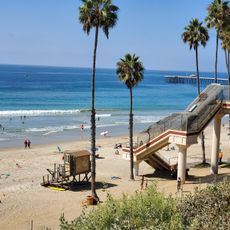
Doheny State Beach, State beach and campground in Dana Point, United States

Description

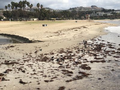
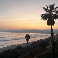
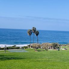
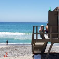
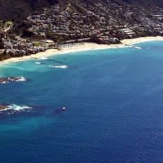
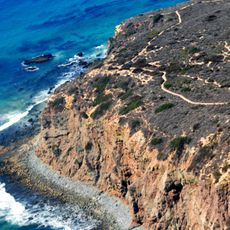
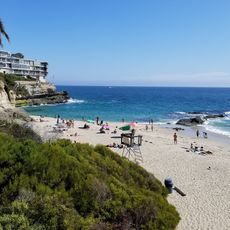
Doheny State Beach is a coastal stretch along the Pacific Ocean in Dana Point spanning about 62 acres (25 hectares), with sand, tide pools, and a campground offering over 100 sites. The spot accommodates swimming, surfing, and all kinds of beach activities, with some campsites located right along the waterline.

History

The land was donated in 1931 by oil entrepreneur Edward L. Doheny, making it the first state beach in California's park system. The shoreline had previously belonged to the Acjachemen, who lived here for about 9,000 years before European settlers arrived in Southern California.

Culture

The name honors Edward L. Doheny, an oil magnate from the early 20th century whose family donated this land to the state. Today locals and visitors come here to sit on the sand, barbecue, and spend afternoons by the sea with friends or family.

Practical

The campground offers 113 sites with fire rings, picnic tables, and access to hot showers, with 33 located right on the beachfront. Day visitors can find good space for swimming or walking, especially during low tide when tide pools become accessible.

Did you know?

Dolphins and seals appear regularly near the shore, especially during spring and fall when large migrations pass along the coast. Some visitors spot them swimming from the beach itself, often in small groups moving parallel to the shoreline.

Location
Operator
California Department of Parks and Recreation
Address
Dana Point Harbor Drive
GPS coordinates
33.46080,-117.67800
Latest update
December 5, 2025 22:30

AroundUs brings together thousands of curated places, local tips, and hidden gems, enriched daily by 60,000 contributors worldwide. Discover all places nearby (Dana Point).

« Doheny State Beach - State beach and campground in Dana Point, United States » is provided by Around Us (aroundus.com). Images and texts are derived from Wikimedia project under a Creative Commons license. You are allowed to copy, distribute, and modify copies of this page, under the conditions set by the license, as long as this note is clearly visible.

Discover hidden gems everywhere you go!

From secret cafés to breathtaking viewpoints, skip the crowded tourist spots and find places that match your style. Our app makes it easy with voice search, smart filtering, route optimization, and insider tips from travelers worldwide. Download now for the complete mobile experience.

Around Us App Screenshot

A unique approach to discovering new places

Le Figaro

All the places worth exploring

France Info

A tailor-made excursion in just a few clicks

20 Minutes

Around Us
Travel Guide & Maps
Download

Send to your phone

QR Code
1

Open the camera app on your mobile.

2

Point at the QR code with your camera. A notification will appear.

3

Tap the notification to open the link.