Enable Location

We need your location to show you interesting places around you

Discover nearby places

Find interesting locations and hidden gems around you

Precise directions

Get accurate directions and distances to places

Your location is never shared with other users. It's only used when you tap the location button.

Savoonga

Log in to your account

Start exploring — it's free

Trusted by 68,248 travelers worldwide

Continue with Google
Continue with Apple
or

We will send you a code to connect

By continuing, you accept our Terms and Conditions and our Privacy Policy

Check your inbox

We've sent a pincode in your inbox. Please enter the code below.

Discussion Reviews 1 Photos
28.9k Popularity

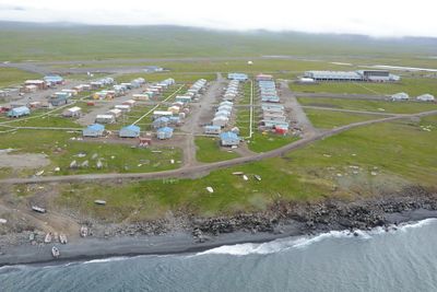
Savoonga, Native settlement on St. Lawrence Island, Nome Census Area, Alaska, US.

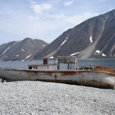
Savoonga sits on St. Lawrence Island along the Bering Sea, spreading across flat terrain with low-lying buildings and gravel pathways. The settlement is surrounded by water and remains isolated from mainland Alaska's road network.

The settlement began as a reindeer herding camp during the 1930s and gained official city status in 1969. This transition marked the shift from seasonal camps to a permanent community on the island.

The Siberian Yupik residents maintain their way of life through year-round subsistence hunting and fishing practices. These activities shape daily routines and the community's connection to the surrounding waters and wildlife.

Visiting this settlement requires flying in, as no road access connects it to the rest of Alaska. Travel is best planned during warmer months when weather is more predictable.

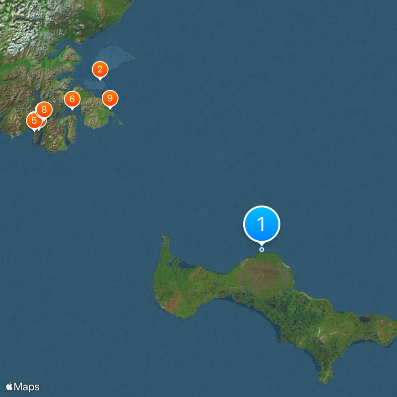
The island is shared with the nearby settlement of Gambell, with only a short distance of water separating the two communities. This arrangement creates an unusual dual settlement in one of Alaska's most remote locations.

The community of curious travelers

AroundUs brings together thousands of curated places, local tips, and hidden gems, enriched daily by 60,000 contributors worldwide.

Start exploring
Location
Inception
October 6, 1969
Elevation above the sea
0 m
GPS coordinates
63.69670,-170.46100
Latest update
December 20, 2025 12:04
Around this place
Whale Bone Alley
Russian Federation

Whale Bone Alley

145.1 km
Beringia National Park
Russian Federation

Beringia National Park

157.2 km
Slavyanka Cove
Russian Federation

Slavyanka Cove

159.2 km
Историко-культурный комплекс Пловер
Russian Federation

Историко-культурный комплекс Пловер

159.2 km
Russian Federation

Памятник Серому киту

146.2 km
Памятный знак в честь 250-летия Первой Камчатской экспедиции (Провидения)
Russian Federation

Памятный знак в честь 250-летия Первой Камчатской экспедиции (Провидения)

157.8 km
Russian Federation

Бюст В.И. Ленина (Провидения)

157.3 km
Russian Federation

Святилище «Найван» (поселение «Униирамкыт»)

128.4 km
Russian Federation

Поселение «Тыфляк»

132.1 km
Russian Federation

Памятник адмиралу Сергею Осиповичу Макарову (Янракыннот)

168.1 km
United States of America

Aneegulgit

18.2 km
Russian Federation

Обелиск памяти погибших в проливе Сенявина 24–25 августа 1974 года (Янракыннот)

168.5 km
United States of America

Ningeehak Beach

56 km
United States of America

Niyghakpak Cliff

52.6 km
Russian Federation

Многослойная стоянка «Найван»

128.3 km
United States of America

Kooku Beach

83.6 km
United States of America

Salghat Beach

75.2 km
United States of America

Nivalghat Beach

69 km
Russian Federation

Этноплощадка

157.1 km
Russian Federation

Коса Вэнэткэн

167.4 km
Russian Federation

Memorial

152.5 km
Russian Federation

В честь 90-летия пограничных войск России

157.7 km
Russian Federation

Первой Камчатской экспедиции

157.7 km
Russian Federation

А. Г. Хабарову

157.1 km
Russian Federation

В. И. Ленину

157.2 km
Russian Federation

В честь 65-летия победы в Великой Отечественной войне

157.2 km
Russian Federation

Ворон "Кутх"

157.1 km
Russian Federation

Адмиралу Сергею Осиповичу Макарову

168.1 km
Show the full map
Reviews
Share your experience

No review yet

Discussions
Start a discussion...

No discussion yet

« Savoonga - Native settlement on St. Lawrence Island, Nome Census Area, Alaska, US » is provided by Around Us (aroundus.com). Images and texts are derived from Wikimedia project under a Creative Commons license. You are allowed to copy, distribute, and modify copies of this page, under the conditions set by the license, as long as this note is clearly visible.

Discover hidden gems everywhere you go!

From secret cafés to breathtaking viewpoints, skip the crowded tourist spots and find places that match your style. Our app makes it easy with voice search, smart filtering, route optimization, and insider tips from travelers worldwide. Download now for the complete mobile experience.

Around Us App Screenshot

A unique approach to discovering new places

Le Figaro

All the places worth exploring

France Info

A tailor-made excursion in just a few clicks

20 Minutes

Around Us
Travel Guide & Maps
Download

Send to your phone

QR Code
1

Open the camera app on your mobile.

2

Point at the QR code with your camera. A notification will appear.

3

Tap the notification to open the link.