Enable Location

We need your location to show you interesting places around you

Discover nearby places

Find interesting locations and hidden gems around you

Precise directions

Get accurate directions and distances to places

Your location is never shared with other users. It's only used when you tap the location button.

Beringia National Park

Log in to your account

Start exploring — it's free

Trusted by 62,290 travelers worldwide

Continue with Google
Continue with Apple
or

We will send you a code to connect

By continuing, you accept our Terms and Conditions and our Privacy Policy

Check your inbox

We've sent a pincode in your inbox. Please enter the code below.

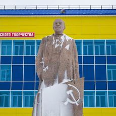
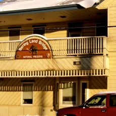
Beringia National Park, National park in Chukotka Autonomous Okrug, Russia

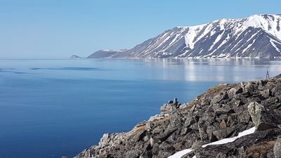
Beringia National Park is a protected area in Chukotka featuring maritime highland subarctic tundra with mountains averaging around 900 meters in elevation. The park consists of five separate clusters distributed across three municipalities, forming one of Russia's largest protected wilderness areas.

The territory was part of a land bridge connecting Asia and North America until approximately 11,000 years ago, enabling early human migration between continents. This ancient geographic connection shaped the distribution of indigenous peoples across the region for thousands of years afterward.

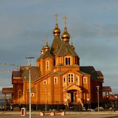
Indigenous Yupik and Chukchi communities maintain their traditional practices within designated areas of the park, contributing to environmental management decisions.

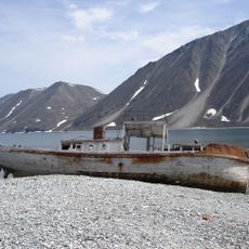
Visiting requires a flight to Anadyr and specific border documentation required for entry to the Chukotka region. Most visitors access the park through organized tours or cruise ships, which provide the most practical way to explore the area.

The park sits at the intersection where the Pacific and Arctic Oceans meet, creating a rare ecological meeting point. This position results in distinctive environmental conditions that blend different oceanic influences in ways found nowhere else.

The community of curious travelers

AroundUs brings together thousands of curated places, local tips, and hidden gems, enriched daily by 60,000 contributors worldwide.

Start exploring
Inception
2013
GPS coordinates
64.36667,-173.30000
Latest update
December 10, 2025 16:26
Around this place
Whale Bone Alley
Russian Federation

Whale Bone Alley

48.3 km
United States of America

Ipiutak Site

528.2 km
Trinity Cathedral
Russian Federation

Trinity Cathedral

440.5 km
Monument to Semyon Dezhnev
Russian Federation

Monument to Semyon Dezhnev

248.9 km
Trail Creek Caves
United States of America

Trail Creek Caves

489.4 km
Cape Nome Mining District Discovery Sites
United States of America

Cape Nome Mining District Discovery Sites

380.9 km
Old St. Joseph's Catholic Church
United States of America

Old St. Joseph's Catholic Church

379.2 km
Nome River
United States of America

Nome River

385.3 km
Snake River
United States of America

Snake River

376.4 km
Wales Site
United States of America

Wales Site

281.5 km
Kougarok River
United States of America

Kougarok River

423.6 km
Kuzitrin River
United States of America

Kuzitrin River

434.1 km
Swanberg Dredge
United States of America

Swanberg Dredge

381.2 km
Solomon Roadhouse
United States of America

Solomon Roadhouse

425.4 km
Niukluk River
United States of America

Niukluk River

451 km
Kugruk River
United States of America

Kugruk River

527.5 km
Shishmaref Inlet
United States of America

Shishmaref Inlet

404 km
Noxapaga River
United States of America

Noxapaga River

455 km
Slavyanka Cove
Russian Federation

Slavyanka Cove

2.2 km
Историко-культурный комплекс Пловер
Russian Federation

Историко-культурный комплекс Пловер

2.7 km
Памятный знак в честь 250-летия Первой Камчатской экспедиции (Провидения)
Russian Federation

Памятный знак в честь 250-летия Первой Камчатской экспедиции (Провидения)

6.3 km
Дворец Пионеров (Анадырь)
Russian Federation

Дворец Пионеров (Анадырь)

440.4 km
Историко-этнографический памятник «Коса Святого Александра» (Анадырь)
Russian Federation

Историко-этнографический памятник «Коса Святого Александра» (Анадырь)

440.1 km
Мемориальный комплекс «Памятник первым Ревкомовцам» (Анадырь)
Russian Federation

Мемориальный комплекс «Памятник первым Ревкомовцам» (Анадырь)

441 km
Памятник В. И. Ленину (Анадырь)
Russian Federation

Памятник В. И. Ленину (Анадырь)

440.4 km
Памятник «Авиаторам — первопроходцам и защитникам неба Чукотки» (Угольные Копи)
Russian Federation

Памятник «Авиаторам — первопроходцам и защитникам неба Чукотки» (Угольные Копи)

432.7 km
Bering Land Bridge Visitor Center
United States of America

Bering Land Bridge Visitor Center

379.2 km
Ванкаремская школа - памятник Челюскинской эпопеи (Ванкарем)
Russian Federation

Ванкаремская школа - памятник Челюскинской эпопеи (Ванкарем)

403.4 km
Show the full map
« Beringia National Park - National park in Chukotka Autonomous Okrug, Russia » is provided by Around Us (aroundus.com). Images and texts are derived from Wikimedia project under a Creative Commons license. You are allowed to copy, distribute, and modify copies of this page, under the conditions set by the license, as long as this note is clearly visible.

Discover hidden gems everywhere you go!

From secret cafés to breathtaking viewpoints, skip the crowded tourist spots and find places that match your style. Our app makes it easy with voice search, smart filtering, route optimization, and insider tips from travelers worldwide. Download now for the complete mobile experience.

Around Us App Screenshot

A unique approach to discovering new places

Le Figaro

All the places worth exploring

France Info

A tailor-made excursion in just a few clicks

20 Minutes

Around Us
Travel Guide & Maps
Download

Send to your phone

QR Code
1

Open the camera app on your mobile.

2

Point at the QR code with your camera. A notification will appear.

3

Tap the notification to open the link.