Ipiutak Site, Archaeological site in Point Hope, Alaska, US.
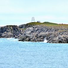
The Ipiutak Site is an archaeological location near Point Hope where about 600 house depressions are visible along four beach ridges. The remains show how an ancient settlement was organized along the Arctic shoreline.
The location was discovered in 1939 by archaeologists Helge Larsen and Froelich Rainey, which prompted large-scale excavations. The findings came from roughly 74 houses built with driftwood, showing how people inhabited this harsh shoreline.
The artifacts reflect how people living along the Arctic coast understood and depicted animals like polar bears and seals that were central to their survival. The carved figures and tools show how they transformed their daily surroundings into objects of meaning.
The most important discoveries are now kept in several museums, including the National Museum of Denmark, the American Museum of Natural History, and the University of Alaska Fairbanks. If you want to visit the site itself, ask locally about access and guided tours in the area.
Among the burial gifts were masks with striking details, such as one showing a human face with blowfly larvae appearing to come out of its nostrils. This artistic depiction of decay and death seems to have held meaning for the people who lived there.
The community of curious travelers
AroundUs brings together thousands of curated places, local tips, and hidden gems, enriched daily by 60,000 contributors worldwide.