Onion Portage Archeological District, Archaeological site in Kobuk Valley National Park, Alaska, US
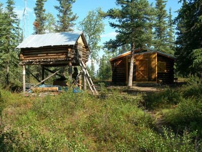
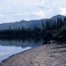
Onion Portage Archeological District spreads across the northern banks of the Kobuk River and contains layered deposits holding artifacts from nine separate cultural periods. The excavations reveal how people continuously occupied and used this location for thousands of years.
The site was first identified in 1940 by Arctic archaeologist J. Louis Giddings, who found evidence of human presence spanning from about 6500 BC until around 1700 AD. This long timeline makes the location one of the most important records of how Arctic peoples lived over thousands of years.
Inupiat hunters have long used this location to intercept caribou during their seasonal river crossings, a practice rooted in understanding the land's natural patterns. The site remains meaningful to local communities as a place where traditional knowledge about wildlife and the river continues to guide hunting practices.
Reaching this site requires arranging chartered aircraft, as it sits far from roads and is only accessible by air. Exact location details are intentionally kept confidential to prevent damage to the fragile archaeological layers.
The materials excavated here create the most complete cultural chronology for Arctic settlements in northwestern Alaska and reveal nine successive periods of occupation. This unbroken sequence allows researchers to trace how people adapted their ways of life across many centuries.
The community of curious travelers
AroundUs brings together thousands of curated places, local tips, and hidden gems, enriched daily by 60,000 contributors worldwide.