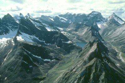
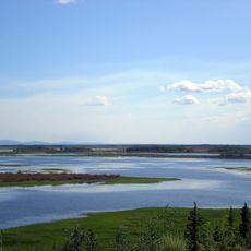
Gates of the Arctic Wilderness, National wilderness area in northern Brooks Range, Alaska
Gates of the Arctic Wilderness is a vast area of rugged mountains, glacial valleys, and tundra landscape located north of the Arctic Circle. The region consists of exposed ridgelines, flowing waterways, and open plains without roads or marked trails running through it.
President Carter designated this area as a national monument in 1978, and in 1980 it became a national park and preserve through federal legislation. This protection preserved one of North America's largest remaining roadless wilderness areas from development.
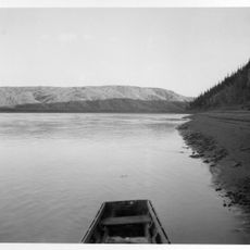
Athabaskan and Inupiat peoples have lived here for thousands of years, continuing to hunt and fish using traditional methods passed down through generations. Visitors may encounter evidence of these practices and the deep relationship these communities maintain with the landscape.
The wilderness has no roads or maintained trails, so visitors must arrange air transportation from Fairbanks or reach it via the Dalton Highway. You should be experienced in backcountry travel and prepared to navigate and camp independently.
During winter months the sun does not rise for extended periods, while summer brings midnight sun conditions where darkness never falls. The northern lights appear when darkness returns in fall and spring, creating a rare light show in one of Earth's most remote places.
The community of curious travelers
AroundUs brings together thousands of curated places, local tips, and hidden gems, enriched daily by 60,000 contributors worldwide.