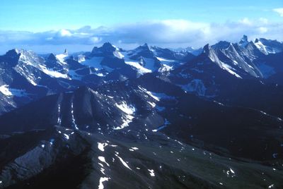
Arrigetch Peaks, Granite peaks in Gates of the Arctic National Park, Alaska, US.
Arrigetch Peaks are granite spires rising from tundra in the central Brooks Range of northern Alaska, creating a stark and dramatic mountain landscape. The formation consists of several distinct peaks that together create a recognizable silhouette, standing out sharply from the surrounding terrain.
The granite formation was shaped by glacial activity over millennia and received recognition as a National Natural Landmark in 1968. This designation acknowledged the geological importance that makes it a notable feature in the region's landscape.
The Nunamiut people named these peaks 'fingers of the outstretched hand', a description that reflects how they perceived and navigated the landscape. This traditional name remains connected to how the formation is understood and recognized in the region.
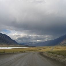
Reaching the peaks requires a small aircraft flight from the nearest town, which lands nearby in the remote region. Hiking happens on unmarked terrain with no established trails, so visitors need good navigation skills and preparation for harsh conditions.
Eleven small cirque glaciers persist within the peaks, demonstrating where metamorphic and granite rock types meet and transition. These glaciers are remnants of past climate conditions and help explain the geological complexity of the range.
The community of curious travelers
AroundUs brings together thousands of curated places, local tips, and hidden gems, enriched daily by 60,000 contributors worldwide.