Northwest Arctic Borough

Log in to your account

AroundUs is a community-driven map of interesting places, built by curious explorers like you. It grows with every review, story, and photo you share.
Connect to save your favorite spots, contribute locations, and create personalized routes.
Continue with Google
Continue with Apple
Continue with X
Continue with Facebook
Continue with email
By continuing, you accept our Terms and Conditions and our Privacy Policy
Create an account
Add to collection
Map
Suggest a change
Share

Northwest Arctic Borough, Administrative division in northern Alaska, United States

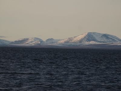
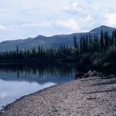
Northwest Arctic Borough is an administrative region in northern Alaska that encompasses vast tundra areas and numerous Indigenous settlements spread across remote territory. The district stretches across frozen landscapes near the Arctic Ocean with small communities separated by large distances.

The borough was established in 1972 following the Alaska Native Claims Settlement Act of 1971, which reorganized land rights and Indigenous governance structures. This reorganization fundamentally changed how local communities held title to their ancestral lands.

Local communities practice traditional ways of living based on fishing, hunting, and gathering that define daily routines and social structures. These activities remain central to how people organize their lives and support their families.

Most communities lack road connections and travel between settlements primarily happens by air, especially during winter months when weather is severe. Visitors should expect limited access to goods and services, and plan accordingly for self-sufficiency.

During winter months the region experiences extended darkness lasting more than two months, while summer brings weeks of continuous daylight when the sun never sets. These extreme cycles of light and darkness shape life and nature in this polar landscape.

Location: Alaska

Inception: 1986

Capital city: Kotzebue

Part of: organized borough

Shares border with: North Slope Borough, Yukon-Koyukuk Census Area, Nome Census Area

Website: http://nwabor.org

GPS coordinates: 67.00000,-160.00000

Latest update: December 7, 2025 19:22

Photos
Around this place
Kobuk Valley National Park
United States of America

Kobuk Valley National Park

68.5 km
Gates of the Arctic Wilderness
United States of America

Gates of the Arctic Wilderness

318.9 km
United States of America

Ipiutak Site

324.7 km
Mount Igikpak
United States of America

Mount Igikpak

221.9 km
Arrigetch Peaks
United States of America

Arrigetch Peaks

255.2 km
Trail Creek Caves
United States of America

Trail Creek Caves

203.2 km
Noatak Wilderness
United States of America

Noatak Wilderness

120.1 km
Kanuti National Wildlife Refuge
United States of America

Kanuti National Wildlife Refuge

365 km
John River
United States of America

John River

345.5 km
Koyukuk National Wildlife Refuge
United States of America

Koyukuk National Wildlife Refuge

222.2 km
Selawik National Wildlife Refuge
United States of America

Selawik National Wildlife Refuge

59.1 km
Nowitna National Wildlife Refuge
United States of America

Nowitna National Wildlife Refuge

376.8 km
Cape Nome Mining District Discovery Sites
United States of America

Cape Nome Mining District Discovery Sites

365.4 km
Unalakleet River
United States of America

Unalakleet River

335.2 km
North Fork Koyukuk River
United States of America

North Fork Koyukuk River

397.3 km
Old St. Joseph's Catholic Church
United States of America

Old St. Joseph's Catholic Church

372 km
Selawik River
United States of America

Selawik River

90.4 km
Nome River
United States of America

Nome River

355.6 km
Snake River
United States of America

Snake River

362.2 km
Chamisso Wilderness
United States of America

Chamisso Wilderness

118.1 km
Onion Portage Archeological District
United States of America

Onion Portage Archeological District

74.7 km
Wales Site
United States of America

Wales Site

393.1 km
Kougarok River
United States of America

Kougarok River

271.1 km
Squirrel River
United States of America

Squirrel River

57.2 km
Kuzitrin River
United States of America

Kuzitrin River

272.7 km
Walker Lake
United States of America

Walker Lake

244.9 km
Kanuti River
United States of America

Kanuti River

383.2 km
Swanberg Dredge
United States of America

Swanberg Dredge

371.4 km
Show the full map
Reviews

Visited this place? Tap the stars to rate it and share your experience / photos with the community! Try now! You can cancel it anytime.

« Northwest Arctic Borough - Administrative division in northern Alaska, United States » is provided by Around Us (aroundus.com). Images and texts are derived from Wikimedia project under a Creative Commons license. You are allowed to copy, distribute, and modify copies of this page, under the conditions set by the license, as long as this note is clearly visible.

Discover hidden gems everywhere you go!

From secret cafés to breathtaking viewpoints, skip the crowded tourist spots and find places that match your style. Our app makes it easy with voice search, smart filtering, route optimization, and insider tips from travelers worldwide. Download now for the complete mobile experience.

Around Us App Screenshot

A unique approach to discovering new places

Le Figaro

All the places worth exploring

France Info

A tailor-made excursion in just a few clicks

20 Minutes