·

Enable Location

We need your location to show you interesting places around you

Discover nearby places

Find interesting locations and hidden gems around you

Precise directions

Get accurate directions and distances to places

Your location is never shared with other users. It's only used when you tap the location button.

Cape Vankarem

Log in to your account

Start exploring — it's free

Trusted by 62,650 travelers worldwide

Continue with Google
Continue with Apple
or

We will send you a code to connect

By continuing, you accept our Terms and Conditions and our Privacy Policy

Check your inbox

We've sent a pincode in your inbox. Please enter the code below.

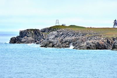
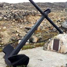
Cape Vankarem, cape in Chukotka Autonomous Okrug, Russia

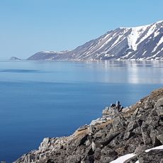
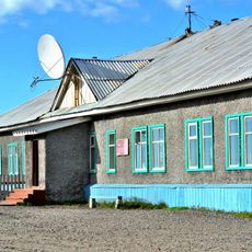
Cape Vankarem is a headland on the northern coast of Chukotka that juts into the waters of the Chukchi Sea. The terrain consists of flat coastal areas with sandy beaches, low ridges, and lagoons, with the village of Vankarem situated at a lagoon entrance.

The region was explored by early expeditions such as Adolf Erik Nordenskiöld, who documented remains of old settlements and animal bones. The Chukchi community has maintained its traditional way of life for generations through hunting and fishing in these waters.

The name Vankarem comes from the Chukchi people who have long lived in this region. The local community organizes its life around the seasons and animal migrations, especially when walruses return to rest on the beaches.

Access is challenging and usually requires travel by boat or airplane during summer months, as there are no regular roads. Winter brings extreme cold and ice conditions, so careful planning is necessary and an experienced guide is highly recommended.

Around 40,000 walruses return each autumn to rest on the beaches after the local community undertook intensive protection efforts starting in the 1990s. This recovery demonstrates how traditional hunting methods connect with modern conservation.

The community of curious travelers

AroundUs brings together thousands of curated places, local tips, and hidden gems, enriched daily by 60,000 contributors worldwide.

Start exploring
GPS coordinates
67.84861,-175.80667
Latest update
February 9, 2026 07:45
Around this place
Zapovednik Wrangel Island
Russian Federation

Zapovednik Wrangel Island

420.1 km

Herald Island
Russian Federation

Herald Island

393.5 km
Whale Bone Alley
Russian Federation

Whale Bone Alley

386 km
Beringia National Park
Russian Federation

Beringia National Park

403.7 km
United States of America

Ipiutak Site

376.8 km
Trinity Cathedral
Russian Federation

Trinity Cathedral

457 km
Monument to Semyon Dezhnev
Russian Federation

Monument to Semyon Dezhnev

334.7 km
Pegtymel Petroglyphs
Russian Federation

Pegtymel Petroglyphs

438.9 km
Trail Creek Caves
United States of America

Trail Creek Caves

588 km
Cape Nome Mining District Discovery Sites
United States of America

Cape Nome Mining District Discovery Sites

593.2 km
Old St. Joseph's Catholic Church
United States of America

Old St. Joseph's Catholic Church

596.8 km
Nome River
United States of America

Nome River

590.4 km
Snake River
United States of America

Snake River

584.4 km
Wales Site
United States of America

Wales Site

420.9 km
Kougarok River
United States of America

Kougarok River

556 km
Kuzitrin River
United States of America

Kuzitrin River

577.3 km
Shishmaref Inlet
United States of America

Shishmaref Inlet

464.2 km
Noxapaga River
United States of America

Noxapaga River

572.8 km
Slavyanka Cove
Russian Federation

Slavyanka Cove

403 km
Историко-культурный комплекс Пловер
Russian Federation

Историко-культурный комплекс Пловер

403.6 km
Памятный знак в честь 250-летия Первой Камчатской экспедиции (Провидения)
Russian Federation

Памятный знак в честь 250-летия Первой Камчатской экспедиции (Провидения)

398.7 km
Дворец Пионеров (Анадырь)
Russian Federation

Дворец Пионеров (Анадырь)

457.2 km
Историко-этнографический памятник «Коса Святого Александра» (Анадырь)
Russian Federation

Историко-этнографический памятник «Коса Святого Александра» (Анадырь)

456.7 km
Мемориальный комплекс «Памятник первым Ревкомовцам» (Анадырь)
Russian Federation

Мемориальный комплекс «Памятник первым Ревкомовцам» (Анадырь)

456.9 km
Памятник В. И. Ленину (Анадырь)
Russian Federation

Памятник В. И. Ленину (Анадырь)

457.2 km
Памятник «Авиаторам — первопроходцам и защитникам неба Чукотки» (Угольные Копи)
Russian Federation

Памятник «Авиаторам — первопроходцам и защитникам неба Чукотки» (Угольные Копи)

451.3 km
Ванкаремская школа - памятник Челюскинской эпопеи (Ванкарем)
Russian Federation

Ванкаремская школа - памятник Челюскинской эпопеи (Ванкарем)

1.4 km
Show the full map
« Cape Vankarem - cape in Chukotka Autonomous Okrug, Russia » is provided by Around Us (aroundus.com). Images and texts are derived from Wikimedia project under a Creative Commons license. You are allowed to copy, distribute, and modify copies of this page, under the conditions set by the license, as long as this note is clearly visible.

Discover hidden gems everywhere you go!

From secret cafés to breathtaking viewpoints, skip the crowded tourist spots and find places that match your style. Our app makes it easy with voice search, smart filtering, route optimization, and insider tips from travelers worldwide. Download now for the complete mobile experience.

Around Us App Screenshot

A unique approach to discovering new places

Le Figaro

All the places worth exploring

France Info

A tailor-made excursion in just a few clicks

20 Minutes

Around Us
Travel Guide & Maps
Download

Send to your phone

QR Code
1

Open the camera app on your mobile.

2

Point at the QR code with your camera. A notification will appear.

3

Tap the notification to open the link.