Enable Location

We need your location to show you interesting places around you

Discover nearby places

Find interesting locations and hidden gems around you

Precise directions

Get accurate directions and distances to places

Your location is never shared with other users. It's only used when you tap the location button.

Herald Island

Log in to your account

Start exploring — it's free

Trusted by 66,426 travelers worldwide

Continue with Google
Continue with Apple
or

We will send you a code to connect

By continuing, you accept our Terms and Conditions and our Privacy Policy

Check your inbox

We've sent a pincode in your inbox. Please enter the code below.

Herald Island
Discussion Reviews 2 Photos
10k Popularity

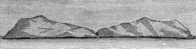
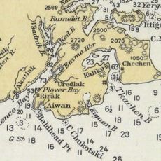
Herald Island, Arctic island in Chukotka Autonomous Okrug, Russia.

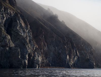
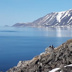
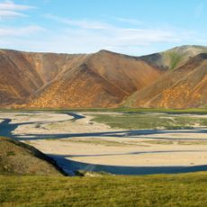
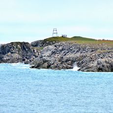
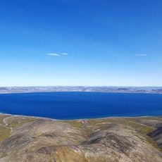
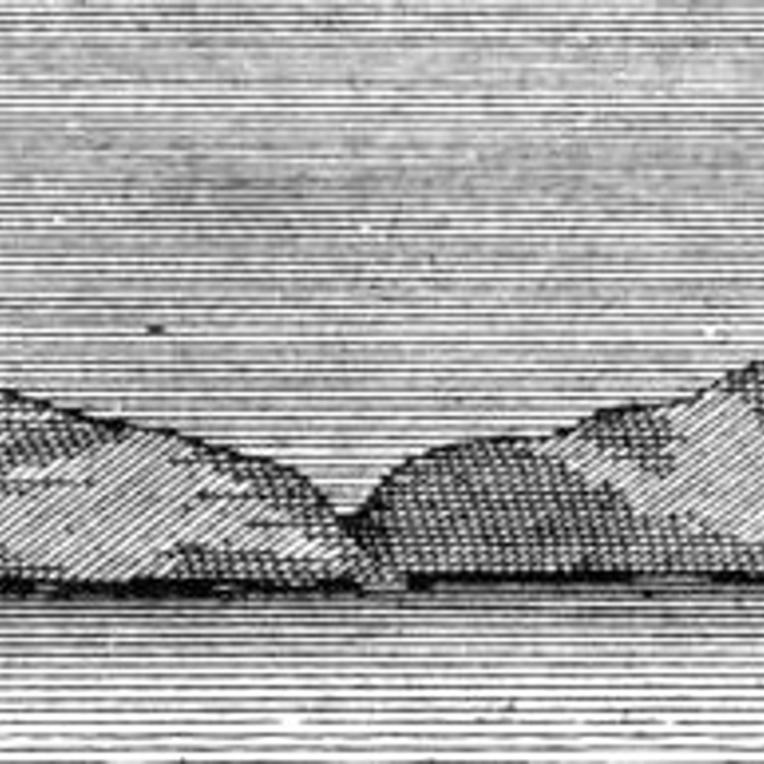
Herald Island is an uninhabited island in the Chukchi Sea, in Russia's far northeast, surrounded by steep cliffs that rise sharply from the water. The surface is mostly bare rock with little vegetation, and the northwestern tip is the only area where the shoreline is even partly accessible.

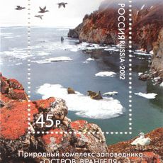
The British survey ship HMS Herald came upon the island in 1849 during a search for Sir John Franklin's lost expedition. Russia formally claimed it in 1916, and it was later included in a protected nature reserve.

The island takes its name from the British survey ship HMS Herald, which charted it in the mid-19th century. This kind of naming was common during the era when naval expeditions mapped the edges of the known world.

Getting to the island requires special permits and a well-equipped vessel, as there are no regular routes or facilities of any kind. Weather in this part of the Arctic changes quickly, so any visit needs careful planning in advance.

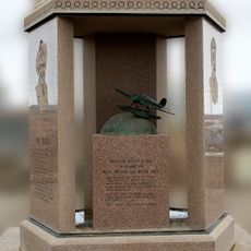
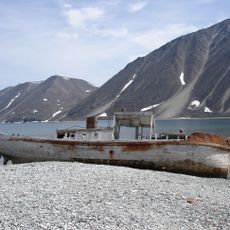
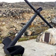
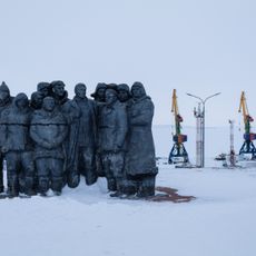
In 1914, four members of the Canadian Arctic Expedition died on the island after their ship became trapped in ice, and the cause of their deaths was never fully explained. Their remains were not found until roughly a decade later, making this one of the more puzzling episodes in polar exploration.

The community of curious travelers

AroundUs brings together thousands of curated places, local tips, and hidden gems, enriched daily by 60,000 contributors worldwide.

Start exploring
Elevation above the sea
364 m
GPS coordinates
71.38333,-175.66667
Latest update
March 3, 2026 08:19
Around this place
Zapovednik Wrangel Island
Russian Federation

Zapovednik Wrangel Island

176.7 km
Kobuk Valley National Park
United States of America

Kobuk Valley National Park

765.2 km
Rogers-Post Site
United States of America

Rogers-Post Site

663.4 km
Whale Bone Alley
Russian Federation

Whale Bone Alley

761.5 km
Point Barrow Long Range Radar Site
United States of America

Point Barrow Long Range Radar Site

674.5 km
Beringia National Park
Russian Federation

Beringia National Park

787.2 km
United States of America

Ipiutak Site

478.1 km
Monument to Semyon Dezhnev
Russian Federation

Monument to Semyon Dezhnev

643.2 km
Pegtymel Petroglyphs
Russian Federation

Pegtymel Petroglyphs

418.7 km
Point Barrow Refuge Station
United States of America

Point Barrow Refuge Station

670.2 km
Noatak Wilderness
United States of America

Noatak Wilderness

719.9 km
Palyavaam River
Russian Federation

Palyavaam River

452.4 km
Birnirk Site
United States of America

Birnirk Site

671.3 km
Wales Site
United States of America

Wales Site

712.3 km
Cape Vankarem
Russian Federation

Cape Vankarem

393.5 km
Squirrel River
United States of America

Squirrel River

728.9 km
Iñupiat Heritage Center
United States of America

Iñupiat Heritage Center

670.9 km
Elgygytgyn Lake
Russian Federation

Elgygytgyn Lake

643.7 km
Utqiaġvik Church Manse
United States of America

Utqiaġvik Church Manse

670.1 km
Shishmaref Inlet
United States of America

Shishmaref Inlet

690 km
Salmon River
United States of America

Salmon River

752.7 km
Slavyanka Cove
Russian Federation

Slavyanka Cove

786.9 km
Историко-культурный комплекс Пловер
Russian Federation

Историко-культурный комплекс Пловер

787.6 km
Kugururok River
United States of America

Kugururok River

643.3 km
Памятный знак в честь 250-летия Первой Камчатской экспедиции (Провидения)
Russian Federation

Памятный знак в честь 250-летия Первой Камчатской экспедиции (Провидения)

781.7 km
Мемориальный комплекс «Памятник первым Ревкомовцам» (Анадырь)
Russian Federation

Мемориальный комплекс «Памятник первым Ревкомовцам» (Анадырь)

791 km
Памятник «Авиаторам — первопроходцам и защитникам неба Чукотки» (Угольные Копи)
Russian Federation

Памятник «Авиаторам — первопроходцам и защитникам неба Чукотки» (Угольные Копи)

787.9 km
Памятник-бюст геологу Ю.А. Билибину (Билибино)
Russian Federation

Памятник-бюст геологу Ю.А. Билибину (Билибино)

779.2 km
Show the full map
Reviews
Share your experience

No review yet

Discussions
Start a discussion...

No discussion yet

« Herald Island - Arctic island in Chukotka Autonomous Okrug, Russia » is provided by Around Us (aroundus.com). Images and texts are derived from Wikimedia project under a Creative Commons license. You are allowed to copy, distribute, and modify copies of this page, under the conditions set by the license, as long as this note is clearly visible.

Discover hidden gems everywhere you go!

From secret cafés to breathtaking viewpoints, skip the crowded tourist spots and find places that match your style. Our app makes it easy with voice search, smart filtering, route optimization, and insider tips from travelers worldwide. Download now for the complete mobile experience.

Around Us App Screenshot

A unique approach to discovering new places

Le Figaro

All the places worth exploring

France Info

A tailor-made excursion in just a few clicks

20 Minutes

Around Us
Travel Guide & Maps
Download

Send to your phone

QR Code
1

Open the camera app on your mobile.

2

Point at the QR code with your camera. A notification will appear.

3

Tap the notification to open the link.