·

Enable Location

We need your location to show you interesting places around you

Discover nearby places

Find interesting locations and hidden gems around you

Precise directions

Get accurate directions and distances to places

Your location is never shared with other users. It's only used when you tap the location button.

Palyavaam River

Log in to your account

Start exploring — it's free

Trusted by 62,650 travelers worldwide

Continue with Google
Continue with Apple
or

We will send you a code to connect

By continuing, you accept our Terms and Conditions and our Privacy Policy

Check your inbox

We've sent a pincode in your inbox. Please enter the code below.

Palyavaam River

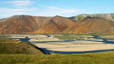
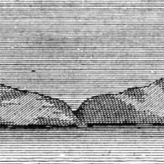
Palyavaam River, River system in Chukotka Autonomous Okrug, Russia

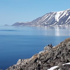
The Palyavaam is a river system in Chukotka Autonomous Okrug that flows through the Arctic tundra of Russia's Far East. The waterway drains a large basin through multiple channels and supports important fish populations adapted to cold northern conditions.

The first documented exploration of the Palyavaam basin occurred in 1746 when an expedition mapped this remote waterway. That early survey established the foundation for understanding this isolated river system in the region.

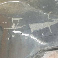
The name Palyavaam comes from the Yukaghir language meaning mountain river, reflecting how indigenous peoples have always viewed this waterway. You can still see this heritage in the traditional fishing practices that continue along the river today.

The waterway freezes from October through June, making navigation impossible during much of the year. The best time to visit is during the short summer months when the water is open and conditions are milder for outdoor activities.

The system is home to several fish species specially adapted to far northern conditions that many travelers overlook. These populations are integral to the local food chain and have long supported subsistence fishing in the region.

The community of curious travelers

AroundUs brings together thousands of curated places, local tips, and hidden gems, enriched daily by 60,000 contributors worldwide.

Start exploring
GPS coordinates
68.02170,177.72500
Latest update
December 14, 2025 12:21
Around this place
Zapovednik Wrangel Island
Russian Federation

Zapovednik Wrangel Island

363.3 km

Pleistocene Park
Russian Federation

Pleistocene Park

668 km
Bilibino Nuclear Power Plant
Russian Federation

Bilibino Nuclear Power Plant

465.1 km
Herald Island
Russian Federation

Herald Island

452.4 km
Whale Bone Alley
Russian Federation

Whale Bone Alley

574.6 km
Beringia National Park
Russian Federation

Beringia National Park

571.8 km
United States of America

Ipiutak Site

638.6 km
Trinity Cathedral
Russian Federation

Trinity Cathedral

366 km
Monument to Semyon Dezhnev
Russian Federation

Monument to Semyon Dezhnev

588.5 km
Pegtymel Petroglyphs
Russian Federation

Pegtymel Petroglyphs

218.9 km
Khatyrka meteorite
Russian Federation

Khatyrka meteorite

615.9 km
Russian Federation

Routan Islands

359.8 km
Pilgrim Hot Springs
United States of America

Pilgrim Hot Springs

831.2 km
Lake Bolshoye Morskoye
Russian Federation

Lake Bolshoye Morskoye

785.9 km
Snake River
United States of America

Snake River

836.9 km
Northeast Science Station
Russian Federation

Northeast Science Station

672.3 km
Wales Site
United States of America

Wales Site

675.5 km
Kougarok River
United States of America

Kougarok River

819.8 km
Shishmaref Inlet
United States of America

Shishmaref Inlet

732.3 km
Slavyanka Cove
Russian Federation

Slavyanka Cove

570.3 km
Историко-культурный комплекс Пловер
Russian Federation

Историко-культурный комплекс Пловер

570.6 km
Памятный знак в честь 250-летия Первой Камчатской экспедиции (Провидения)
Russian Federation

Памятный знак в честь 250-летия Первой Камчатской экспедиции (Провидения)

569.1 km
Дворец Пионеров (Анадырь)
Russian Federation

Дворец Пионеров (Анадырь)

366.3 km
Историко-этнографический памятник «Коса Святого Александра» (Анадырь)
Russian Federation

Историко-этнографический памятник «Коса Святого Александра» (Анадырь)

366 km
Мемориальный комплекс «Памятник первым Ревкомовцам» (Анадырь)
Russian Federation

Мемориальный комплекс «Памятник первым Ревкомовцам» (Анадырь)

365.6 km
Памятник В. И. Ленину (Анадырь)
Russian Federation

Памятник В. И. Ленину (Анадырь)

366.3 km
Памятник-бюст геологу Ю.А. Билибину (Билибино)
Russian Federation

Памятник-бюст геологу Ю.А. Билибину (Билибино)

468.8 km
Show the full map
« Palyavaam River - River system in Chukotka Autonomous Okrug, Russia » is provided by Around Us (aroundus.com). Images and texts are derived from Wikimedia project under a Creative Commons license. You are allowed to copy, distribute, and modify copies of this page, under the conditions set by the license, as long as this note is clearly visible.

Discover hidden gems everywhere you go!

From secret cafés to breathtaking viewpoints, skip the crowded tourist spots and find places that match your style. Our app makes it easy with voice search, smart filtering, route optimization, and insider tips from travelers worldwide. Download now for the complete mobile experience.

Around Us App Screenshot

A unique approach to discovering new places

Le Figaro

All the places worth exploring

France Info

A tailor-made excursion in just a few clicks

20 Minutes

Around Us
Travel Guide & Maps
Download

Send to your phone

QR Code
1

Open the camera app on your mobile.

2

Point at the QR code with your camera. A notification will appear.

3

Tap the notification to open the link.