Enable Location

We need your location to show you interesting places around you

Discover nearby places

Find interesting locations and hidden gems around you

Precise directions

Get accurate directions and distances to places

Your location is never shared with other users. It's only used when you tap the location button.

Encinitas

Log in to your account

Start exploring — it's free

Trusted by 62,829 travelers worldwide

Continue with Google
Continue with Apple
or

We will send you a code to connect

By continuing, you accept our Terms and Conditions and our Privacy Policy

Check your inbox

We've sent a pincode in your inbox. Please enter the code below.

Encinitas, Coastal city in San Diego County, United States

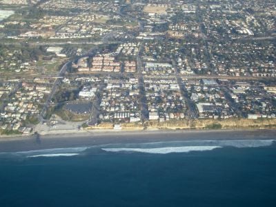
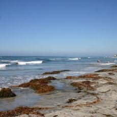
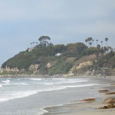
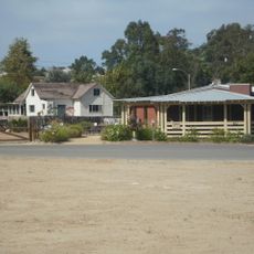
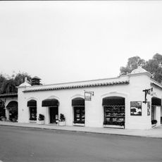
Encinitas is a coastal city in San Diego County, California, extending about 20 miles (32 kilometers) north of San Diego between the Pacific Ocean and gentle hills. The city consists of several neighborhoods with beaches like Moonlight Beach, houses on the bluffs, and a historic downtown with low buildings along the coastal highway.

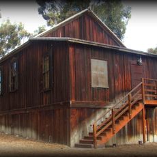
The area was originally inhabited by the Kumeyaay people before the Mexican government granted the land to Andrés Ybarra as Rancho Las Encinitas in 1842. The town developed after the railroad arrived in the 1880s and was officially incorporated in 1986.

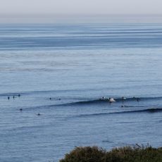
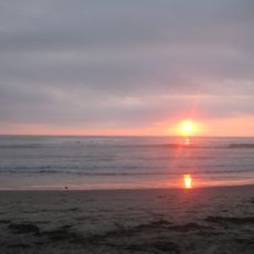
The name comes from the Spanish word for small oaks that once grew along the coast and gave shade to early settlers. Today the city is known as a surfing destination where people from the region spend weekends and local cafés reflect the beach culture of southern California.

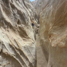
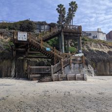
Most visitors arrive by car and park along main streets or in public lots near the beaches. Access to the beaches often involves stairs or ramps descending from the bluffs, with some sections that may be difficult for wheelchairs.

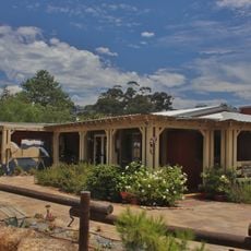
The city is home to several yoga studios and meditation centers, including gardens with koi ponds on the cliffs that have attracted visitors since the 1920s. A historic cinema from 1928 still shows films in the original hall with preserved interior.

The community of curious travelers

AroundUs brings together thousands of curated places, local tips, and hidden gems, enriched daily by 60,000 contributors worldwide.

Start exploring
Location
Inception
1986
Elevation above the sea
25 m
GPS coordinates
33.04444,-117.27167
Latest update
December 15, 2025 07:47
Around this place
Swami's
United States of America

Swami's

2.2 km
Moonlight Beach
United States of America

Moonlight Beach

2.4 km
United States of America

Cardiff Kook

3 km
San Elijo State Beach
United States of America

San Elijo State Beach

2.6 km
San Diego Botanic Garden
United States of America

San Diego Botanic Garden

1.2 km
Cardiff State Beach
United States of America

Cardiff State Beach

3.9 km
Surfing Madonna
United States of America

Surfing Madonna

2.1 km
Encinitas Gardens of Self Realization Fellowship Hermitage
United States of America

Encinitas Gardens of Self Realization Fellowship Hermitage

2.3 km
San Elijo Lagoon
United States of America

San Elijo Lagoon

4 km
Annie's Canyon Trail
United States of America

Annie's Canyon Trail

4.5 km
San Dieguito Heritage Museum
United States of America

San Dieguito Heritage Museum

1.6 km
United States of America

San Dieguito County Park

6.2 km
Olivenhain Town Meeting Hall
United States of America

Olivenhain Town Meeting Hall

3.5 km
Grandview Surf Beach
United States of America

Grandview Surf Beach

5.3 km
Rancho Santa Fe Land and Improvement Company Office
United States of America

Rancho Santa Fe Land and Improvement Company Office

7 km
Casa Pearl Baker Row
United States of America

Casa Pearl Baker Row

7 km
Casa Charles A. Shaffer
United States of America

Casa Charles A. Shaffer

5.3 km
Casa Reginald M. and Constance Clotfelter Row
United States of America

Casa Reginald M. and Constance Clotfelter Row

7 km
United States of America

Lilian Jenette Rice House

7 km
Rancho Santa Fe Golf Club
United States of America

Rancho Santa Fe Golf Club

5.4 km
San Dieguito Heritage Museum at the Heritage Ranch
United States of America

San Dieguito Heritage Museum at the Heritage Ranch

1.6 km
United States of America

Tide Beach County Park

5.2 km
United States of America

Cosmos Research Center

6.7 km
United States of America

Encinitas Beach County Park

3.4 km
South Ponto
United States of America

South Ponto

5.8 km
United States of America

Denk Mountain

7.2 km
United States of America

Dancing Topiaries

1.3 km
United States of America

Village

1.2 km
Show the full map
« Encinitas - Coastal city in San Diego County, United States » is provided by Around Us (aroundus.com). Images and texts are derived from Wikimedia project under a Creative Commons license. You are allowed to copy, distribute, and modify copies of this page, under the conditions set by the license, as long as this note is clearly visible.

Discover hidden gems everywhere you go!

From secret cafés to breathtaking viewpoints, skip the crowded tourist spots and find places that match your style. Our app makes it easy with voice search, smart filtering, route optimization, and insider tips from travelers worldwide. Download now for the complete mobile experience.

Around Us App Screenshot

A unique approach to discovering new places

Le Figaro

All the places worth exploring

France Info

A tailor-made excursion in just a few clicks

20 Minutes

Around Us
Travel Guide & Maps
Download

Send to your phone

QR Code
1

Open the camera app on your mobile.

2

Point at the QR code with your camera. A notification will appear.

3

Tap the notification to open the link.