Enable Location

We need your location to show you interesting places around you

Discover nearby places

Find interesting locations and hidden gems around you

Precise directions

Get accurate directions and distances to places

Your location is never shared with other users. It's only used when you tap the location button.

Banning

Log in to your account

Start exploring — it's free

Trusted by 63,013 travelers worldwide

Continue with Google
Continue with Apple
or

We will send you a code to connect

By continuing, you accept our Terms and Conditions and our Privacy Policy

Check your inbox

We've sent a pincode in your inbox. Please enter the code below.

Discussion Reviews 2 Photos
38.8k Popularity

Banning, Administrative center in Riverside County, California, United States.

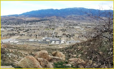
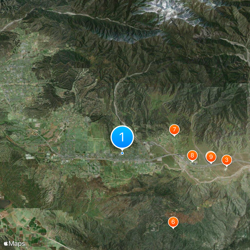
Banning is a city in Riverside County situated across the San Gorgonio Pass, serving as a natural gateway between two major California regions. Located at about 716 meters in elevation, it connects the Inland Empire to the Coachella Valley.

Established in 1913, the city was named after Phineas Banning, a transport businessman who played a key role in developing the Port of Los Angeles. This connection to California's infrastructure growth shaped the community from its beginning.

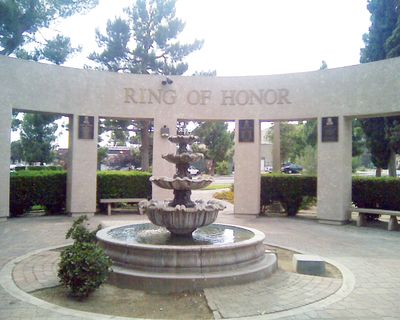
The Cahuilla people shaped this region long before the city existed, and their heritage remains visible in how the community celebrates local traditions and connects to the land. You can sense this history in the way residents honor these deep roots.

The city has several parks and recreation areas scattered throughout that offer outdoor activities and spaces for visitors to explore. Since the city spreads across a wider area, allow time to move between different sections if you plan to visit multiple spots.

From 1890 to 1974, the city was home to the St. Boniface Indian Industrial School, an educational institution focused on teaching Native American students vocational skills and trades. This school left a complex mark on both the community and the broader history of Native American education in the region.

The community of curious travelers

AroundUs brings together thousands of curated places, local tips, and hidden gems, enriched daily by 60,000 contributors worldwide.

Start exploring
Location
Inception
1913
Elevation above the sea
716 m
GPS coordinates
33.93167,-116.89750
Latest update
December 17, 2025 09:29
Around this place
Cabazon Dinosaurs
United States of America

Cabazon Dinosaurs

11.6 km
San Gorgonio Pass
United States of America

San Gorgonio Pass

13.6 km
Mr. Rex Dinosaur Adventure
United States of America

Mr. Rex Dinosaur Adventure

11.5 km
Gilman Ranch
United States of America

Gilman Ranch

1.1 km
United States of America

Ranger Peak

11.7 km
United States of America

Malki Museum

7.1 km
Morongo's Oasis Beach
United States of America

Morongo's Oasis Beach

9.2 km
United States of America

Dinny

11.6 km
United States of America

Statue, Work of art

11.5 km
United States of America

Morongo Golf Club at Tukwet Canyon

13 km
United States of America

Oak Valley Golf Club

9.8 km
United States of America

Gilman Ranch

525 m
United States of America

Sun Lakes Country Club Championship Golf Course

4.1 km
United States of America

Oak Tree Mountain Slide

14.4 km
United States of America

Sun Lakes Country Club Executive Golf Course

3.7 km
United States of America

Mr. Rex

11.6 km
United States of America

Momyer Creek Trailhead

17.4 km
United States of America

Statue, Work of art

11.5 km
United States of America

Sun Lakes Country Club and Golf Course

4.1 km
United States of America

Statue, Work of art

11.5 km
United States of America

Statue, Work of art

11.5 km
United States of America

Statue, Work of art

11.5 km
United States of America

Work of art, statue

11.5 km
United States of America

Statue, Work of art

11.5 km
United States of America

Statue, Work of art

11.5 km
United States of America

Scenic viewpoint

12.7 km
United States of America

Big Falls

17.2 km
United States of America

Silverwood Falls

17.6 km
Show the full map
Reviews
Share your experience

No review yet

Discussions
Start a discussion...

No discussion yet

« Banning - Administrative center in Riverside County, California, United States » is provided by Around Us (aroundus.com). Images and texts are derived from Wikimedia project under a Creative Commons license. You are allowed to copy, distribute, and modify copies of this page, under the conditions set by the license, as long as this note is clearly visible.

Discover hidden gems everywhere you go!

From secret cafés to breathtaking viewpoints, skip the crowded tourist spots and find places that match your style. Our app makes it easy with voice search, smart filtering, route optimization, and insider tips from travelers worldwide. Download now for the complete mobile experience.

Around Us App Screenshot

A unique approach to discovering new places

Le Figaro

All the places worth exploring

France Info

A tailor-made excursion in just a few clicks

20 Minutes

Around Us
Travel Guide & Maps
Download

Send to your phone

QR Code
1

Open the camera app on your mobile.

2

Point at the QR code with your camera. A notification will appear.

3

Tap the notification to open the link.