San Gorgonio Pass

Log in to your account

AroundUs is a community-driven map of interesting places, built by curious explorers like you. It grows with every review, story, and photo you share.
Connect to save your favorite spots, contribute locations, and create personalized routes.
Continue with Google
Continue with Apple
Continue with X
Continue with Facebook
Continue with email
By continuing, you accept our Terms and Conditions and our Privacy Policy
Create an account
Add to collection
Map
Suggest a change
Share

San Gorgonio Pass, Rail mountain pass in California, United States.

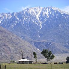
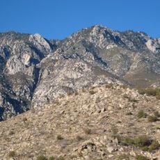
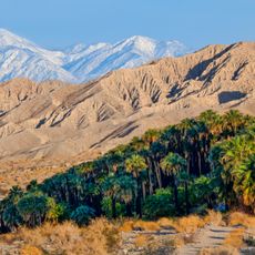
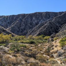
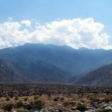
San Gorgonio Pass is a mountain corridor in California running at about 485 meters elevation, connecting the Los Angeles region with the Coachella Valley. The route accommodates both Interstate 10 and railroad tracks that carry cargo and passengers.

The rail line was completed in 1883, establishing the second transcontinental railroad route in the United States. This created a vital connection between the East Coast and southern California.

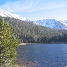
The pass marks a natural boundary between two distinct climate zones and has shaped settlement patterns on both sides. Visitors notice the transition from green hills to drier terrain as they cross through.

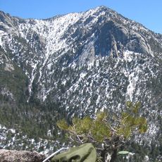
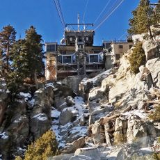
Visitors can easily drive through on Interstate 10 or explore views from several overlooks along the corridor. Wind conditions are common in this area and can change quickly, so plan accordingly.

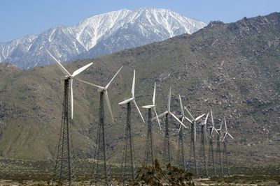
The pass is one of California's windiest locations because surrounding mountain ranges create a natural wind tunnel. This phenomenon has led to wind turbine development in the area.

Location: California

Elevation above the sea: 485 m

GPS coordinates: 33.91670,-116.75100

Latest update: December 7, 2025 10:04

Photos
Around this place
Cabazon Dinosaurs
United States of America

Cabazon Dinosaurs

2.1 km
Palm Springs Aerial Tramway
United States of America

Palm Springs Aerial Tramway

15.4 km
Kaufmann Desert House
United States of America

Kaufmann Desert House

20.1 km
San Jacinto Peak
United States of America

San Jacinto Peak

13.2 km
San Gorgonio Mountain
United States of America

San Gorgonio Mountain

21.4 km
Forever Marilyn
United States of America

Forever Marilyn

21.4 km
Cactus to Clouds Trail
United States of America

Cactus to Clouds Trail

21.1 km
Sand to Snow National Monument
United States of America

Sand to Snow National Monument

16.2 km
Tahquitz Peak
United States of America

Tahquitz Peak

19.2 km
Mount San Jacinto State Park
United States of America

Mount San Jacinto State Park

15.2 km
San Gorgonio Wilderness
United States of America

San Gorgonio Wilderness

16.6 km
Palm Springs Art Museum
United States of America

Palm Springs Art Museum

21.2 km
Tramway Gas Station
United States of America

Tramway Gas Station

19 km
Tahquitz Falls
United States of America

Tahquitz Falls

21.5 km
Big Morongo Canyon Preserve
United States of America

Big Morongo Canyon Preserve

20.1 km
Palm Springs Aerial Tramway Mountain Station
United States of America

Palm Springs Aerial Tramway Mountain Station

15.5 km
Agua Caliente Cultural Museum
United States of America

Agua Caliente Cultural Museum

21.6 km
Plaza Theatre
United States of America

Plaza Theatre

21.6 km
Chino Canyon
United States of America

Chino Canyon

17.6 km
Cornelia White House
United States of America

Cornelia White House

21.7 km
Gilman Ranch
United States of America

Gilman Ranch

14.4 km
James Reserve
United States of America

James Reserve

12.3 km
Coachella Valley Savings No. 2
United States of America

Coachella Valley Savings No. 2

21.9 km
Dr. Franz Alexander House
United States of America

Dr. Franz Alexander House

19.4 km
Long Valley Ranger Station
United States of America

Long Valley Ranger Station

15.3 km
Peak Shelter Cabin
United States of America

Peak Shelter Cabin

13.2 km
Mount San Jacinto State Park Historic District
United States of America

Mount San Jacinto State Park Historic District

13.2 km
Never Forget
United States of America

Never Forget

19 km
Show the full map
Reviews

Visited this place? Tap the stars to rate it and share your experience / photos with the community! Try now! You can cancel it anytime.

« San Gorgonio Pass - Rail mountain pass in California, United States » is provided by Around Us (aroundus.com). Images and texts are derived from Wikimedia project under a Creative Commons license. You are allowed to copy, distribute, and modify copies of this page, under the conditions set by the license, as long as this note is clearly visible.

Discover hidden gems everywhere you go!

From secret cafés to breathtaking viewpoints, skip the crowded tourist spots and find places that match your style. Our app makes it easy with voice search, smart filtering, route optimization, and insider tips from travelers worldwide. Download now for the complete mobile experience.

Around Us App Screenshot

A unique approach to discovering new places

Le Figaro

All the places worth exploring

France Info

A tailor-made excursion in just a few clicks

20 Minutes