Enable Location

We need your location to show you interesting places around you

Discover nearby places

Find interesting locations and hidden gems around you

Precise directions

Get accurate directions and distances to places

Your location is never shared with other users. It's only used when you tap the location button.

Mount San Jacinto State Park

Log in to your account

Start exploring — it's free

Trusted by 62,622 travelers worldwide

Continue with Google
Continue with Apple
or

We will send you a code to connect

By continuing, you accept our Terms and Conditions and our Privacy Policy

Check your inbox

We've sent a pincode in your inbox. Please enter the code below.

Mount San Jacinto State Park

Mount San Jacinto State Park, State park in Riverside County, California.

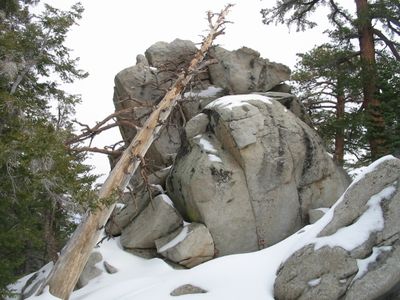
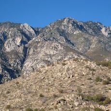
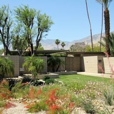
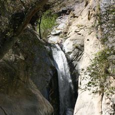
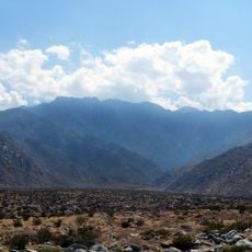
Mount San Jacinto State Park is a protected area in the San Jacinto Mountains featuring rocky peaks, coniferous forests, and open meadows. The landscape changes as you move through different elevations, creating a variety of natural settings to explore.

The park was established in 1933 as a protected area for one of Southern California's tallest peaks. This creation reflected a growing effort to safeguard natural lands across the state during that era.

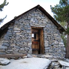
The mountain holds deep meaning for the Tongva people, who lived in these highlands long before settlers arrived and left behind evidence of their presence. Walking through the park, you encounter places and names that reflect this long indigenous heritage.

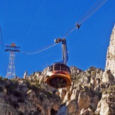
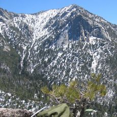
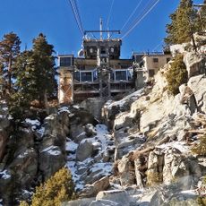
The Palm Springs Aerial Tramway connects the desert floor directly to the upper mountain, saving you from a long climb on foot. Wear layers, since it gets much colder at the higher elevation than down in the valley.

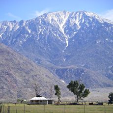
The park displays a rare sight over a short distance: desert plants at the base transition to mountain vegetation higher up as elevation increases rapidly. This quick shift makes you experience what would normally take traveling hundreds of miles north.

The community of curious travelers

AroundUs brings together thousands of curated places, local tips, and hidden gems, enriched daily by 60,000 contributors worldwide.

Start exploring
Location
GPS coordinates
33.80000,-116.66667
Latest update
December 8, 2025 19:52
Around this place
Cabazon Dinosaurs
United States of America

Cabazon Dinosaurs

16.6 km
Palm Springs Aerial Tramway
United States of America

Palm Springs Aerial Tramway

6.4 km
Kaufmann Desert House
United States of America

Kaufmann Desert House

11.7 km
San Jacinto Peak
United States of America

San Jacinto Peak

2 km
Cactus to Clouds Trail
United States of America

Cactus to Clouds Trail

11.1 km
San Gorgonio Pass
United States of America

San Gorgonio Pass

15.2 km
Lake Hemet
United States of America

Lake Hemet

15.1 km
Palm Springs Air Museum
United States of America

Palm Springs Air Museum

15.4 km
Tahquitz Peak
United States of America

Tahquitz Peak

5.1 km
Mr. Rex Dinosaur Adventure
United States of America

Mr. Rex Dinosaur Adventure

16.7 km
Twin Palms
United States of America

Twin Palms

12.7 km
Palm Springs Art Museum
United States of America

Palm Springs Art Museum

11.1 km
Tahquitz Falls
United States of America

Tahquitz Falls

9.7 km
Moorten Botanical Garden and Cactarium
United States of America

Moorten Botanical Garden and Cactarium

11.2 km
Palm Springs Aerial Tramway Mountain Station
United States of America

Palm Springs Aerial Tramway Mountain Station

2.9 km
Agua Caliente Cultural Museum
United States of America

Agua Caliente Cultural Museum

11.3 km
Plaza Theatre
United States of America

Plaza Theatre

11.4 km
Chino Canyon
United States of America

Chino Canyon

11.4 km
Cornelia White House
United States of America

Cornelia White House

11.3 km
Yokoji Zen Mountain Center
United States of America

Yokoji Zen Mountain Center

13.9 km
James Reserve
United States of America

James Reserve

10.3 km
Koerner House
United States of America

Koerner House

12.4 km
Coachella Valley Savings No. 2
United States of America

Coachella Valley Savings No. 2

11.2 km
Dr. Franz Alexander House
United States of America

Dr. Franz Alexander House

11.1 km
Palm Springs Unified School District Educational Administrative Center
United States of America

Palm Springs Unified School District Educational Administrative Center

13.9 km
Long Valley Ranger Station
United States of America

Long Valley Ranger Station

2.7 km
Peak Shelter Cabin
United States of America

Peak Shelter Cabin

1.9 km
Mount San Jacinto State Park Historic District
United States of America

Mount San Jacinto State Park Historic District

1.9 km
Show the full map
« Mount San Jacinto State Park - State park in Riverside County, California » is provided by Around Us (aroundus.com). Images and texts are derived from Wikimedia project under a Creative Commons license. You are allowed to copy, distribute, and modify copies of this page, under the conditions set by the license, as long as this note is clearly visible.

Discover hidden gems everywhere you go!

From secret cafés to breathtaking viewpoints, skip the crowded tourist spots and find places that match your style. Our app makes it easy with voice search, smart filtering, route optimization, and insider tips from travelers worldwide. Download now for the complete mobile experience.

Around Us App Screenshot

A unique approach to discovering new places

Le Figaro

All the places worth exploring

France Info

A tailor-made excursion in just a few clicks

20 Minutes

Around Us
Travel Guide & Maps
Download

Send to your phone

QR Code
1

Open the camera app on your mobile.

2

Point at the QR code with your camera. A notification will appear.

3

Tap the notification to open the link.