Enable Location

We need your location to show you interesting places around you

Discover nearby places

Find interesting locations and hidden gems around you

Precise directions

Get accurate directions and distances to places

Your location is never shared with other users. It's only used when you tap the location button.

San Jacinto Peak

Log in to your account

Start exploring — it's free

Trusted by 63,014 travelers worldwide

Continue with Google
Continue with Apple
or

We will send you a code to connect

By continuing, you accept our Terms and Conditions and our Privacy Policy

Check your inbox

We've sent a pincode in your inbox. Please enter the code below.

San Jacinto Peak
Discussion Reviews 2 Photos
61.1k Popularity

San Jacinto Peak, Mountain summit in Riverside County, United States.

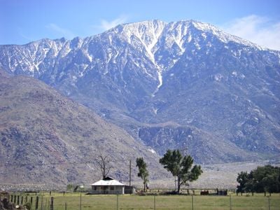
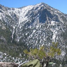
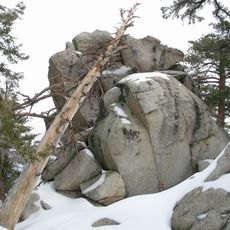
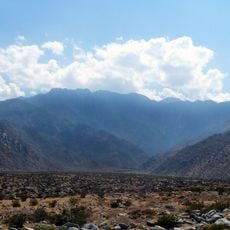
San Jacinto Peak sits in California's desert region and reaches an elevation of 10,834 feet (3,302 meters) above sea level. Its slopes show different climate zones from dry valley floors to forested and alpine areas near the summit.

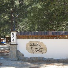
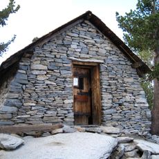
In September 1874, an explorer named F. from Riverside became the first documented climber to reach this summit. The region previously served the Cahuilla for centuries as sacred territory and hunting grounds.

The Cahuilla called this mountain I a kitch, meaning smooth cliffs, and view it as the home of their spiritual figure Dakush. This connection to indigenous tradition remains part of the regional identity to this day.

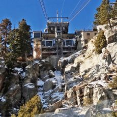
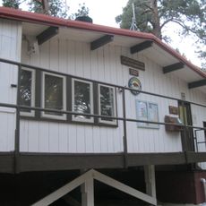
The tram in Palm Springs brings visitors to an upper starting point where several trails begin. Depending on the chosen route, the ascent takes between five and six hours, and altitude adjustment is recommended.

The north face rises over 10,000 feet (3,000 meters) within just 7 miles (11 kilometers) of horizontal distance, forming one of the steepest landforms in North America. This extreme elevation change over a short distance makes the region geologically remarkable.

The community of curious travelers

AroundUs brings together thousands of curated places, local tips, and hidden gems, enriched daily by 60,000 contributors worldwide.

Start exploring
Location
Elevation above the sea
3,302 m
GPS coordinates
33.81446,-116.67918
Latest update
December 13, 2025 19:07
Around this place
Cabazon Dinosaurs
United States of America

Cabazon Dinosaurs

14.6 km
Palm Springs Aerial Tramway
United States of America

Palm Springs Aerial Tramway

6.5 km
Kaufmann Desert House
United States of America

Kaufmann Desert House

12.2 km
Cactus to Clouds Trail
United States of America

Cactus to Clouds Trail

11.9 km
San Gorgonio Pass
United States of America

San Gorgonio Pass

13.2 km
Palm Springs Air Museum
United States of America

Palm Springs Air Museum

16.3 km
Tahquitz Peak
United States of America

Tahquitz Peak

6.6 km
Mount San Jacinto State Park
United States of America

Mount San Jacinto State Park

2 km
Mr. Rex Dinosaur Adventure
United States of America

Mr. Rex Dinosaur Adventure

14.7 km
Twin Palms
United States of America

Twin Palms

13.5 km
Palm Springs Art Museum
United States of America

Palm Springs Art Museum

12 km
Tahquitz Falls
United States of America

Tahquitz Falls

10.9 km
Moorten Botanical Garden and Cactarium
United States of America

Moorten Botanical Garden and Cactarium

12.4 km
Palm Springs Aerial Tramway Mountain Station
United States of America

Palm Springs Aerial Tramway Mountain Station

3.7 km
Agua Caliente Cultural Museum
United States of America

Agua Caliente Cultural Museum

12.2 km
Plaza Theatre
United States of America

Plaza Theatre

12.3 km
Chino Canyon
United States of America

Chino Canyon

11.4 km
Cornelia White House
United States of America

Cornelia White House

12.2 km
Yokoji Zen Mountain Center
United States of America

Yokoji Zen Mountain Center

15.4 km
James Reserve
United States of America

James Reserve

9.1 km
Koerner House
United States of America

Koerner House

13.6 km
Coachella Valley Savings No. 2
United States of America

Coachella Valley Savings No. 2

12.2 km
Dr. Franz Alexander House
United States of America

Dr. Franz Alexander House

11.6 km
Palm Springs Unified School District Educational Administrative Center
United States of America

Palm Springs Unified School District Educational Administrative Center

14.9 km
Long Valley Ranger Station
United States of America

Long Valley Ranger Station

3.4 km
Peak Shelter Cabin
United States of America

Peak Shelter Cabin

80 m
Mount San Jacinto State Park Historic District
United States of America

Mount San Jacinto State Park Historic District

80 m
Never Forget
United States of America

Never Forget

12.2 km
Show the full map
Reviews
Share your experience

No review yet

Discussions
Start a discussion...

No discussion yet

« San Jacinto Peak - Mountain summit in Riverside County, United States » is provided by Around Us (aroundus.com). Images and texts are derived from Wikimedia project under a Creative Commons license. You are allowed to copy, distribute, and modify copies of this page, under the conditions set by the license, as long as this note is clearly visible.

Discover hidden gems everywhere you go!

From secret cafés to breathtaking viewpoints, skip the crowded tourist spots and find places that match your style. Our app makes it easy with voice search, smart filtering, route optimization, and insider tips from travelers worldwide. Download now for the complete mobile experience.

Around Us App Screenshot

A unique approach to discovering new places

Le Figaro

All the places worth exploring

France Info

A tailor-made excursion in just a few clicks

20 Minutes

Around Us
Travel Guide & Maps
Download

Send to your phone

QR Code
1

Open the camera app on your mobile.

2

Point at the QR code with your camera. A notification will appear.

3

Tap the notification to open the link.