Palm Springs Aerial Tramway, Rotating aerial tramway in Palm Springs, California.
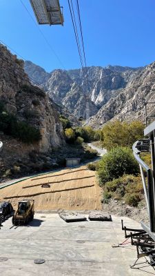
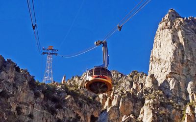
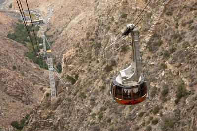
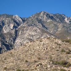
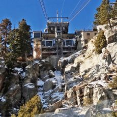
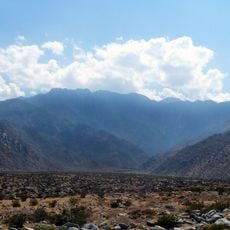
Palm Springs Aerial Tramway is a cable car in Chino Canyon in Palm Springs, California, that takes visitors from the desert floor to an elevation of 8516 feet (2596 meters). The ride passes over a steep granite wall and ends at a mountain station from which hiking paths branch into Mount San Jacinto State Park.
Francis Crocker proposed the tramway in 1935, but construction did not begin until 1961 and took two years. Helicopters placed four of the five towers on the rock faces because the terrain was too steep.
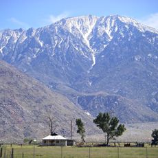
Riders travel from desert floor to alpine zone and experience a shift from cactus to pine forest in just minutes. Hikers at the top often encounter mule deer and can find snow in winter while temperatures below reach over 100 degrees.
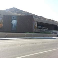
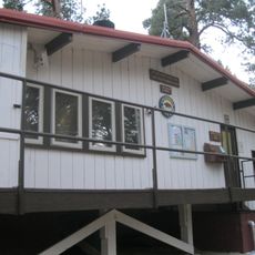
The valley station sits at the end of Tramway Road, with ample parking for visitors. Once at the top, bring warm clothing because the temperature is often 15 to 20 degrees cooler than in the valley.
The cabins rotate twice completely around their axis during the ride, so all passengers can enjoy the view of the canyon and the mountain ranges. Some visitors only notice upon exiting that the floor has turned.
Location: Palm Springs
Address: Palm Springs Aerial Tramway, 1 Tramway Rd, Palm Springs, CA 92262, USA
Website: https://pstramway.com
GPS coordinates: 33.83719,-116.61415
Latest update: December 12, 2025 18:05
California offers families many places where children learn through play and exploration. From major theme parks to museums and nature centers, there are opportunities for hands-on experiences throughout the state. Children can perform scientific experiments, watch animals up close, enjoy rides, and...
San Jacinto Peak
6.5 km
Cactus to Clouds Trail
6 km
Mount San Jacinto State Park
6.4 km
Palm Springs Art Museum
6.1 km
Tahquitz Falls
6.1 km
Palm Springs Aerial Tramway Mountain Station
3.5 km
Chino Canyon
5 kmEdris House
5 km
Dr. Franz Alexander House
5.1 kmFrey House II
5.8 km
Long Valley Ranger Station
3.8 km
Peak Shelter Cabin
6.5 km
Mount San Jacinto State Park Historic District
6.5 kmTramway aérien
11 mNotch 4
3.8 kmAnnenberg Theater
6.1 kmDesert View
4.7 kmCaramba Overlook
6.3 kmNotch 2
3.6 kmNotch 3
3.6 kmO'Donnell Golf Club
5.9 kmNotch 1
3.5 kmNotch 5
4 kmScenic viewpoint
3.5 kmScenic viewpoint
5.9 kmTahquitz Falls
6.1 kmWaterfall
6.2 kmDry Falls
4 kmVisited this place? Tap the stars to rate it and share your experience / photos with the community! Try now! You can cancel it anytime.
Discover hidden gems everywhere you go!
From secret cafés to breathtaking viewpoints, skip the crowded tourist spots and find places that match your style. Our app makes it easy with voice search, smart filtering, route optimization, and insider tips from travelers worldwide. Download now for the complete mobile experience.
A unique approach to discovering new places❞
— Le Figaro
All the places worth exploring❞
— France Info
A tailor-made excursion in just a few clicks❞
— 20 Minutes