Enable Location

We need your location to show you interesting places around you

Discover nearby places

Find interesting locations and hidden gems around you

Precise directions

Get accurate directions and distances to places

Your location is never shared with other users. It's only used when you tap the location button.

Log in to your account

Start exploring — it's free

Trusted by travelers worldwide

Continue with Google
Continue with Apple
or

We will send you a code to connect

By continuing, you accept our Terms and Conditions and our Privacy Policy

Check your inbox

We've sent a pincode in your inbox. Please enter the code below.

Doubtful Canyon

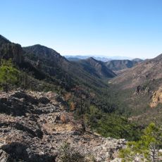
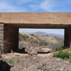
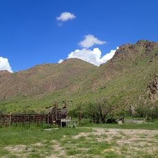
Doubtful Canyon, Canyon in Cochise County, Arizona, United States

Description

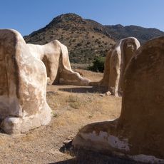
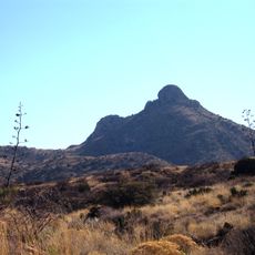
Doubtful Canyon is a gorge that stretches through the Peloncillo Mountains near the Arizona-New Mexico border, carved by a creek that flows seasonally. The canyon walls reveal multiple layers of rock and diverse geological features shaped over millions of years.

History

The canyon got its name during the Apache Wars in the 1800s when it became notorious as a place where Apache fighters would ambush travelers and soldiers. The difficult terrain made it a strategic location for these confrontations.

Culture

Apache groups lived in and moved through this region for centuries, leaving behind archaeological sites that show their deep connection to the land. Walking through the canyon, you can sense the historical presence of these communities.

Practical

The canyon is remote with little to no cell service, so bring all supplies and gear you may need before entering the area. Weather here can shift quickly, especially during summer monsoon season when flash floods become possible.

Did you know?

A small tributary called Little Doubtful Canyon branches off and joins the main canyon east of where the state line crosses the area. This smaller offshoot displays its own interesting rock patterns and water-carved passages.

Location
GPS coordinates
32.35140,-109.08700
Latest update
December 9, 2025 12:26

AroundUs brings together thousands of curated places, local tips, and hidden gems, enriched daily by 60,000 contributors worldwide. Discover all places nearby (Arizona).

Around this place
Fort Bowie
United States of America

Fort Bowie

40 km
Roper Lake State Park
United States of America

Roper Lake State Park

73.4 km
Chiricahua Peak
United States of America

Chiricahua Peak

59.5 km
Shakespeare
United States of America

Shakespeare

32.9 km
Faraway Ranch Historic District
United States of America

Faraway Ranch Historic District

46.5 km
Gila Box Riparian National Conservation Area
United States of America

Gila Box Riparian National Conservation Area

73.6 km
Rex Allen Arizona Cowboy Museum and Willcox Cowboy Hall of Fame
United States of America

Rex Allen Arizona Cowboy Museum and Willcox Cowboy Hall of Fame

70.9 km
United States of America

Bonita Canyon

45.8 km
Rucker Canyon
United States of America

Rucker Canyon

74.1 km
Chiricahua National Monument Historic Designed Landscape
United States of America

Chiricahua National Monument Historic Designed Landscape

43.7 km
Portal Ranger Station
United States of America

Portal Ranger Station

50.9 km
Benjamin F. Billingsley House
United States of America

Benjamin F. Billingsley House

41.2 km
Gila River Bridge
United States of America

Gila River Bridge

71.4 km
Hidalgo County Courthouse
United States of America

Hidalgo County Courthouse

35.7 km
Lordsburg-Hidalgo County Library
United States of America

Lordsburg-Hidalgo County Library

35.7 km
Black Gap Bridge
United States of America

Black Gap Bridge

69.7 km
Old Lordsburg High School
United States of America

Old Lordsburg High School

35.3 km
Johnson-Tillotson House
United States of America

Johnson-Tillotson House

71.1 km
John Gung'l House
United States of America

John Gung'l House

71.4 km
Benjamin E. Briscoe House
United States of America

Benjamin E. Briscoe House

71.5 km
Fort Bowie National Historic Site
United States of America

Fort Bowie National Historic Site

41 km
Bowie School District No. 14
United States of America

Bowie School District No. 14

38 km
Chiricahua Desert Museum
United States of America

Chiricahua Desert Museum

53.8 km
Silver Peak Lookout Complex
United States of America

Silver Peak Lookout Complex

50.7 km
Monte Vista Lookout Cabin
United States of America

Monte Vista Lookout Cabin

62.4 km
Fort Bowie Ranger Station & Visitor Center
United States of America

Fort Bowie Ranger Station & Visitor Center

40.1 km
Sugarloaf Mountain Lookout
United States of America

Sugarloaf Mountain Lookout

43.7 km
Horseshoe Canyon
United States of America

Horseshoe Canyon

64.3 km
Show the full map
« Doubtful Canyon - Canyon in Cochise County, Arizona, United States » is provided by Around Us (aroundus.com). Images and texts are derived from Wikimedia project under a Creative Commons license. You are allowed to copy, distribute, and modify copies of this page, under the conditions set by the license, as long as this note is clearly visible.

Discover hidden gems everywhere you go!

From secret cafés to breathtaking viewpoints, skip the crowded tourist spots and find places that match your style. Our app makes it easy with voice search, smart filtering, route optimization, and insider tips from travelers worldwide. Download now for the complete mobile experience.

Around Us App Screenshot

A unique approach to discovering new places

Le Figaro

All the places worth exploring

France Info

A tailor-made excursion in just a few clicks

20 Minutes

Around Us
Travel Guide & Maps
Download

Send to your phone

QR Code
1

Open the camera app on your mobile.

2

Point at the QR code with your camera. A notification will appear.

3

Tap the notification to open the link.