Chest opened
+${chestReward.xp} XP
Explorer
NOUVEAU ×${chestReward.collectible.quantity}
tapez pour fermer
Chest locked

Open chests in the app

Around Us is built for your phone — chests unlock when you walk, explore and capture nearby places.

Enable Location

We need your location to show you interesting places around you

Discover nearby places

Find interesting locations and hidden gems around you

Precise directions

Get accurate directions and distances to places

Your location is never shared with other users. It's only used when you tap the location button.

Log in to your account

Start exploring — it's free

Trusted by 72,878 travelers worldwide

Continue with Google
Continue with Apple
or

We will send you a code to connect

By continuing, you accept our Terms and Conditions and our Privacy Policy

Check your inbox

We've sent a pincode in your inbox. Please enter the code below.

McRae Formation
Discussion Reviews Photo
1.2k Popularity

McRae Formation, Geological formation in Sierra County, New Mexico.

The McRae Formation is a geological feature in Sierra County featuring stacked layers of mudstone, shale, and conglomerate that exceed 1 kilometer in thickness. These deposits record shifting environmental conditions and sediment sources from the Late Cretaceous period.

The formation developed during the Late Cretaceous period in the Maastrichtian age, with fossil discoveries beginning in 1905. It represents a time when marine and coastal environments dominated the region with varied animal populations.

Scientists and researchers examine the formation's layers to understand the environmental changes and animal life of New Mexico during prehistoric times.

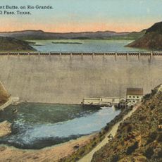
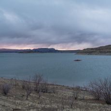
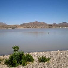
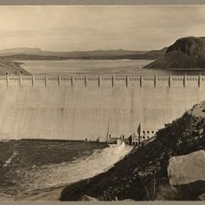
The site sits near Elephant Butte Reservoir, positioned between the Fra Cristobal and Caballo Mountains in south-central New Mexico. Plan visits for cooler months since the region experiences hot desert conditions most of the year.

The Hall Lake Member contains fossils of Tyrannosaurus rex and a previously unknown ceratopsian genus related to Torosaurus. This makes it one of the few places where top predators and large herbivores from the end of the Cretaceous have been found together.

The community of curious travelers

AroundUs brings together thousands of curated places, local tips, and hidden gems, enriched daily by 60,000 contributors worldwide.

Start exploring
Location
GPS coordinates
33.19700,-107.16700
Latest update
March 12, 2026 20:28
Around this place
United States of America

Elephant Butte Reservoir

5.3 km
Elephant Butte Dam
United States of America

Elephant Butte Dam

5.3 km
Elephant Butte Lake State Park
United States of America

Elephant Butte Lake State Park

5.9 km
United States of America

Truth or Consequences Hot Springs

10.7 km
Caballo Lake
United States of America

Caballo Lake

32.5 km
Caballo Lake State Park
United States of America

Caballo Lake State Park

25 km
United States of America

Fort McRae

2.3 km
Hot Springs Bathhouse and Commercial Historic District in Truth or Consequences
United States of America

Hot Springs Bathhouse and Commercial Historic District in Truth or Consequences

11.2 km
United States of America

Wetback Tank

32.7 km
Carrie Tingley Hospital Historic District
United States of America

Carrie Tingley Hospital Historic District

12.1 km
United States of America

Red Canyon

18.8 km
Elephant Butte Historic District
United States of America

Elephant Butte Historic District

5.7 km
United States of America

McRae Canyon

250 m
US Post Office-Truth or Consequences Main
United States of America

US Post Office-Truth or Consequences Main

11 km
United States of America

Lions Beach

3.8 km
United States of America

White Cliffs

15.5 km
United States of America

Red Cliff

9.3 km
United States of America

Spaceport America Visitor's Center

11.1 km
United States of America

Sierra del Rio Golf Course

6.2 km
United States of America

Alamosa Ranch House and Blacksmith Shop Historic Site

11.2 km
United States of America

Truth or Consequences Municipal Golf Course

10.1 km
United States of America

Long Point

4.9 km
United States of America

Palomas Gap

17.3 km
United States of America

Unknown Arch

19.3 km
United States of America

Work of art, sculpture

28.7 km
United States of America

Work of art, sculpture

6.6 km
United States of America

Scenic viewpoint

5.4 km
United States of America

Monument featuring aircraft, aircraft model

10.3 km
Show the full map
Reviews
Share your experience

No review yet

Discussions
Start a discussion...

No discussion yet

« McRae Formation - Geological formation in Sierra County, New Mexico » is provided by Around Us (aroundus.com). Images and texts are derived from Wikimedia project under a Creative Commons license. You are allowed to copy, distribute, and modify copies of this page, under the conditions set by the license, as long as this note is clearly visible.

Discover hidden gems everywhere you go!

From secret cafés to breathtaking viewpoints, skip the crowded tourist spots and find places that match your style. Our app makes it easy with voice search, smart filtering, route optimization, and insider tips from travelers worldwide. Download now for the complete mobile experience.

Around Us App Screenshot

A unique approach to discovering new places

Le Figaro

All the places worth exploring

France Info

A tailor-made excursion in just a few clicks

20 Minutes

Around Us
Travel Guide & Maps
Download

Send to your phone

QR Code
1

Open the camera app on your mobile.

2

Point at the QR code with your camera. A notification will appear.

3

Tap the notification to open the link.