Cobán, Municipality capital in Alta Verapaz, Guatemala
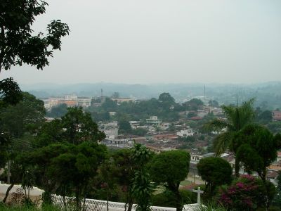
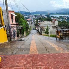
Cobán is the capital of a municipality located in the Chamá Mountains at 1,320 meters elevation, with the Cahabón River running through its territory. The town sits in a mountainous region with dense vegetation that defines its setting.
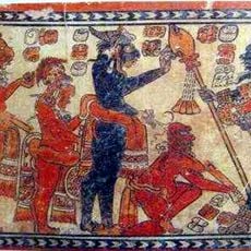
Spanish colonizers founded the town in 1543 near existing Maya settlements and named it after a local indigenous leader. This early establishment shaped the lasting connection between Spanish and Maya populations in the area.
The annual National Indigenous Festival brings together traditional dances, music, and ceremonies from Maya communities. The town serves as a center where these cultural practices remain visible throughout the year.
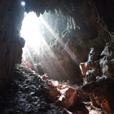
The town is best explored by taking time to adjust to the mountainous terrain and the cooler climate of the highlands. Visitors should wear sturdy shoes and bring weather-appropriate clothing, as rain is common in the area.
Las Victorias National Park contains a historic orchid nursery that has protected rare plant species from the surrounding forests since 1898. This long-standing collection offers visitors a chance to see orchids in their natural mountain setting.
Location: Alta Verapaz Department
Inception: August 4, 1543
Elevation above the sea: 1,320 m
Shares border with: Ixcán, Chisec, Santa Cruz Verapaz, Tactic
Website: https://municoban.com
GPS coordinates: 15.48333,-90.36667
Latest update: December 14, 2025 18:09
Parque Nacional Laguna Lachuá
58.6 km
Chamá
28.8 km
Rey Marcos Caves
11.1 km
Calvario
18.3 km
Cuevas de B'omb'il Pek
40.1 kmSitio Arqueológico Chahumpec I
68.1 kmSitio Arqueológico Camelá
61.8 km
Hun Nal Ye
22.2 kmSitio Arqueológico Chahumpec II
68.8 kmCueva Jul Iq'
40.5 kmBalneario San José La Colonia
3.6 kmComunidad Guacamaya Chinaja
61.2 kmComunidad Cerro Azul
46.4 kmParking Bombil Pek Caves
40.1 kmNational Park Laguna Lachua
61.8 kmIɴɢʀᴇsᴏ ɢʀᴜᴛᴀ ᴅᴇʟ ʀᴇʏ sᴀɴ ᴍᴀʀᴄᴏs
10.9 kmEntrada cueva de Candelaria
48.5 kmMirador al valle
38.7 kmCruce a Sayaxche
54.8 kmSachicha
12.5 kmEntrada ku nal ye
23 kmJjg
34.2 kmTuricentro Municipal de Talpetate
3 kmSalón de Usos Múltiples No. 2
71.6 kmTeatro Municipal
71.7 kmCampo de Feria
71.5 kmWaterfall
6.1 kmMonument featuring aircraft, aircraft model
67.6 kmVisited this place? Tap the stars to rate it and share your experience / photos with the community! Try now! You can cancel it anytime.
Discover hidden gems everywhere you go!
From secret cafés to breathtaking viewpoints, skip the crowded tourist spots and find places that match your style. Our app makes it easy with voice search, smart filtering, route optimization, and insider tips from travelers worldwide. Download now for the complete mobile experience.
A unique approach to discovering new places❞
— Le Figaro
All the places worth exploring❞
— France Info
A tailor-made excursion in just a few clicks❞
— 20 Minutes