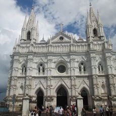
Santa Ana, Historical district and second largest city in El Salvador
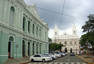
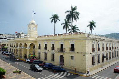
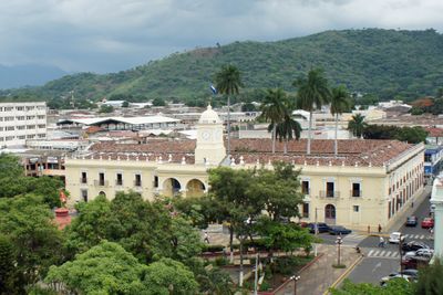
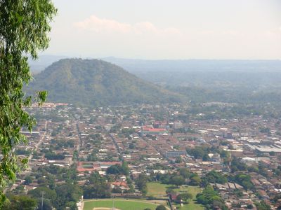
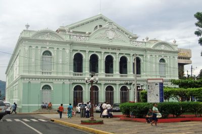
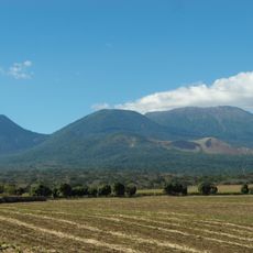
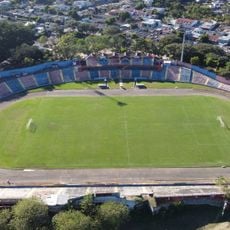
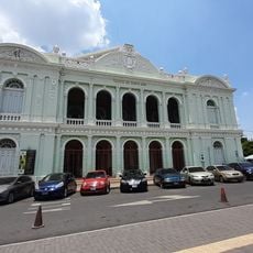
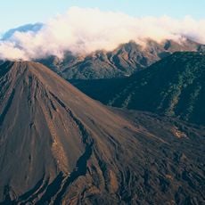
Santa Ana is a large city in El Salvador situated along the Inter-American Highway between mountain ranges and surrounded by coffee plantations. The city center contains historic buildings including a cathedral and theater that date back more than a century.
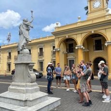
Spanish colonists founded this settlement in 1569 on the site of a previous Maya town called Sihuatehuacán. Bishop Bernardino Villalpando led the formal reorganization, establishing it as a religious and administrative center for the surrounding region.
The theater from the early 1900s shows how the city developed as a cultural hub for the region. The Cathedral with its neo-gothic details remains a central meeting place where religious and community gatherings still happen today.
The city can be reached by bus from surrounding areas, with regular services connecting different neighborhoods throughout the day. Visitors should allow time to explore the hilly streets, particularly in the center where the main attractions are located.
A coffee processing facility called El Molino operates here and handles raw coffee from local plantations for export worldwide. This facility ranks among the largest of its kind globally and significantly contributes to the region's economy.
Location: Central Santa Ana
Inception: July 26, 1569
Elevation above the sea: 665 m
Website: http://santaana.gob.sv/amsa
GPS coordinates: 13.99478,-89.55661
Latest update: December 12, 2025 18:20
El Salvador presents a collection of places where history, nature, and culture meet. The country is shaped by volcanic landscapes, clear lakes, and Pacific beaches that blend with archaeological sites from pre-Columbian times. Visitors can explore ancient Maya temples like Tazumal and Joya de Cerén,...
Cerro Verde
20.1 km
Izalco
21.7 km
Santa Ana Volcano
17.8 km
Santa Ana Cathedral, El Salvador
125 m
Los Volcanes National Park
20 km
National Theatre of Santa Ana
75 m
Estadio Óscar Quiteño
2.4 km
Parque Libertad
2 m
Teatro Nacional de Santa Ana
76 m
Cerro Singüil
10.4 km
Los Volcanes Sector Los Andes National Park
15.6 kmVolcano Santa Ana - park entrance
19.1 kmReal trail goes here to entrance
18.7 kmIntersection free trail - park trail - don’t go at 10:20-10:30
19 kmStation Sysmique
18.7 kmSoapapa Natural Pool
1.3 kmRuta Volcan Izalco
20.5 kmFlower garden with covered walkways
20.1 kmStairway covered by a carved hedge
20.1 kmPlaya Pública
13 kmFree entrance to Volcan Santa Ana
19.1 kmCasa del Expresidente Pedro José Escalón
224 mEscuela de Artes y Oficios José Mariano Méndez
910 mTermos del Río
23.2 kmGalicia
10 kmCrossing to: uphill - free entrance, downhill - road, left - parc entrance, right - another path
19.1 kmCruz del Tecana
2 kmScenic viewpoint
18.9 kmVisited this place? Tap the stars to rate it and share your experience / photos with the community! Try now! You can cancel it anytime.
Discover hidden gems everywhere you go!
From secret cafés to breathtaking viewpoints, skip the crowded tourist spots and find places that match your style. Our app makes it easy with voice search, smart filtering, route optimization, and insider tips from travelers worldwide. Download now for the complete mobile experience.
A unique approach to discovering new places❞
— Le Figaro
All the places worth exploring❞
— France Info
A tailor-made excursion in just a few clicks❞
— 20 Minutes