Pasto, Capital city in Nariño Department, Colombia
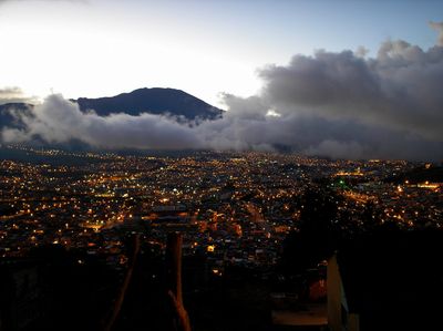
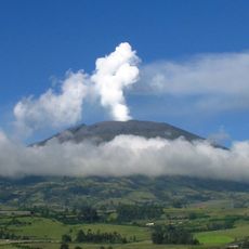
Pasto is the capital of Nariño Department in southern Colombia, located at 2,527 meters (8,290 feet) in the Atriz Valley below the active Galeras Volcano. The municipality spreads across several neighborhoods with a cathedral and colonial buildings surrounding a central plaza.
Sebastian de Belalcázar founded the settlement in 1539 on the territory of indigenous Quillacinga communities. The place later became an important religious center with monasteries and church schools during colonial times.
The January carnival transforms streets into stages for large painted floats and dancers wearing regional costumes. Families paint each other with white powder and black color during the multi-day celebrations.
The Pan-American Highway connects the municipality with Bogotá to the north and Ecuador to the south, while Antonio Nariño Airport offers domestic flights 35 kilometers (22 miles) away. The elevation requires slow movement on the first day for visitors arriving from lower regions.
Street vendors prepare helado de paila, ice cream made in copper bowls by hand while spinning the container on blocks of ice. This colonial-era technique creates a grainier texture than modern methods and is prepared with natural fruit flavors.
The community of curious travelers
AroundUs brings together thousands of curated places, local tips, and hidden gems, enriched daily by 60,000 contributors worldwide.