Enable Location

We need your location to show you interesting places around you

Discover nearby places

Find interesting locations and hidden gems around you

Precise directions

Get accurate directions and distances to places

Your location is never shared with other users. It's only used when you tap the location button.

Aburrá Valley

Log in to your account

Start exploring — it's free

Trusted by 62,514 travelers worldwide

Continue with Google
Continue with Apple
or

We will send you a code to connect

By continuing, you accept our Terms and Conditions and our Privacy Policy

Check your inbox

We've sent a pincode in your inbox. Please enter the code below.

Aburrá Valley

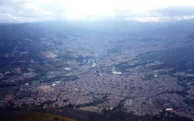
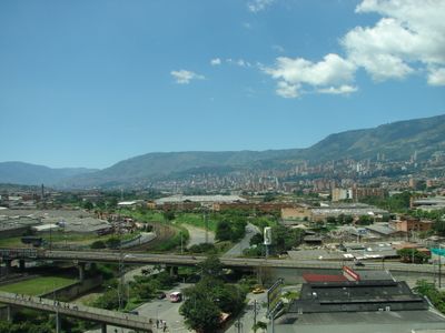
Aburrá Valley, Natural river basin in Antioquia Department, Colombia.

The Aburrá Valley is a region in Antioquia that extends through the Central Range and contains ten municipalities. The area spans different elevations, creating a landscape with varied climates and natural features.

The valley has been inhabited for thousands of years, with traces of continuous human activity reaching back into ancient times. Several indigenous groups shaped the region before Spanish conquest transformed its future.

The valley takes its name from the Aburrá people, who lived here long before Spanish arrival and developed farming and crafts. The region still carries traces of these roots in how communities live together and maintain their ways.

Visitors should expect the region to span multiple elevations with varying weather conditions as you move through different areas. It helps to prepare for changing climates if you plan to explore several parts of the valley.

The valley became Colombia's first officially recognized metropolitan area when it received this designation in 1980. This early recognition made it a model for managing multiple municipalities under a unified regional structure.

The community of curious travelers

AroundUs brings together thousands of curated places, local tips, and hidden gems, enriched daily by 60,000 contributors worldwide.

Start exploring
Location
Elevation above the sea
2,420 m
GPS coordinates
6.23194,-75.56806
Latest update
December 14, 2025 17:47
« Aburrá Valley - Natural river basin in Antioquia Department, Colombia » is provided by Around Us (aroundus.com). Images and texts are derived from Wikimedia project under a Creative Commons license. You are allowed to copy, distribute, and modify copies of this page, under the conditions set by the license, as long as this note is clearly visible.

Discover hidden gems everywhere you go!

From secret cafés to breathtaking viewpoints, skip the crowded tourist spots and find places that match your style. Our app makes it easy with voice search, smart filtering, route optimization, and insider tips from travelers worldwide. Download now for the complete mobile experience.

Around Us App Screenshot

A unique approach to discovering new places

Le Figaro

All the places worth exploring

France Info

A tailor-made excursion in just a few clicks

20 Minutes

Around Us
Travel Guide & Maps
Download

Send to your phone

QR Code
1

Open the camera app on your mobile.

2

Point at the QR code with your camera. A notification will appear.

3

Tap the notification to open the link.