Ometepe, Volcanic island in Lake Nicaragua, Nicaragua
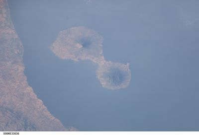
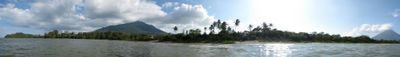
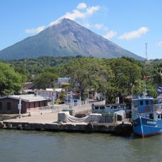
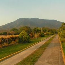
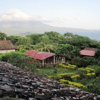
Ometepe is an island in Lake Nicaragua shaped by two volcanoes, Concepción and Maderas, which rise from the water and form an hourglass-like shape. The entire landmass extends across considerable distances and features varied terrain, from steep slopes to flatter areas.
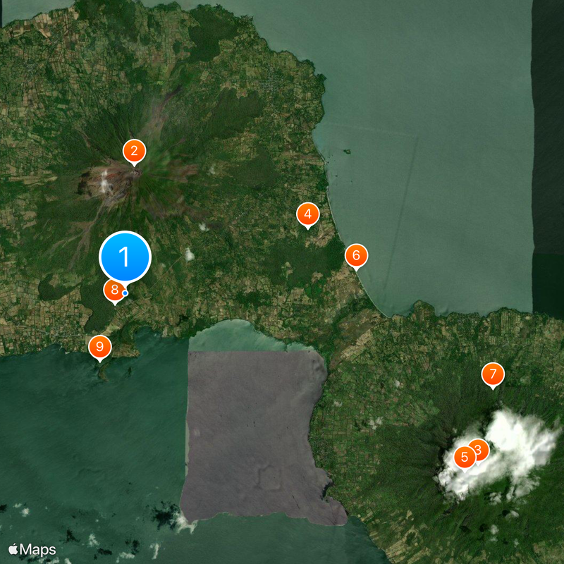
The island was first inhabited around 2000 BC and supported various indigenous groups who left behind rock carvings and stone figures. These archaeological remains, especially on the northern slopes of Maderas volcano, show the long human presence in this region.
The name Ometepe comes from Nahuatl words meaning two and mountain, reflecting the ancient Mesoamerican peoples who lived here and saw this place as sacred. Local residents continue to honor this heritage through their connection to the land and the stories passed down through generations.
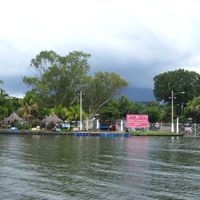
Regular ferry services connect San Jorge to settlements on the island, and a small airport offers additional travel options. The island is relatively easy to reach, so visitors have several ways to arrive.
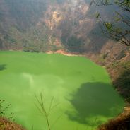
The island appears on a global list of about 100 geological heritage sites, selected for its volcanic formations and interactions with the lake. This scientific recognition makes it an important location for study, even though many visitors are unaware of this distinction.
Location: Rivas Department
Elevation above the sea: 1,610 m
Address: Ometepe, Nicaragua
GPS coordinates: 11.49839,-85.62554
Latest update: December 20, 2025 11:56
Nicaragua offers a diverse and lively nature. You will see still-smoking volcanoes, beaches stretching from the Pacific to the Caribbean, and tropical islands sitting on volcanic lakes. The country also has large natural reserves with thick forests and mangroves along the coasts. Everywhere, paths...
Concepción
4.5 km
Maderas
13.8 km
Ojo de Agua
6.8 km
Cascada de San Ramón
13.5 kmPlaya Santo Domingo
8.1 kmReserva Natural Volcán Maderas
13.4 kmPlace to see monkies
526 mLaguna Charco Verde
2.5 kmOjo de Agua de Zopilote
10.3 kmPetroglifos
10.2 kmMonkey Island
10.2 kmTrail
7.8 kmViewpoint
13.4 kmEnterence to Charco Verde
2.3 kmReserva Natural Volcán La Concepción
8.8 kmChico Largo Adventure
1.2 kmEl Perú
7.8 kmPetroglyphs
9.8 kmView point of Wind Farm
2.8 kmView Point A Nada
13.5 kmVivero
9.3 kmPetroglifos
13.4 kmParc
8.4 kmNatural swimming pool
12.3 kmPetroglifos
9.1 kmVolcán Maderas National Park
14.1 kmPlaya El Istián
7.1 kmScenic viewpoint
11.6 kmVisited this place? Tap the stars to rate it and share your experience / photos with the community! Try now! You can cancel it anytime.
Discover hidden gems everywhere you go!
From secret cafés to breathtaking viewpoints, skip the crowded tourist spots and find places that match your style. Our app makes it easy with voice search, smart filtering, route optimization, and insider tips from travelers worldwide. Download now for the complete mobile experience.
A unique approach to discovering new places❞
— Le Figaro
All the places worth exploring❞
— France Info
A tailor-made excursion in just a few clicks❞
— 20 Minutes