Chest opened
+${chestReward.xp} XP
Explorer
NOUVEAU ×${chestReward.collectible.quantity}
tapez pour fermer
Chest locked

Open chests in the app

Around Us is built for your phone — chests unlock when you walk, explore and capture nearby places.

Enable Location

We need your location to show you interesting places around you

Discover nearby places

Find interesting locations and hidden gems around you

Precise directions

Get accurate directions and distances to places

Your location is never shared with other users. It's only used when you tap the location button.

Log in to your account

Start exploring — it's free

Trusted by 72,891 travelers worldwide

Continue with Google
Continue with Apple
or

We will send you a code to connect

By continuing, you accept our Terms and Conditions and our Privacy Policy

Check your inbox

We've sent a pincode in your inbox. Please enter the code below.

Magdalena State
Discussion Reviews Photo
4.4k Popularity

Magdalena State, Former administrative territory in northern Colombia

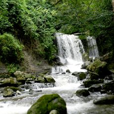
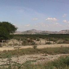
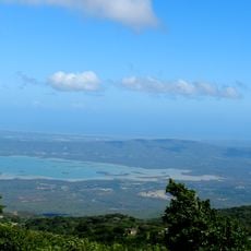
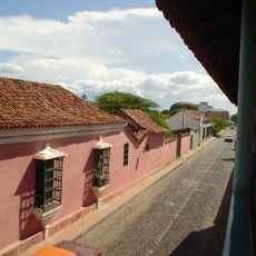
Magdalena State was a former administrative territory in northern Colombia that stretched from the Caribbean coast through the Andes to inland marshlands. It encompassed areas that today form Magdalena, Cesar, and La Guajira departments and contained several major river basins originating from the Sierra Nevada de Santa Marta.

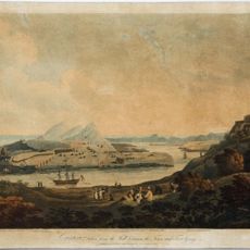
The territory was established on June 15, 1857, as the Federal State of Magdalena and remained a sovereign entity during Colombia's federal period. On September 7, 1886, it was transformed into the Department of Magdalena when the country restructured its government to a more centralized system.

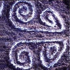
The region was home to indigenous communities whose traditions shaped local ways of life, and it developed a distinct Caribbean character through its coastal trade and farming practices. These cultural elements remain visible in the customs and knowledge of people living in the area today.

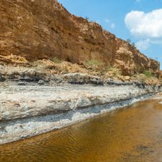
The territory contained four major river basins flowing from the Sierra Nevada de Santa Marta that supported farming and provided crucial water resources for local communities. The varied terrain, ranging from coastal areas to mountains, created different living conditions and economic activities across the region.

The state was one of the earliest independent federal entities in Colombia and maintained its own constitution and government structure during the country's federalist period. This autonomy made it a key player in the political conflicts and decisions that shaped Colombia during the 1800s.

The community of curious travelers

AroundUs brings together thousands of curated places, local tips, and hidden gems, enriched daily by 60,000 contributors worldwide.

Start exploring
GPS coordinates
11.25300,-70.21670
Latest update
March 5, 2026 18:17
Reviews
Share your experience

No review yet

Discussions
Start a discussion...

No discussion yet

« Magdalena State - Former administrative territory in northern Colombia » is provided by Around Us (aroundus.com). Images and texts are derived from Wikimedia project under a Creative Commons license. You are allowed to copy, distribute, and modify copies of this page, under the conditions set by the license, as long as this note is clearly visible.

Discover hidden gems everywhere you go!

From secret cafés to breathtaking viewpoints, skip the crowded tourist spots and find places that match your style. Our app makes it easy with voice search, smart filtering, route optimization, and insider tips from travelers worldwide. Download now for the complete mobile experience.

Around Us App Screenshot

A unique approach to discovering new places

Le Figaro

All the places worth exploring

France Info

A tailor-made excursion in just a few clicks

20 Minutes

Around Us
Travel Guide & Maps
Download

Send to your phone

QR Code
1

Open the camera app on your mobile.

2

Point at the QR code with your camera. A notification will appear.

3

Tap the notification to open the link.