Chest opened
+${chestReward.xp} XP
Explorer
NOUVEAU ×${chestReward.collectible.quantity}
tapez pour fermer
Chest locked

Open chests in the app

Around Us is built for your phone — chests unlock when you walk, explore and capture nearby places.

Enable Location

We need your location to show you interesting places around you

Discover nearby places

Find interesting locations and hidden gems around you

Precise directions

Get accurate directions and distances to places

Your location is never shared with other users. It's only used when you tap the location button.

Puruándiro

Log in to your account

Start exploring — it's free

Trusted by 72,920 travelers worldwide

Continue with Google
Continue with Apple
or

We will send you a code to connect

By continuing, you accept our Terms and Conditions and our Privacy Policy

Check your inbox

We've sent a pincode in your inbox. Please enter the code below.

Puruándiro
Discussion Reviews 1 Photos
12.5k Popularity

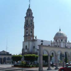
Puruándiro, Administrative center in northern Michoacán, Mexico

Puruándiro is the administrative center of northern Michoacán, positioned at roughly 1,900 meters elevation. The municipality features natural thermal springs and extensive green spaces scattered throughout the territory.

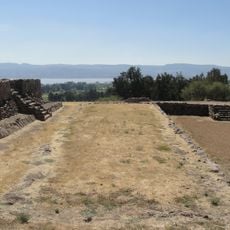
Juan de Villaseñor y Orozco founded this settlement in 1522, establishing Spanish colonial control in northern Michoacán. It later developed into a key administrative point for the surrounding region.

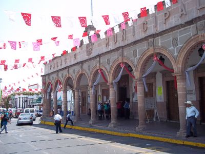
The central plaza displays statues honoring figures from Mexico's past, reflecting values that matter to the community. Walking through the gardens, you notice how these monuments shape the local gathering space.

The town is most comfortable to visit during warmer months when the natural hot springs feel most pleasant. The Los Arcos thermal facility operates year-round with mineral-rich waters available for soaking.

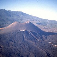
The name comes from the Purépecha language and refers to where water meets fire, alluding to the natural hot springs. This meaning reminds visitors that the land's geological features shaped the place's identity.

The community of curious travelers

AroundUs brings together thousands of curated places, local tips, and hidden gems, enriched daily by 60,000 contributors worldwide.

Start exploring
Elevation above the sea
1,898 m
GPS coordinates
20.08695,-101.51418
Latest update
December 7, 2025 20:44
Reviews
Share your experience

No review yet

Discussions
Start a discussion...

No discussion yet

« Puruándiro - Administrative center in northern Michoacán, Mexico » is provided by Around Us (aroundus.com). Images and texts are derived from Wikimedia project under a Creative Commons license. You are allowed to copy, distribute, and modify copies of this page, under the conditions set by the license, as long as this note is clearly visible.

Discover hidden gems everywhere you go!

From secret cafés to breathtaking viewpoints, skip the crowded tourist spots and find places that match your style. Our app makes it easy with voice search, smart filtering, route optimization, and insider tips from travelers worldwide. Download now for the complete mobile experience.

Around Us App Screenshot

A unique approach to discovering new places

Le Figaro

All the places worth exploring

France Info

A tailor-made excursion in just a few clicks

20 Minutes

Around Us
Travel Guide & Maps
Download

Send to your phone

QR Code
1

Open the camera app on your mobile.

2

Point at the QR code with your camera. A notification will appear.

3

Tap the notification to open the link.