Cuajimalpa

Log in to your account

AroundUs is a community-driven map of interesting places, built by curious explorers like you. It grows with every review, story, and photo you share.
Connect to save your favorite spots, contribute locations, and create personalized routes.
Continue with Google
Continue with Apple
Continue with X
Continue with Facebook
Continue with email
By continuing, you accept our Terms and Conditions and our Privacy Policy
Create an account
Add to collection
Map
Suggest a change
Share

Cuajimalpa, Administrative district in western Mexico City, Mexico

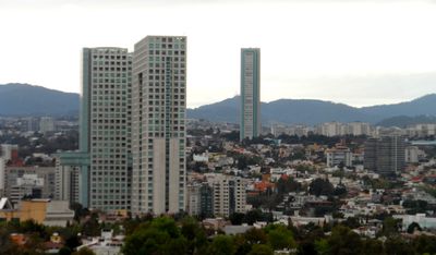
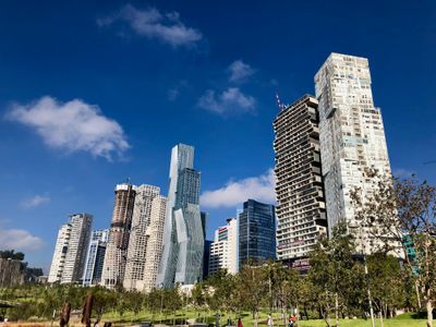
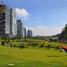
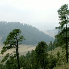
Cuajimalpa is an administrative district in western Mexico City situated within the Sierra de las Cruces mountains. The area features deep canyons and volcanic rock formations across its landscape.

The name comes from the Nahuatl word Cuauhximalpan, meaning place of sawmills, and was given the addition of Morelos in 1970 to honor the independence hero. This naming reflects both indigenous heritage and the nation's path to independence.

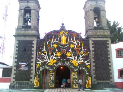
The Parish of San Pedro serves as a gathering place where the community comes together for religious observances and celebrations. The church reflects the importance of faith in the daily lives of residents here.

The district is mountainous with deep valleys, so visitors should wear sturdy shoes and dress for variable weather. Canyon paths can become slippery during rain, so checking conditions beforehand is advisable.

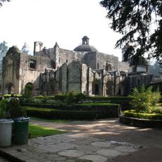
The area contains the Desierto de los Leones National Park, home to one of Mexico's oldest monasteries founded by Carmelite monks. This 17th-century religious building stands as a reminder of the nation's early missionary history.

Location: Mexico City

Inception: 1928

Elevation above the sea: 2,711 m

Website: http://cuajimalpa.cdmx.gob.mx

GPS coordinates: 19.37444,-99.28472

Latest update: December 14, 2025 18:15

Photos
Reviews

Visited this place? Tap the stars to rate it and share your experience / photos with the community! Try now! You can cancel it anytime.

« Cuajimalpa - Administrative district in western Mexico City, Mexico » is provided by Around Us (aroundus.com). Images and texts are derived from Wikimedia project under a Creative Commons license. You are allowed to copy, distribute, and modify copies of this page, under the conditions set by the license, as long as this note is clearly visible.

Discover hidden gems everywhere you go!

From secret cafés to breathtaking viewpoints, skip the crowded tourist spots and find places that match your style. Our app makes it easy with voice search, smart filtering, route optimization, and insider tips from travelers worldwide. Download now for the complete mobile experience.

Around Us App Screenshot

A unique approach to discovering new places

Le Figaro

All the places worth exploring

France Info

A tailor-made excursion in just a few clicks

20 Minutes