San Miguel de Allende, Colonial city in Guanajuato, Mexico
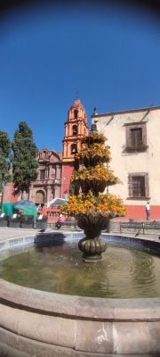
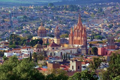
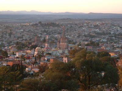
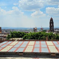
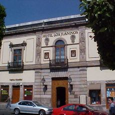
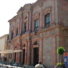
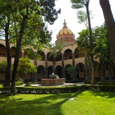
San Miguel de Allende is a city in Guanajuato, Mexico, part of a World Heritage Site and showing colonial features. The streets run in a grid around central plazas, with buildings made of red and orange stone, carved wooden doors, wrought iron balconies, and interior courtyards hidden behind tall walls.
The place was founded in the 16th century as a Spanish settlement and grew into a trade center for silver and textiles. By the early 19th century it became a starting point for the independence movement that later shaped the Mexican nation.
Local dances and music performances fill the plazas, where families gather on weekends and street vendors sell freshly prepared food. Residents celebrate religious processions with decorated streets, colorful sawdust carpets, and traditional costumes that move through the cobblestoned lanes.
The central area can be explored on foot, with most buildings arranged around the main plaza and nearby streets. Markets open in the morning, so visiting earlier in the day lets you discover local produce and crafts.
The Parroquia de San Miguel Arcángel was designed by a local stonemason inspired by European postcards of Gothic cathedrals, without ever visiting the continent. He created pointed arches and towers in pink stone, inserting a secondhand architectural image into the Guanajuato landscape.
Location: Guanajuato
Inception: 1542
Elevation above the sea: 1,900 m
Part of: Protective town of San Miguel and the Sanctuary of Jesús Nazareno de Atotonilco
Address: San Miguel de Allende, Guanajuato, Mexico
Website: http://sanmiguelallende.gob.mx
GPS coordinates: 20.91422,-100.74378
Latest update: December 3, 2025 08:45
Photo license: CC BY 2.0
Cerro de las Campanas
49.8 km
El Cerrito
51.2 km
Sanctuary of Atotonilco
11.4 km
Cerro de las Campanas
49.9 km
Casa de la Corregidora
51.3 km
Teatro de la República
51 km
Emperor Maximilian Memorial Chapel
49.9 km
Cañada de la Virgen
20.2 km
St. Philip Neri Cathedral, Querétaro
51 km
Saint Rose of Viterbo Church and Convent
51.2 km
La Casa de la Marquesa
51.1 km
Fuente de Neptuno (Queretaro)
51.1 km
Parque Joya La Barreta
25.3 km
Immaculate Conception Cathedral, Celaya
44.2 km
Miguel Hidalgo House, Dolores Hidalgo
33.7 km
Museo La Esquina del Juguete popular Mexicano
386 m
Museo Regional de Querétaro
51.3 km
Former royal hospital of San Juan de Dios
533 m
Antigua Estacion Del Tren
50.2 km
Museo de la Indepencia
33.7 km
Old Train Station
2.6 km
Museo de los Conspiradores
51.3 km
Museo de Sitio El Cerrito
51.2 km
Museo Del Vino
33.5 km
Museo Fundación Santiago Carbonell
51.5 km
Valle de Los Senderos
2.8 km
Teatro Ángela Peralta
185 m
El Sindicato Centro Cultural Comunitario
182 mVisited this place? Tap the stars to rate it and share your experience / photos with the community! Try now! You can cancel it anytime.
Discover hidden gems everywhere you go!
From secret cafés to breathtaking viewpoints, skip the crowded tourist spots and find places that match your style. Our app makes it easy with voice search, smart filtering, route optimization, and insider tips from travelers worldwide. Download now for the complete mobile experience.
A unique approach to discovering new places❞
— Le Figaro
All the places worth exploring❞
— France Info
A tailor-made excursion in just a few clicks❞
— 20 Minutes