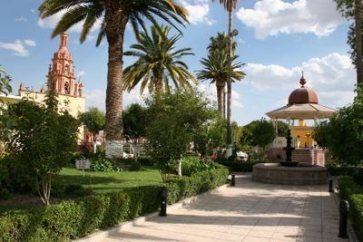
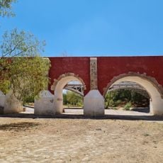
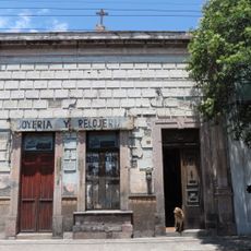
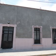
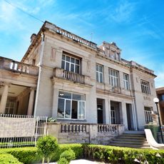
Rincón de Romos, Municipal seat in Aguascalientes, Mexico
Rincón de Romos is a municipality in the northern part of Aguascalientes state situated at about 1,945 meters (6,380 feet) in elevation. The territory includes roughly 64 towns and communities spread across the region.
The municipality was originally founded as Chora in 1639 and was renamed in 1658 in honor of Captain Diego Romo de Vivar. This change in name marked an important shift in the area's local identity.
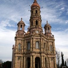
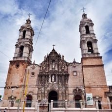
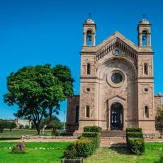
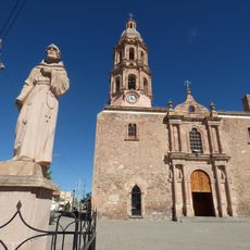
The town holds January celebrations for Señor de las Angustias with traditional dances and religious ceremonies at the downtown church. These gatherings reflect how local people mark important occasions through shared practices rooted in their heritage.
The Panamerican Highway connects the area with neighboring regions and makes travel between different towns easier. Visiting during the drier months works better if you prefer easier road conditions.
The area is known for growing a range of crops including garlic, potatoes, chiles, peaches, and grapes with the help of irrigation systems. This farming activity shapes the daily rhythm and economy of the region.
Location: Rincón de Romos Municipality
Elevation above the sea: 1,945 m
Website: http://rinconderomos.gob.mx
GPS coordinates: 22.22972,-102.32250
Latest update: December 7, 2025 20:22
Santuario del Cristo Roto, San José de Gracia, Aguascalientes
15.1 km
Temple of Saint Anthony of Padua
38.4 km
Castillo Douglas
38.4 km
Our Lady of Guadalupe Shrine, Aguascalientes City, Aguascalientes State, Mexico
38.5 km
National Museum of Death
38.6 km
Aguascalientes Museum
38.4 km
Templo del Señor de los Rayos
38.2 km
Ferrocarrilero Aguascalientes Museum
38.6 km
Museo Escarcega
38.6 km
Museo Espacio, Aguascalientes
38 km
Jardín Botánico Rey Netzahualcoyotl
35.4 km
Casa de la Cultura de San José de Gracia
13.3 km
Tepozán Shrine
22.4 km
Templo de San Isidro Labrador, Hacienda de Garabato
16.1 km
Templo del Sagrado Corazón de Jesús, Luis Moya, Zacatecas
23.9 km
Casa de Ignacio Zaragoza 414
38.5 km
Biblioteca Pública Central Centenario Bicentenario
38.2 km
Ex Hacienda de Cañada Honda, Ags.
28.3 km
Casa de Melchor Ocampo 142
38.2 km
Casa de Ignacio Zaragoza 426
38.5 km
Puente de San Ignacio
36.8 km
Casa de Morelos y Pavón 517
38.4 km
Casa de Melchor Ocampo 116
38.3 km
Casa de Morelos y Pavón 519
38.4 km
Casa de Morelos y Pavón 516
38.4 km
Chalet Douglas
38.4 km
Almas blancas
35.5 km
Casa de Melchor Ocampo 122
38.3 kmVisited this place? Tap the stars to rate it and share your experience / photos with the community! Try now! You can cancel it anytime.
Discover hidden gems everywhere you go!
From secret cafés to breathtaking viewpoints, skip the crowded tourist spots and find places that match your style. Our app makes it easy with voice search, smart filtering, route optimization, and insider tips from travelers worldwide. Download now for the complete mobile experience.
A unique approach to discovering new places❞
— Le Figaro
All the places worth exploring❞
— France Info
A tailor-made excursion in just a few clicks❞
— 20 Minutes