Brackettville

Log in to your account

AroundUs is a community-driven map of interesting places, built by curious explorers like you. It grows with every review, story, and photo you share.
Connect to save your favorite spots, contribute locations, and create personalized routes.
By continuing, you accept our Terms and Conditions and our Privacy Policy
Add to collection
Map
Suggest a change
Share

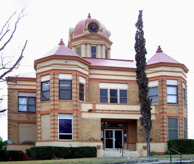
Brackettville, County seat in Kinney County, Texas, United States.
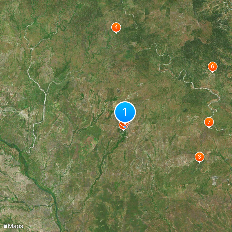
Brackettville sits at an elevation of 337 meters near Las Moras Springs, with U.S. Highway 90 running along its southern border to Del Rio and Uvalde.

The settlement, established in 1852 as Las Moras, changed its name to honor Oscar B. Brackett, who opened the first dry goods store near Fort Clark.

The town holds significant military heritage through Fort Clark, which served as a base for Buffalo Soldiers and later housed German prisoners during World War II.

The Brackett Independent School District serves the educational needs of approximately 1,341 residents, with multiple dining establishments and accommodation options available.

Alamo Village, constructed in 1959 north of town, served as the film set for John Wayne's production of The Alamo and numerous other Western movies.

Location: Kinney County

Inception: 1852

Elevation above the sea: 337 m

GPS coordinates: 29.31530,-100.41500

Latest update: May 27, 2025 09:53

Around this place
Show the full map
Garner State Park
United States of America

Garner State Park

72 km
Lost Maples State Natural Area
United States of America

Lost Maples State Natural Area

98.2 km
Amistad Reservoir
United States of America

Amistad Reservoir

64.1 km
Fort Clark
United States of America

Fort Clark

1.2 km
Sleeping Spring Draw
United States of America

Sleeping Spring Draw

29 km
Seminole Canyon State Park and Historic Site
United States of America

Seminole Canyon State Park and Historic Site

96.6 km
Amistad National Recreation Area
United States of America

Amistad National Recreation Area

63.1 km
Fort Inge
United States of America

Fort Inge

64.9 km
Fort Duncan
United States of America

Fort Duncan

68.9 km
Eagle Pass – Piedras Negras International Bridge
Mexico

Eagle Pass – Piedras Negras International Bridge

68.5 km
John Nance Garner House
United States of America

John Nance Garner House

61.5 km
Lake Amistad Dam International Crossing
United States of America

Lake Amistad Dam International Crossing

64.2 km
Camino Real International Bridge
United States of America

Camino Real International Bridge

69.4 km
Whitehead Memorial Museum
United States of America

Whitehead Memorial Museum

47 km
Grand Opera House
United States of America

Grand Opera House

62.1 km
Rio San Rodrigo
Mexico

Rio San Rodrigo

50.5 km
Martyrs of Christ the King Cathedral, Piedras Negras
Mexico

Martyrs of Christ the King Cathedral, Piedras Negras

71.4 km
Edwards County Courthouse and Jail
United States of America

Edwards County Courthouse and Jail

80.5 km
Fate Bell Shelter
United States of America

Fate Bell Shelter

96.9 km
State Highway 3 Bridge at the Nueces River
United States of America

State Highway 3 Bridge at the Nueces River

51.3 km
Lower Pecos Canyonlands Archeological District
United States of America

Lower Pecos Canyonlands Archeological District

96.9 km
Uvalde Downtown Historic District
United States of America

Uvalde Downtown Historic District

62.1 km
Seminole Canyon District
United States of America

Seminole Canyon District

96.9 km
Popeye statue in Crystal City
United States of America

Popeye statue in Crystal City

90.8 km
St. Philip's Episcopal Church
United States of America

St. Philip's Episcopal Church

61.9 km
Aztec Theatre
United States of America

Aztec Theatre

68.1 km
Combination Building
United States of America

Combination Building

72.5 km
Nicolas Street School
United States of America

Nicolas Street School

61.7 km
Show the full map

Reviews

Visited this place? Tap the stars to rate it and share your experience / photos with the community! Try now! You can cancel it anytime.

« Brackettville: County seat in Kinney County, Texas, United States » is provided by Around Us (aroundus.com). Images and texts are derived from Wikimedia project under a Creative Commons license. You are allowed to copy, distribute, and modify copies of this page, under the conditions set by the license, as long as this note is clearly visible.

Discover hidden gems everywhere you go!

From secret cafés to breathtaking viewpoints, skip the crowded tourist spots and find places that match your style. Our app makes it easy with voice search, smart filtering, route optimization, and insider tips from travelers worldwide. Download now for the complete mobile experience.

Around Us App Screenshot

A unique approach to discovering new places

Le Figaro

All the places worth exploring

France Info

A tailor-made excursion in just a few clicks

20 Minutes