Kickapoo Cavern State Park, Show cave and state park in Texas, United States
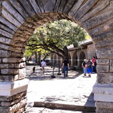
Kickapoo Cavern State Park is a Texas state park in the southwestern part of the state, built around a show cave set inside a limestone formation. The cave itself has several rooms and passages lined with stalactites, stalagmites, and other mineral formations that can be visited on guided tours.
The cave formed over a very long period as water slowly dissolved the limestone bedrock and carved out the rooms and passages visible today. The land around it was set aside as a state park in the 20th century to protect both the underground system and the surface habitat.
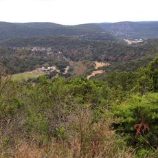
The park is one of the few places in Texas where the golden-cheeked warbler and the black-capped vireo can be spotted in the same area. Birdwatchers visit specifically for these species, which nest in the oak and juniper woodland that covers much of the grounds.
Cave tours are guided and need to be booked ahead of time, as group sizes are limited and not all areas are open every day. Wear sturdy closed-toe shoes since the floor inside can be uneven and damp in places.
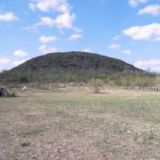
Stuart Bat Cave, located within the park, shelters hundreds of thousands of Mexican free-tailed bats that roost there during the warmer months. On summer evenings, they all leave together in a dense, swirling cloud that can be watched from outside the cave entrance.
The community of curious travelers
AroundUs brings together thousands of curated places, local tips, and hidden gems, enriched daily by 60,000 contributors worldwide.