Amistad National Recreation Area, National Recreation Area at Rio Grande confluence in Val Verde County, United States.
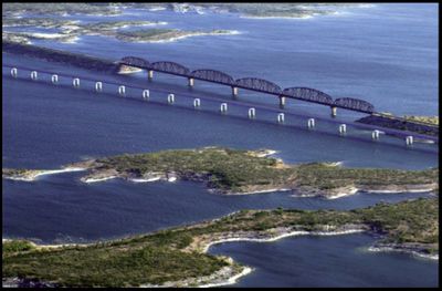
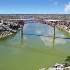
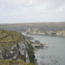
Amistad National Recreation Area is a large protected region centered on a reservoir formed by three rivers near Del Rio in Texas. The landscape includes dry hills, canyons, and water surfaces spread across the territory in a varied pattern.
The National Park Service established this recreation area in 1965, before the associated dam was completed in 1969. Its creation was part of a regional effort to manage water storage and use along the border.
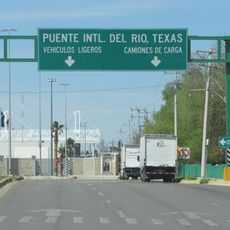
The name comes from the Spanish word for friendship, reflecting the bond between the neighboring towns of Del Rio and Ciudad Acuña. You can sense this cross-border connection at many spots where people from both sides gather together.
Visitors reach the area via US Highway 277/377, with the main entrance located several miles west of Del Rio. Multiple access points and boat ramps are available by road, though checking local conditions ahead of time helps with planning.
The area draws divers interested in exploring underwater cave systems beneath the reservoir, navigating through submerged limestone passages. This underwater world offers an uncommon adventure for those seeking experiences beyond typical water recreation.
Location: Val Verde County
Inception: November 11, 1965
Elevation above the sea: 349 m
Website: https://nps.gov/amis
GPS coordinates: 29.43667,-101.05000
Latest update: December 8, 2025 20:03
Garner State Park
128.1 km
Amistad Reservoir
1.7 km
Fort Clark
62.8 km
Sleeping Spring Draw
91.6 km
Pecos River High Bridge
46.6 km
Seminole Canyon State Park and Historic Site
37.8 km
Fort Duncan
97.5 km
Eagle Pass – Piedras Negras International Bridge
96.8 km
John Nance Garner House
124.6 km
Del Río – Ciudad Acuña International Bridge
17.1 km
Lake Amistad Dam International Crossing
1.7 km
Camino Real International Bridge
97.6 km
Whitehead Memorial Museum
17.5 km
Mile Canyon
64.2 km
Grand Opera House
125.2 km
Rio San Rodrigo
72 km
Union Pacific International Railroad Bridge
97.7 km
Martyrs of Christ the King Cathedral, Piedras Negras
95.9 km
Edwards County Courthouse and Jail
103.8 km
Pecos River Bridge
42.1 km
Fate Bell Shelter
38.8 km
State Highway 3 Bridge at the Nueces River
114.3 km
Lower Pecos Canyonlands Archeological District
38.8 km
Uvalde Downtown Historic District
125.2 km
Seminole Canyon District
38.8 km
St. Philip's Episcopal Church
124.9 km
Aztec Theatre
97 km
Pecos River Boat Dock
42.3 kmVisited this place? Tap the stars to rate it and share your experience / photos with the community! Try now! You can cancel it anytime.
Discover hidden gems everywhere you go!
From secret cafés to breathtaking viewpoints, skip the crowded tourist spots and find places that match your style. Our app makes it easy with voice search, smart filtering, route optimization, and insider tips from travelers worldwide. Download now for the complete mobile experience.
A unique approach to discovering new places❞
— Le Figaro
All the places worth exploring❞
— France Info
A tailor-made excursion in just a few clicks❞
— 20 Minutes