Enable Location

We need your location to show you interesting places around you

Discover nearby places

Find interesting locations and hidden gems around you

Precise directions

Get accurate directions and distances to places

Your location is never shared with other users. It's only used when you tap the location button.

Eagle Pass – Piedras Negras International Bridge

Log in to your account

Start exploring — it's free

Trusted by 62,075 travelers worldwide

Continue with Google
Continue with Apple
or

We will send you a code to connect

By continuing, you accept our Terms and Conditions and our Privacy Policy

Check your inbox

We've sent a pincode in your inbox. Please enter the code below.

Eagle Pass – Piedras Negras International Bridge

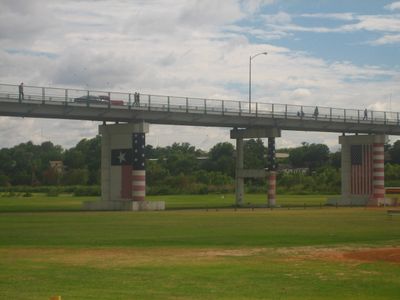
Eagle Pass – Piedras Negras International Bridge, Road bridge between Eagle Pass, Texas and Piedras Negras, Coahuila.

This bridge carries both vehicles and pedestrians across the Rio Grande between Eagle Pass, Texas and Piedras Negras, Coahuila, serving as a primary border crossing between the United States and Mexico. The two-lane roadway accommodates cars while a separate path allows foot traffic to cross safely.

Construction began in 1927, but the structure suffered flood damage that required complete reconstruction in 1954. A third major project in 1985 reinforced the bridge to ensure it could continue handling modern traffic demands.

The bridge links two commercial hubs where shoppers and traders move between the retail districts of Eagle Pass and the market stalls and craft vendors of Piedras Negras. This daily flow of people creates a shared economic rhythm that connects both communities across the river.

Toll rates differ for vehicles and pedestrians and depend on which direction you are crossing. Having cash in both U.S. dollars and Mexican pesos is helpful since payment methods vary depending on which country you enter.

The bridge creates a seamless connection where U.S. Route 57 continues directly as Mexican Federal Highway 57, making it one of the few places where road numbers align perfectly across the border. This straight-through routing eliminates the need for confusing direction changes when crossing into Mexico.

The community of curious travelers

AroundUs brings together thousands of curated places, local tips, and hidden gems, enriched daily by 60,000 contributors worldwide.

Start exploring
Location
Location
Inception
1954
Official opening
1927
GPS coordinates
28.70556,-100.51194
Latest update
December 12, 2025 08:01
Around this place
Garner State Park
United States of America

Garner State Park

123.3 km
Amistad Reservoir
Mexico

Amistad Reservoir

98.5 km
Fort Clark
United States of America

Fort Clark

67.4 km
Sleeping Spring Draw
United States of America

Sleeping Spring Draw

65.9 km
Seminole Canyon State Park and Historic Site
United States of America

Seminole Canyon State Park and Historic Site

134.1 km
Amistad National Recreation Area
United States of America

Amistad National Recreation Area

96.8 km
Fort Inge
United States of America

Fort Inge

89.8 km
Fort Duncan
United States of America

Fort Duncan

797 m
John Nance Garner House
United States of America

John Nance Garner House

90 km
Lake Amistad Dam International Crossing
United States of America

Lake Amistad Dam International Crossing

98.4 km
Camino Real International Bridge
United States of America

Camino Real International Bridge

876 m
Whitehead Memorial Museum
United States of America

Whitehead Memorial Museum

81.2 km
Grand Opera House
United States of America

Grand Opera House

90.3 km
Mexico

Rio San Rodrigo

24.8 km
Martyrs of Christ the King Cathedral, Piedras Negras
Mexico

Martyrs of Christ the King Cathedral, Piedras Negras

5.4 km
Asher and Mary Isabelle Richardson House
United States of America

Asher and Mary Isabelle Richardson House

78.9 km
Pecos River Bridge
United States of America

Pecos River Bridge

138.3 km
Fate Bell Shelter
United States of America

Fate Bell Shelter

135.3 km
State Highway 3 Bridge at the Nueces River
United States of America

State Highway 3 Bridge at the Nueces River

81.4 km
Lower Pecos Canyonlands Archeological District
United States of America

Lower Pecos Canyonlands Archeological District

135.3 km
Uvalde Downtown Historic District
United States of America

Uvalde Downtown Historic District

90.2 km
Seminole Canyon District
United States of America

Seminole Canyon District

135.3 km
La Salle County Courthouse
United States of America

La Salle County Courthouse

128.2 km
Popeye statue in Crystal City
United States of America

Popeye statue in Crystal City

66.7 km
St. Philip's Episcopal Church
United States of America

St. Philip's Episcopal Church

90.4 km
Aztec Theatre
United States of America

Aztec Theatre

941 m
Combination Building
United States of America

Combination Building

123.7 km
Nicolas Street School
United States of America

Nicolas Street School

89.2 km
Show the full map
« Eagle Pass – Piedras Negras International Bridge - Road bridge between Eagle Pass, Texas and Piedras Negras, Coahuila » is provided by Around Us (aroundus.com). Images and texts are derived from Wikimedia project under a Creative Commons license. You are allowed to copy, distribute, and modify copies of this page, under the conditions set by the license, as long as this note is clearly visible.

Discover hidden gems everywhere you go!

From secret cafés to breathtaking viewpoints, skip the crowded tourist spots and find places that match your style. Our app makes it easy with voice search, smart filtering, route optimization, and insider tips from travelers worldwide. Download now for the complete mobile experience.

Around Us App Screenshot

A unique approach to discovering new places

Le Figaro

All the places worth exploring

France Info

A tailor-made excursion in just a few clicks

20 Minutes

Around Us
Travel Guide & Maps
Download

Send to your phone

QR Code
1

Open the camera app on your mobile.

2

Point at the QR code with your camera. A notification will appear.

3

Tap the notification to open the link.