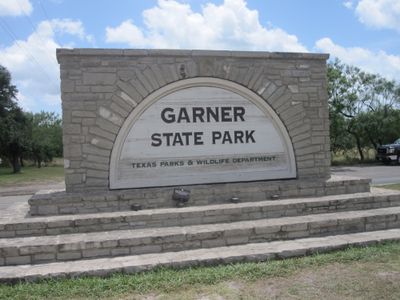
Garner State Park, State park in Uvalde County, Texas.
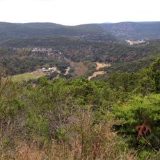
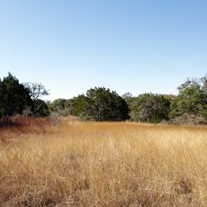
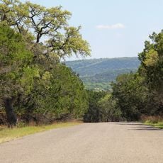
Garner State Park is a natural area along the Frio River in the Texas Hill Country, covering 7.2 square kilometers. The park contains walking paths through wooded sections, exposed limestone formations, and riverside spots with access to the water.
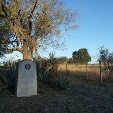
The Civilian Conservation Corps built the main facilities during the 1930s, erecting stone structures and the Combination Building. The site opened to visitors in June 1941 after work on paths and camping grounds was complete.
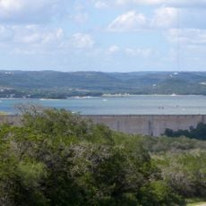
The river winds between limestone bluffs and forms shallow pools where families wade and cool off during summer months. Local visitors often bring inner tubes and float slowly downstream while children play along the riverbanks and toss stones into the water.
Trails vary in steepness and some follow uneven ground, so sturdy footwear and enough drinking water are helpful. River access is easiest during summer months when water levels drop and currents slow down.
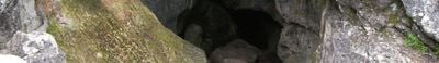
The limestone layers hold fossils of marine creatures from the Cretaceous period when this part of Texas lay beneath shallow seas. Some visitors spot small embedded shell shapes and impressions of ancient sea dwellers while walking along the rock faces.
Location: Uvalde County
Inception: 1941
Official opening: June 1, 1941
Website: https://tpwd.texas.gov/state-parks/garner
GPS coordinates: 29.58330,-99.73890
Latest update: December 5, 2025 22:26
New Hampshire reveals a land where the White Mountains have shaped the skyline for millennia. Between northern coniferous forests and southeastern Atlantic coasts, this New England state features waterfalls cascading over granite, glacial passes carved 15,000 years ago, and industrial villages embedded in red stone. Archaeological sites, lighthouses guiding ships on Piscataqua, and estates where early 20th-century artists shaped American identity await discovery. Trails wind through gorges, along lakes reflecting peaks, and through forests where remnants of old foundries remain. Autumn light illuminates maple trees, winter turns ravines into ice amphitheaters, and spring causes waterfalls to roar. From Mount Monadnock to the Shoals Islands, New Hampshire offers a varied geography where each hill, waterfall, and stone bears witness to a deeply rooted natural and human story within the landscape of New England.
Lost Maples State Natural Area
30.3 km
Medina Lake
74 km
Fort Clark
72.9 km
Sleeping Spring Draw
57.8 km
Stonehenge II
72.2 km
Fort Inge
45 km
Hill Country State Natural Area
54.3 km
Old Camp Verde
68.9 km
John Nance Garner House
41.6 km
Kerrville-Schreiner Park
76.4 km
Capt. Charles Schreiner Mansion
77.5 km
Castroville Historic District
87 km
The Coming King Sculpture Prayer Gardens
81.1 km
Grand Opera House
41.8 km
Bandera County Courthouse and Jail
66.4 km
Masonic Building
77.4 km
Edwards County Courthouse and Jail
66.2 km
Jureczki House
66 km
State Highway 3 Bridge at the Nueces River
44.9 km
Uvalde Downtown Historic District
41.8 km
Old Huffmeyer Store
66.5 km
Pampell's Opera House
77.4 km
Frontier Times Museum
66.6 km
St. Philip's Episcopal Church
41.4 km
Raye Theater
63.5 km
Combination Building
505 m
D'Hanis Historic District
54.3 km
Nicolas Street School
42.7 kmVisited this place? Tap the stars to rate it and share your experience / photos with the community! Try now! You can cancel it anytime.
Discover hidden gems everywhere you go!
From secret cafés to breathtaking viewpoints, skip the crowded tourist spots and find places that match your style. Our app makes it easy with voice search, smart filtering, route optimization, and insider tips from travelers worldwide. Download now for the complete mobile experience.
A unique approach to discovering new places❞
— Le Figaro
All the places worth exploring❞
— France Info
A tailor-made excursion in just a few clicks❞
— 20 Minutes