Medina Lake, Reservoir in Texas Hill Country, United States.
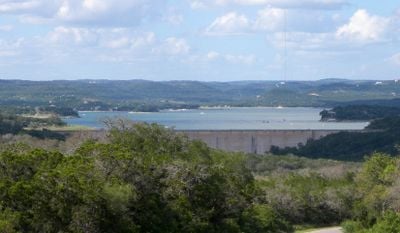
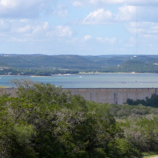
Medina Lake is a crescent-shaped reservoir on the Medina River, about 40 miles northwest of San Antonio, running west to east for 18 miles and up to 3 miles wide. Its south end is held by Medina Dam, a long concrete wall with a flat top and a downstream face divided into rectangular panels by vertical joints. The lake borders Mico, Lake Medina Shores and Lakehills.
Medina Dam was completed in 1913, a privately financed project that created the lake to supply irrigation water for local agriculture. At the time of its construction it was the largest concrete dam in the country and the fourth largest dam overall. The dam is listed on the National Register of Historic Places.
The lake serves as a water source for farming communities in the region, with canals carrying water to local crops and towns. People here depend on it as part of their way of life and local economy.
You can access the shoreline from several points for fishing, boating, and picnicking, though conditions vary by season. Plan visits during warmer months for the best water conditions, and bring sun protection due to open exposure.
At its 1913 completion, Medina Dam was the largest concrete dam in the United States and the fourth largest in the world; it is now listed on the National Register of Historic Places. The reservoir it holds back is crescent-shaped, running west to east for 18 miles (29 km) and reaching 3 miles (5 km) at its widest.
The community of curious travelers
AroundUs brings together thousands of curated places, local tips, and hidden gems, enriched daily by 94,537 contributors worldwide.