Enable Location

We need your location to show you interesting places around you

Discover nearby places

Find interesting locations and hidden gems around you

Precise directions

Get accurate directions and distances to places

Your location is never shared with other users. It's only used when you tap the location button.

Old Camp Verde

Log in to your account

Start exploring — it's free

Trusted by 62,109 travelers worldwide

Continue with Google
Continue with Apple
or

We will send you a code to connect

By continuing, you accept our Terms and Conditions and our Privacy Policy

Check your inbox

We've sent a pincode in your inbox. Please enter the code below.

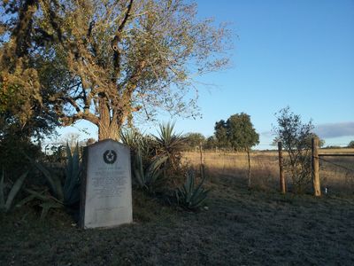
Old Camp Verde, human settlement in Kerr County, Texas, United States of America

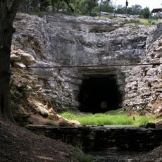
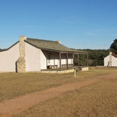
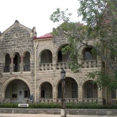
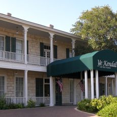
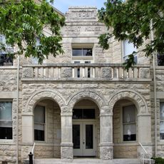
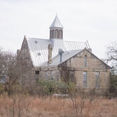
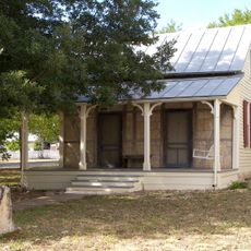
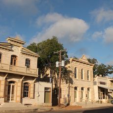
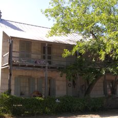
Old Camp Verde is a former military post in Kerr County, Texas, with scattered ruins of buildings and fortifications from the 1800s. The site contains remains of soldier quarters, a general store, and a corral where camels were once kept and studied by the Army.

The camp was founded in 1855 as a frontier post to protect settlers and secure communication routes in the region. During the Civil War, Confederate forces captured it in 1861, and the post was officially abandoned in 1869.

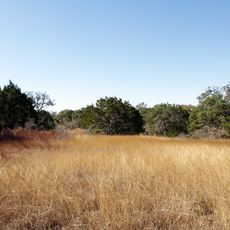
The name Camp Verde refers to the green valley near Verde Creek where soldiers once lived and worked. Today, the fading buildings and scattered ruins reflect how this place was shaped by military experiments and frontier life that left lasting impressions on local memory.

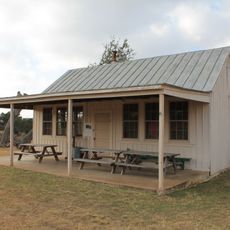
The original camp site is not open to visitors as most ruins are on private property, but historic markers and an entrance gate mark the location. Few facilities exist on site, so it is best to plan ahead and bring what you need for your visit.

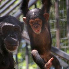
The camp was home to an unusual Army experiment with about 75 camels from Africa and the Middle East, brought starting in 1856 to test them as military supply animals. After the Civil War, surviving camels scattered across the western states, with some eventually reaching as far as Iowa.

The community of curious travelers

AroundUs brings together thousands of curated places, local tips, and hidden gems, enriched daily by 60,000 contributors worldwide.

Start exploring
Location
GPS coordinates
29.89030,-99.12030
Latest update
February 7, 2026 11:00
Around this place
Lost Maples State Natural Area
United States of America

Lost Maples State Natural Area

45.4 km
Medina Lake
United States of America

Medina Lake

40 km
Stonehenge II
United States of America

Stonehenge II

23.7 km
Old Tunnel State Park
United States of America

Old Tunnel State Park

37.2 km
Cave Without a Name
United States of America

Cave Without a Name

48.6 km
Treue der Union Monument
United States of America

Treue der Union Monument

21.8 km
Hill Country State Natural Area
United States of America

Hill Country State Natural Area

29.8 km
Fort Martin Scott
United States of America

Fort Martin Scott

47.9 km
Primarily Primates
United States of America

Primarily Primates

47.8 km
Hygieostatic Bat Roost
United States of America

Hygieostatic Bat Roost

24.4 km
Kerrville-Schreiner Park
United States of America

Kerrville-Schreiner Park

13.4 km
Capt. Charles Schreiner Mansion
United States of America

Capt. Charles Schreiner Mansion

17.4 km
Kendall Inn
United States of America

Kendall Inn

38.8 km
The Coming King Sculpture Prayer Gardens
United States of America

The Coming King Sculpture Prayer Gardens

20.2 km
Kendall County Courthouse and Jail
United States of America

Kendall County Courthouse and Jail

39.1 km
Bandera County Courthouse and Jail
United States of America

Bandera County Courthouse and Jail

18.8 km
Masonic Building
United States of America

Masonic Building

17.4 km
Morris Ranch Schoolhouse
United States of America

Morris Ranch Schoolhouse

37.9 km
Wrede School
United States of America

Wrede School

43.2 km
Otto Brinkmann House
United States of America

Otto Brinkmann House

22.1 km
Comfort Historic District
United States of America

Comfort Historic District

22.2 km
Meusebach Creek School
United States of America

Meusebach Creek School

43.4 km
Jureczki House
United States of America

Jureczki House

19.4 km
Old Huffmeyer Store
United States of America

Old Huffmeyer Store

19.1 km
Pampell's Opera House
United States of America

Pampell's Opera House

17.5 km
Frontier Times Museum
United States of America

Frontier Times Museum

18.7 km
Comfort Community Theatre
United States of America

Comfort Community Theatre

22.3 km
Gazebo for Albert Steves
United States of America

Gazebo for Albert Steves

24.5 km
Show the full map
« Old Camp Verde - human settlement in Kerr County, Texas, United States of America » is provided by Around Us (aroundus.com). Images and texts are derived from Wikimedia project under a Creative Commons license. You are allowed to copy, distribute, and modify copies of this page, under the conditions set by the license, as long as this note is clearly visible.

Discover hidden gems everywhere you go!

From secret cafés to breathtaking viewpoints, skip the crowded tourist spots and find places that match your style. Our app makes it easy with voice search, smart filtering, route optimization, and insider tips from travelers worldwide. Download now for the complete mobile experience.

Around Us App Screenshot

A unique approach to discovering new places

Le Figaro

All the places worth exploring

France Info

A tailor-made excursion in just a few clicks

20 Minutes

Around Us
Travel Guide & Maps
Download

Send to your phone

QR Code
1

Open the camera app on your mobile.

2

Point at the QR code with your camera. A notification will appear.

3

Tap the notification to open the link.