Val Verde County

Log in to your account

AroundUs is a community-driven map of interesting places, built by curious explorers like you. It grows with every review, story, and photo you share.
Connect to save your favorite spots, contribute locations, and create personalized routes.
By continuing, you accept our Terms and Conditions and our Privacy Policy
Add to collection
Map
Suggest a change
Share

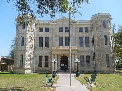
Val Verde County, County seat in southwestern Texas, United States

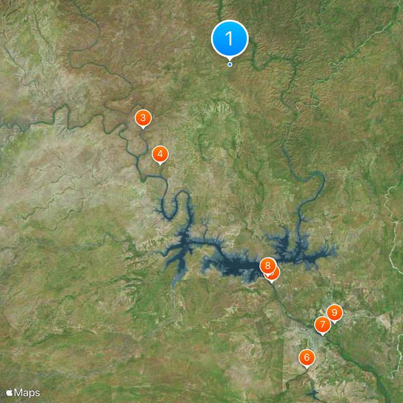
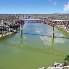
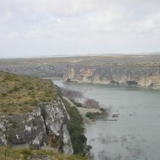
Val Verde County is an administrative division in southwestern Texas that covers a large territory. The landscape features limestone formations, deep canyons, and rivers that cut through the terrain.

The county was established in 1885 and named after a Civil War battle that took place in the southwestern region. This naming reflects the area's connection to that historical period.

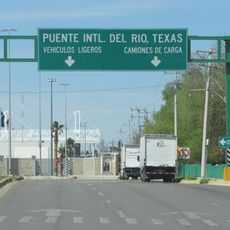
The region shows a living blend of American and Mexican traditions visible in everyday customs, food, celebrations, and how communities are built. These influences shape the way people live and gather in towns throughout the county.

Visiting requires time to explore the distances and experience the varied landscapes across the territory. Having a vehicle and planning ahead makes it easier to move between different towns and areas.

The area contains limestone caves and rock shelters that hold evidence of human habitation from ancient times. These archaeological sites reveal to visitors how people lived in this region thousands of years ago.

Location: Texas

Inception: 1885

Capital city: Del Rio

Shares border with: Terrell County, Edwards County, Sutton County, Crockett County, Kinney County, Jiménez Municipality

Website: http://valverdecounty.org

GPS coordinates: 29.89000,-101.15000

Latest update: December 7, 2025 09:22

Photos
Around this place
Show the full map
Amistad Reservoir
Mexico

Amistad Reservoir

49.8 km
Fort Clark
United States of America

Fort Clark

96 km
Sleeping Spring Draw
United States of America

Sleeping Spring Draw

123.7 km
Pecos River High Bridge
United States of America

Pecos River High Bridge

24.8 km
Seminole Canyon State Park and Historic Site
United States of America

Seminole Canyon State Park and Historic Site

28.2 km
Amistad National Recreation Area
United States of America

Amistad National Recreation Area

51.4 km
Fort Duncan
United States of America

Fort Duncan

146.4 km
Fort Lancaster
United States of America

Fort Lancaster

101.1 km
Rio Grande Wild and Scenic River
United States of America

Rio Grande Wild and Scenic River

134 km
Eagle Pass – Piedras Negras International Bridge
Mexico

Eagle Pass – Piedras Negras International Bridge

145.7 km
Lake Amistad Dam International Crossing
United States of America

Lake Amistad Dam International Crossing

49.8 km
Whitehead Memorial Museum
United States of America

Whitehead Memorial Museum

64.7 km
Mile Canyon
United States of America

Mile Canyon

39.6 km
Canon Ranch Railroad Eclipse Windmill
United States of America

Canon Ranch Railroad Eclipse Windmill

123.9 km
Rio San Rodrigo
Mexico

Rio San Rodrigo

120.9 km
Martyrs of Christ the King Cathedral, Piedras Negras
Mexico

Martyrs of Christ the King Cathedral, Piedras Negras

145.5 km
Crockett County Courthouse
United States of America

Crockett County Courthouse

91.5 km
Edwards County Courthouse and Jail
United States of America

Edwards County Courthouse and Jail

91.9 km
Sutton County Courthouse
United States of America

Sutton County Courthouse

90.2 km
Pecos River Bridge
United States of America

Pecos River Bridge

28 km
Fate Bell Shelter
United States of America

Fate Bell Shelter

26.4 km
Lower Pecos Canyonlands Archeological District
United States of America

Lower Pecos Canyonlands Archeological District

26.4 km
Seminole Canyon District
United States of America

Seminole Canyon District

26.4 km
Fort Lancaster State Historic Site
United States of America

Fort Lancaster State Historic Site

101 km
Aztec Theatre
United States of America

Aztec Theatre

145.8 km
Princess Theater
United States of America

Princess Theater

123.2 km
Pecos River Boat Dock
United States of America

Pecos River Boat Dock

28.9 km
Crockett County Jail
United States of America

Crockett County Jail

91.6 km
Show the full map
Reviews

Visited this place? Tap the stars to rate it and share your experience / photos with the community! Try now! You can cancel it anytime.

Administrative divisions
« Val Verde County - County seat in southwestern Texas, United States » is provided by Around Us (aroundus.com). Images and texts are derived from Wikimedia project under a Creative Commons license. You are allowed to copy, distribute, and modify copies of this page, under the conditions set by the license, as long as this note is clearly visible.

Discover hidden gems everywhere you go!

From secret cafés to breathtaking viewpoints, skip the crowded tourist spots and find places that match your style. Our app makes it easy with voice search, smart filtering, route optimization, and insider tips from travelers worldwide. Download now for the complete mobile experience.

Around Us App Screenshot

A unique approach to discovering new places

Le Figaro

All the places worth exploring

France Info

A tailor-made excursion in just a few clicks

20 Minutes