Enable Location

We need your location to show you interesting places around you

Discover nearby places

Find interesting locations and hidden gems around you

Precise directions

Get accurate directions and distances to places

Your location is never shared with other users. It's only used when you tap the location button.

Rio Grande Valley

Log in to your account

Start exploring — it's free

Trusted by 68,751 travelers worldwide

Continue with Google
Continue with Apple
or

We will send you a code to connect

By continuing, you accept our Terms and Conditions and our Privacy Policy

Check your inbox

We've sent a pincode in your inbox. Please enter the code below.

Rio Grande Valley
Discussion Reviews 2 Photos
20k Popularity

Rio Grande Valley, Border valley in South Texas, United States and Tamaulipas, Mexico.

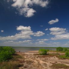
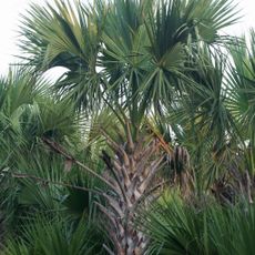
The Rio Grande Valley spans across several Texas counties and borders Mexico, featuring flat plains, scattered hills, and sandy coastal areas. The landscape is shaped by the Rio Grande, which flows through and naturally formed the terrain.

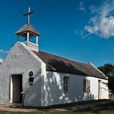
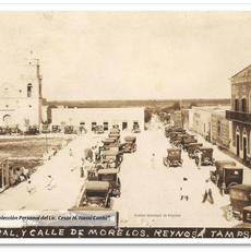
Spanish settlers established the first communities in the 1740s under Jose de Escandon's leadership, with the region originally part of the Spanish colony of Nuevo Santander. Early settlements developed along the river, where water enabled farming and trade.

Spanish and English blend naturally in daily conversation, while Mexican traditions shape the food, music, and celebrations people enjoy. This mix appears everywhere you look, from neighborhood restaurants to street festivities.

Three regional airports connect the valley to major cities, and multiple international bridges cross into Mexico. Plan travel time between destinations, as attractions spread across larger distances.

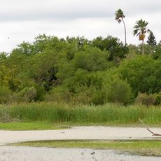
The river creates lakes and lagoons throughout the valley, formed by its shifting path over time. These water bodies appear where the river once curved but eventually abandoned old bends.

The community of curious travelers

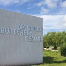
AroundUs brings together thousands of curated places, local tips, and hidden gems, enriched daily by 60,000 contributors worldwide.

Start exploring
Location
GPS coordinates
26.22000,-98.12000
Latest update
December 7, 2025 10:06
Around this place
Basilica of the National Shrine of Our Lady of San Juan del Valle
United States of America

Basilica of the National Shrine of Our Lady of San Juan del Valle

4.5 km
Gladys Porter Zoo
United States of America

Gladys Porter Zoo

71.2 km
Palo Alto Battlefield National Historical Park
United States of America

Palo Alto Battlefield National Historical Park

69 km
Santa Ana National Wildlife Refuge
United States of America

Santa Ana National Wildlife Refuge

15.3 km
National Butterfly Center
United States of America

National Butterfly Center

24.9 km
La Lomita Chapel
United States of America

La Lomita Chapel

22.1 km
Lower Rio Grande Valley National Wildlife Refuge
United States of America

Lower Rio Grande Valley National Wildlife Refuge

27 km
Bentsen-Rio Grande Valley State Park
United States of America

Bentsen-Rio Grande Valley State Park

26.7 km
McAllen–Hidalgo–Reynosa International Bridge
United States of America

McAllen–Hidalgo–Reynosa International Bridge

20.6 km
McAllen Convention Center
United States of America

McAllen Convention Center

14.1 km
McAllen Public Library
United States of America

McAllen Public Library

12.4 km
McAllen Botanical Gardens
United States of America

McAllen Botanical Gardens

11.6 km
Resaca de la Palma Battlefield
United States of America

Resaca de la Palma Battlefield

70.8 km
Estero Llano Grande State Park
United States of America

Estero Llano Grande State Park

19.4 km
First Lift Station
United States of America

First Lift Station

21.1 km
Topgolf
United States of America

Topgolf

8.5 km
Bobz World
United States of America

Bobz World

70.3 km
Veterans War Memorial of Texas
United States of America

Veterans War Memorial of Texas

13.8 km
Border Theater
United States of America

Border Theater

20.6 km
Old Lyford High School
United States of America

Old Lyford High School

38.6 km
Pharr Aquatic Center
United States of America

Pharr Aquatic Center

7.1 km
M and J Nelson Building
United States of America

M and J Nelson Building

11.7 km
Reynosakatedralen
Mexico

Reynosakatedralen

21.2 km
Mcallen public pool
United States of America

Mcallen public pool

11.7 km
Iwo Jima Museum Gift Shop
United States of America

Iwo Jima Museum Gift Shop

45.2 km
McAllen Heritage Center
United States of America

McAllen Heritage Center

11.6 km
Outdoor theater
Mexico

Outdoor theater

68.1 km
Rio Theater
United States of America

Rio Theater

20.7 km
Show the full map
Reviews
Share your experience

No review yet

Discussions
Start a discussion...

No discussion yet

« Rio Grande Valley - Border valley in South Texas, United States and Tamaulipas, Mexico » is provided by Around Us (aroundus.com). Images and texts are derived from Wikimedia project under a Creative Commons license. You are allowed to copy, distribute, and modify copies of this page, under the conditions set by the license, as long as this note is clearly visible.

Discover hidden gems everywhere you go!

From secret cafés to breathtaking viewpoints, skip the crowded tourist spots and find places that match your style. Our app makes it easy with voice search, smart filtering, route optimization, and insider tips from travelers worldwide. Download now for the complete mobile experience.

Around Us App Screenshot

A unique approach to discovering new places

Le Figaro

All the places worth exploring

France Info

A tailor-made excursion in just a few clicks

20 Minutes

Around Us
Travel Guide & Maps
Download

Send to your phone

QR Code
1

Open the camera app on your mobile.

2

Point at the QR code with your camera. A notification will appear.

3

Tap the notification to open the link.