Chest opened
+${chestReward.xp} XP
Explorer
NOUVEAU ×${chestReward.collectible.quantity}
tapez pour fermer
Chest locked

Open chests in the app

Around Us is built for your phone — chests unlock when you walk, explore and capture nearby places.

Enable Location

We need your location to show you interesting places around you

Discover nearby places

Find interesting locations and hidden gems around you

Precise directions

Get accurate directions and distances to places

Your location is never shared with other users. It's only used when you tap the location button.

Schertz

Log in to your account

Start exploring — it's free

Trusted by 72,984 travelers worldwide

Continue with Google
Continue with Apple
or

We will send you a code to connect

By continuing, you accept our Terms and Conditions and our Privacy Policy

Check your inbox

We've sent a pincode in your inbox. Please enter the code below.

Discussion Reviews 1 Photos
30.1k Popularity

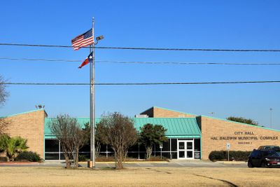
Schertz, Suburban municipality in Guadalupe County, Texas, United States.

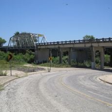
Schertz is a suburban town in Texas that spans portions of Guadalupe, Bexar, and Comal counties with Cibolo Creek flowing through its territory. The community contains residential neighborhoods and commercial areas spread across this three-county region.

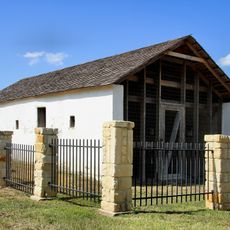
The settlement was originally called Cibolo Pit and Cut Off before receiving its current name in 1899 from Alsatian settlers who arrived in the area. Early growth came through the agricultural work that these pioneers established in the region.

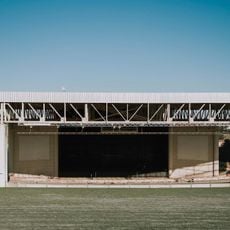
The community gathers for SchertzFest and Fourth of July Jubilee celebrations, where local musicians perform and food vendors set up throughout the town. These events shape how residents connect and spend time together during the year.

The area contains multiple school facilities operated by the Schertz-Cibolo-Universal City Independent School District serving elementary through high school levels. Visitors can navigate residential neighborhoods and commercial zones that are spread throughout the region.

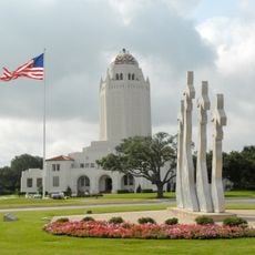
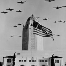
Randolph Air Force Base was established in 1930 and transformed the agricultural town into a residential community for military families. This development brought significant growth and new infrastructure to the area.

The community of curious travelers

AroundUs brings together thousands of curated places, local tips, and hidden gems, enriched daily by 60,000 contributors worldwide.

Start exploring
Location
Location
Location
Inception
1843
Elevation above the sea
217 m
GPS coordinates
29.56670,-98.26440
Latest update
December 20, 2025 02:38
Around this place
Verizon Wireless Amphitheater
United States of America

Verizon Wireless Amphitheater

6.4 km
Administration Building
United States of America

Administration Building

3.9 km
Randolph Field Historic District
United States of America

Randolph Field Historic District

4.1 km
State Highway 3-A Bridge at Cibolo Creek
United States of America

State Highway 3-A Bridge at Cibolo Creek

10.5 km
United States of America

John S. Harrison House

4.3 km
United States of America

Soil Conservation Service Site 6-A Reservoir

9.9 km
Selma Stagecoach Stop and Post Office
United States of America

Selma Stagecoach Stop and Post Office

4.4 km
United States of America

Mural, Work of art

3.7 km
United States of America

Scenic viewpoint

4.2 km
United States of America

Lockheed T-33A

3.6 km
United States of America

Cessna T-37A Tweet

3.7 km
United States of America

Northrop T-38A Talon

3.6 km
United States of America

Boeing T-43 Flying Classroom

3.7 km
United States of America

Pickrell Park

2 km
United States of America

Randolph Oaks

5.2 km
United States of America

Scenic viewpoint

7.3 km
United States of America

Scenic viewpoint

7.5 km
United States of America

Scenic viewpoint

7.6 km
United States of America

Olympia Hills Golf & Event Center

4.2 km
United States of America

Scenic viewpoint

7.6 km
United States of America

Scenic viewpoint

4.9 km
United States of America

Scenic viewpoint

3.5 km
United States of America

Beech T-34B Mentor

3.6 km
United States of America

Cessna T-41A Mescalero

3.6 km
United States of America

North American T-28A Trojan

3.6 km
United States of America

Convair T-29C Samaritan

4.4 km
United States of America

North American AT-6F Texan

3.6 km
United States of America

Beech SNB-1 Kansan

4.3 km
Show the full map
Reviews
Share your experience

No review yet

Discussions
Start a discussion...

No discussion yet

« Schertz - Suburban municipality in Guadalupe County, Texas, United States » is provided by Around Us (aroundus.com). Images and texts are derived from Wikimedia project under a Creative Commons license. You are allowed to copy, distribute, and modify copies of this page, under the conditions set by the license, as long as this note is clearly visible.

Discover hidden gems everywhere you go!

From secret cafés to breathtaking viewpoints, skip the crowded tourist spots and find places that match your style. Our app makes it easy with voice search, smart filtering, route optimization, and insider tips from travelers worldwide. Download now for the complete mobile experience.

Around Us App Screenshot

A unique approach to discovering new places

Le Figaro

All the places worth exploring

France Info

A tailor-made excursion in just a few clicks

20 Minutes

Around Us
Travel Guide & Maps
Download

Send to your phone

QR Code
1

Open the camera app on your mobile.

2

Point at the QR code with your camera. A notification will appear.

3

Tap the notification to open the link.